Melide causeway

Last updated
The Melide causeway in 1966, with Bissone to the left (east) and Melide to the right (west) Around Lugano 1966 07.JPG
The Melide causeway in 1966, with Bissone to the left (east) and Melide to the right (west)
The Melide causeway as seen from the summit of Sighignola, with Melide village to the right Ponte di Melide.jpg
The Melide causeway as seen from the summit of Sighignola, with Melide village to the right

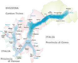
The Melide causeway crosses across Lake Lugano in the Swiss canton of Ticino, connecting the communities of Melide and Bissone, and provides the only domestic land connection between the southern section of Ticino, around Mendrisio and Chiasso, and the rest of Switzerland. [1]

Today the causeway carries the Gotthard railway, the A2 motorway, and a main road. A bridge within the causeway permits water flow and navigation between the two halves of Lake Lugano. The causeway makes use of a submerged glacial moraine, which stretches across the lake reducing its depth to around 10 metres (33 ft), as opposed to the lake's maximum depth of 288 metres (945 ft). [1] [2]

The causeway was designed by Pasquale Lucchini, a self-taught Ticinese civil engineer, who arranged for large quantities of rock to be dumped on top of the moraine to create the causeway. The causeway was built between 1841 and 1847, and opened for road traffic in 1848. The railway was added to the causeway in 1872, and the motorway in 1980. [1] [3] [4]

Related Research Articles

<span class="mw-page-title-main">Ticino</span> Canton of Switzerland

Ticino, sometimes Tessin, officially the Republic and Canton of Ticino or less formally the Canton of Ticino, is one of the 26 cantons forming the Swiss Confederation. It is composed of eight districts and its capital city is Bellinzona. It is also traditionally divided into the Sopraceneri and the Sottoceneri, respectively north and south of Monte Ceneri. Red and blue are the colours of its flag.

<span class="mw-page-title-main">Lugano</span> Municipality in Ticino, Switzerland

Lugano is a city and municipality within the Lugano District in the canton of Ticino, Switzerland. It is the largest city in both Ticino and the Italian-speaking region of southern Switzerland. Lugano has a population of 62,315, and an urban agglomeration of over 150,000. It is the ninth largest Swiss city.

<span class="mw-page-title-main">Lake Lugano</span> Lake in Italy and Switzerland

Lake Lugano is a glacial lake which is situated on the border between southern Switzerland and northern Italy. The lake, named after the city of Lugano, is situated between Lake Como and Lago Maggiore. It was cited for the first time by Gregory of Tours in 590 with the name Ceresio, a name which is said to have derived from the Latin word cerasus, meaning cherry, and refers to the abundance of cherry trees which at one time adorned the shores of the lake. The lake appears in documents in 804 under the name Laco Luanasco.

<span class="mw-page-title-main">Lugano Airport</span> Airport in Agno / Bioggio / Muzzano

Lugano Airport is a regional airport located 4 km (2.5 mi) west of the Swiss city of Lugano, approximately 80 km (50 mi) north of Milan, in the municipalities of Agno, Bioggio and Muzzano. It lies closer to the village of Agno than to Lugano itself, and is sometimes known as Lugano-Agno. Around 200,000 passengers use the airport each year, using some 2,400 flights. There are also limited freight operations, a flying club and flight school. The headquarters of Darwin Airline were located at the airport prior to its bankruptcy.

<span class="mw-page-title-main">Gotthard Pass</span> Mountain pass through the Swiss Alps

The Gotthard Pass or St. Gotthard Pass at 2,106 m (6,909 ft) is a mountain pass in the Alps traversing the Saint-Gotthard Massif and connecting northern Switzerland with southern Switzerland. The pass lies between Airolo in the Italian-speaking canton of Ticino, and Andermatt in the German-speaking canton of Uri, and connects further Bellinzona and Lugano to Lucerne, Basel, and Zurich. The Gotthard Pass lies at the heart of the Gotthard, a major transport axis of Europe, and it is crossed by three traffic tunnels, each being the world's longest at the time of their construction: the Gotthard Rail Tunnel (1882), the Gotthard Road Tunnel (1980) and the Gotthard Base Tunnel (2016). With the Lötschberg to the west, the Gotthard is one of the two main north-south routes through the Swiss Alps.

<span class="mw-page-title-main">Gotthard railway</span> Key central Swiss transport link

The Gotthard railway is the Swiss trans-alpine railway line from northern Switzerland to the canton of Ticino. The line forms a major part of an important international railway link between northern and southern Europe, especially on the Rotterdam-Basel-Genoa corridor. The Gotthard Railway Company was the former private railway company that financed the construction of and originally operated that line.

<span class="mw-page-title-main">Bissone</span> Municipality in Ticino, Switzerland

Bissone is a municipality in the district of Lugano, in the canton of Ticino in Switzerland.

<span class="mw-page-title-main">Capolago</span> Village and Quarter in Ticino, Switzerland

Capolago is a village situated at the south-eastern extremity of Lake Lugano, in the Swiss canton of Ticino. Originally a municipality in its own right, Capolago is now a quarter of the municipality of Mendrisio, itself part of the district of Mendrisio.

<span class="mw-page-title-main">Monte Generoso</span> Mountain in Switzerland

Monte Generoso is a mountain of the Lugano Prealps, located on the border between Switzerland and Italy and between Lake Lugano and Lake Como. The western and southern flanks of the mountain lie in the Swiss canton of Ticino, whilst the north-eastern flanks are in the Italian region of Lombardy.

<span class="mw-page-title-main">Melide, Switzerland</span> Municipality in Ticino, Switzerland

Melide is a municipality in the district of Lugano in the canton of Ticino in Switzerland. The village lies very close to the mountain Monte San Salvatore and is directly on the Lake of Lugano. The Melide causeway to the east was built to make it possible to cross to Bissone and to allow a north-south highway to be built.

<span class="mw-page-title-main">Monte Ceneri</span>

Monte Ceneri is a mountain pass in the canton of Ticino in Switzerland. It connects the Magadino Plain and the Vedeggio Valley across the Lugano Prealps at an elevation of 554 metres (1,818 ft) above sea level. It provides the most direct route between the cities of Bellinzona and Lugano. Despite its name, Monte Ceneri is the lowest point on the crest between Monte Tamaro and the Camoghè.

<span class="mw-page-title-main">Caprino, Switzerland</span> Village in Ticino, Switzerland

Caprino is a village on the southern shore of Lake Lugano in the Swiss canton of Ticino, to the east of the Italian exclave of Campione d'Italia and below the summit of Sighignola. Some 0.5 kilometres (0.31 mi) east of Caprino village is Cantine di Caprino, a smaller settlement. Politically both form part of the Castagnola-Cassarate quarter of the city of Lugano, although until 1972 Castagnola-Cassarate was an independent municipality under the name Castagnola.

<span class="mw-page-title-main">Monte San Salvatore</span> Mountain in Switzerland

The Monte San Salvatore is a mountain in the Lepontine Alps above Lake Lugano and the city of Lugano in Switzerland. The Monte San Salvatore funicular links the city with the summit of the mountain. The village on top of its peaks, Carona, is a popular destination to enjoy views over Lake Lugano and to walk through the exotic plants and flowers of Parco San Grato.

<span class="mw-page-title-main">Monte San Salvatore funicular</span> Funicular railway in Ticino, Switzerland

The Monte San Salvatore funicular, or Funicolare Monte San Salvatore, is a funicular railway in the city of Lugano in the Swiss canton of Ticino. The line links a lower station in the Lugano suburb of Paradiso with an upper station at the summit of the Monte San Salvatore. The top yields a 360° panorama with views of the city, Lake Lugano, Monte Generoso and the Italian enclave of Campione.

<span class="mw-page-title-main">Trasporti Pubblici Luganesi</span>

Trasporti Pubblici Luganesi (TPL) is a public transport operator in and around the Swiss city of Lugano. Previously known as the Società luganese dei tramway elettrici, Tranvie elettriche comunali, Azienda comunale del traffico (ACT) and Azienda comunale dei trasporti della Città di Lugano (ACTL), the organisation was founded in 1884 and adopted its current name in 2000.

<span class="mw-page-title-main">Società Navigazione del Lago di Lugano</span>

The Società Navigazione del Lago di Lugano or Lake Lugano Navigation Company (SNL) is a Swiss company operating passenger services on Lake Lugano. The company also operates bus routes in the same area, and is based at Cassarate in the city of Lugano. It was formerly known as the Società di Navigazione e Ferrovie per lago di Lugano and at one time also operated railways in the area.

<span class="mw-page-title-main">Swiss Customs Museum</span>

The Swiss Customs Museum, or Museo doganale svizzero, is a museum located in the Swiss canton of Ticino. The museum is sited near Cantine di Gandria, directly across the Lake Lugano from the village of Gandria, and adjacent to the border with Italy. The museum was formerly a border post on that border, but now forms part of the Swiss National Museum.

<span class="mw-page-title-main">Melide railway station</span>

Melide railway station is a railway station in the Swiss canton of Ticino and the municipality of Melide. The station is on the Swiss Federal Railways Gotthard railway, between Lugano and Chiasso. It is situated immediately to the west of the Melide causeway, which carries the railway, along with several roads, across Lake Lugano.

The Maroggia Tunnel is a railway tunnel in the Swiss canton of Ticino. The tunnel is situated on the eastern bank of Lake Lugano, between Bissone and Maroggia. It forms part of the Swiss Federal Railways Gotthard line, which links Lugano and the north of Switzerland with Chiasso and Italy, between the Melide causeway and Maroggia-Melano station. It is 569 metres (1,867 ft) in length, and carries standard gauge track electrified at 15 kV AC 16 2/3 Hz using overhead contact line.

<span class="mw-page-title-main">Italy–Switzerland border</span> International border

The border between the modern states of Switzerland and Italy extends for 744 kilometres (462 mi), from the French-Swiss-Italian tripoint at Mont Dolent in the west to the Austrian-Swiss-Italian tripoint near Piz Lad in the east. Much of the border runs across the High Alps, rising above 4,600 metres (15,100 ft) as it passes east of Dufourspitze, but it also descends to the lowest point in Switzerland as it passes Lago Maggiore at below 200 metres (660 ft).

References

  1. 1 2 3 "Lake Lugano, Ticino". Swiss Pics. Swiss Federal Government. Retrieved 2012-08-16.
  2. "Stato di Salute del Ceresio" [Health Status of Lake Lugano] (in Italian). Società Navigazione Lago di Lugano. Archived from the original on 2008-12-28. Retrieved 2012-08-16.
  3. "Lucchini, Pasquale". Historical Dictionary of Switzerland (in Italian). Retrieved 2012-08-16.
  4. "The Great St. Gothard". EngRailHistory. Archived from the original on 2013-02-18. Retrieved 2012-08-16.


45°57′06″N8°57′16″E / 45.951746°N 8.954544°E / 45.951746; 8.954544