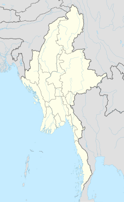
Gyobin is a river town in Homalin Township, Hkamti District, in the Sagaing Region of northwestern Burma. It is located east of Kaukngo. An old frontier outpost was located at Gyobin during the British Burma period.

Yebawmi is a river village in Homalin Township, Hkamti District, in the Sagaing Region of northwestern Burma. It is located near Hwepanan.Yebawmi lies on the banks of the Uyu River and is noted for its salt springs and waistcloth weaving.

Masein is a village in Homalin Township, Hkamti District, in the Sagaing Region of northwestern Burma.

Mezali is a village on the Chindwin River in Homalin Township, Hkamti District, in the Sagaing Region of northwestern Burma. The headworks of the Mon Canals were located at Mezali. The irrigation canal passes into the Chindwin River.

Mongkun is a village in Homalin Township, Hkamti District, in the Sagaing Region of northwestern Burma. It is located 1.7 kilometres west of Tawngbohla, and has an average elevation of 138 metres.

Tatkon is a village in Homalin Township, Hkamti District, in the Sagaing Region of northwestern Burma.

Namhkansi is a village in Homalin Township, Hkamti District, in the Sagaing Region of northwestern Burma.

Nampwehlaing is a village in Homalin Township, Hkamti District, in the Sagaing Region of northwestern Burma.

Nawngpuse is a village in Homalin Township, Hkamti District, in the Sagaing Region of northwestern Burma.

Talaunggyaung is a river village in Homalin Township, Hkamti District, in the Sagaing Region of northwestern Burma. It lies near the border with India.

Thawun is a village in Homalin Township, Hkamti District, in the Sagaing Region of northwestern Burma.

Tonlon is a village in Homalin Township, Hkamti District, in the Sagaing Region of northwestern Burma.

Yegyaw is a village in Homalin Township, Hkamti District, in the Sagaing Region of northwestern Burma.

Kyigon is a village in Kale Township, Kale District, in the Sagaing Region of western Burma (Myanmar). Kyigon is located on the left (north) bank of the Myittha River about 2.4 kilometres (1.5 mi) above where the Neyinzaya River enters the Myittha. It is about 8.8 kilometres (5.5 mi) northeast of the regional capital at Kalemyo.

Okpho is a small town and seat of Okpho Township, Tharrawaddy District, in the Bago Region of southern-central Myanmar. It lies south of Gyobingauk and north of Minhla. It contains a hospital, a pagoda, and an open ground in the town centre. It is located 177 kilometres (110 mi) north of Yangon. The Okpho Railway Station is operated by Myanmar Railways and the town also contains a police station.

Gyobingauk is a small town and seat of Gyobingauk Township, Tharrawaddy District, in the Bago Region of southern-central Burma. It lies approximately 10 kilometres north of Okpho along National Highway 2. It is located roughly 185 kilometres north of Yangon. The town has a Roman Catholic history with missionaries.

Sike Khaung is a town in Hsi Hseng Township, Taunggyi District, in the Shan State of eastern Myanmar. It is located north of the township capital of Hsi Hseng by National Highway 5. Nawnge and Lothkan are located to the west, Loimut to the southeast, and Hsohsa to the northeast.

Hsohsa is a village in Hsi Hseng Township, Taunggyi District, in the Shan State of eastern Burma. It is located northeast of the town of Loisawn. It is a primary agricultural village, with extensive fields around it. The village is named after Hso Hsa Hpa, a ruler of ancient Shan who was the son of Sao Pet Law.

Maihpit is a village in Hsi Hseng Township, Taunggyi District, in the Shan State of eastern Burma. It is located southwest of Nawnghkathpa and Loisawn. It is a primarily agricultural village with extensive fields surrounding it.

Namaklwe is a village near the Burma-Thai border in Mong Ton Township of Shan State in eastern Burma, across the border from Nong Uk, Thailand. It lies along National Highway 45 which connects it to Mong Ton in the north, and Chiang Mai may be accessed to the south. It has been a site of conflict when the Burma Frontier Force once gunned down Siamese invaders at Namaklwe.


