
Interstate 29 (I-29) is an Interstate Highway in the Midwestern United States. I-29 runs from Kansas City, Missouri, at a junction with I-35 and I-70, to the Canada–US border near Pembina, North Dakota, where it connects with Manitoba Provincial Trunk Highway 75 (PTH 75), which continues on to Winnipeg. The road follows the course of three major rivers, all of which form the borders of US states. The southern portion of I-29 closely parallels the Missouri River from Kansas City northward to Sioux City, Iowa, where it crosses and then parallels the Big Sioux River. For the northern third of the highway, it closely follows the Red River of the North. The major cities that I-29 connects to includes Council Bluffs, Iowa; Sioux City, Iowa; Sioux Falls, South Dakota; Fargo, North Dakota; and Grand Forks, North Dakota. I-29 also serves as a road connection between the four largest public universities in the Dakotas: the University of North Dakota, North Dakota State University, the University of South Dakota, and South Dakota State University.
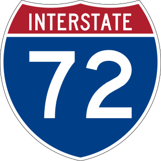
Interstate 72 (I-72) is an Interstate Highway in the midwestern United States. Its western terminus is in Hannibal, Missouri, at an intersection with U.S. Route 61 (US 61); its eastern terminus is at Country Fair Drive in Champaign, Illinois. The route runs through the major cities of Decatur, Illinois, and Springfield, Illinois. In 2006, the Illinois General Assembly dedicated all of I-72 as Purple Heart Memorial Highway. The stretch between Springfield and Decatur is also called Penny Severns Memorial Expressway, and the section between mile 35 and the Mississippi River is known as the Free Frank McWorter Historic Highway.

Route 141, also known as Woods Mill Road in parts of St. Louis County, is a state highway located in the western St. Louis metropolitan area. Its northern terminus is at Route 370 in Bridgeton; its southern terminus is at U.S. Route 61/U.S. Route 67 in Arnold, in Jefferson County. The northern stretches of the highway are often referred to as the Maryland Heights Expressway or Earth City Expressway.

U.S. Route 71 or U.S. Highway 71 is a major north–south United States highway that extends for over 1500 miles (2500 km) in the central United States. This original 1926 route has remained largely unchanged by encroaching Interstate highways. Currently, the highway's northern terminus is in International Falls, Minnesota at the Canada–US border, at the southern end of the Fort Frances-International Falls International Bridge to Fort Frances, Ontario. U.S. Route 53 also ends here. On the other side of the bridge, Trans-Canada Highway is an east–west route while Ontario Highway 71 is a north–south route. US 71's southern terminus is between Port Barre and Krotz Springs, Louisiana at an intersection with U.S. Route 190. For the entirety south of Kansas City, Missouri, US 71 runs parallel and concurrent with the existing and future Interstate 49. North of Kansas City, US 71 runs halfway between Interstate 29 and Interstate 35, which they split in the city at an interchange with Interstate 70.

U.S. Highway 159 (US 159) is a 83.6-mile-long (134.5 km) auxiliary route of US 59. It travels from Nortonville, Kansas at US 59 to New Point, Missouri, also at US 59. The highway permits through traffic on US 59 to bypass the cities of Atchison, Kansas and Saint Joseph, Missouri, traveling instead through Falls City, Nebraska and Hiawatha, Kansas.

Interstate 255 (I-255) is a bypass route of I-55 in Greater St. Louis. Along with I-270, it forms a loop around the central portion of the bi-state metro area; a majority of I-255 is located on the Illinois half. It shares its southern terminus with I-270 at the junction with I-55; I-270 and I-255 go to the west and east, respectively. U.S. Route 50 (US 50) joins I-255 at Lemay Ferry Road. It crosses the Mississippi River on the Jefferson Barracks Bridge, enters Illinois, and then turns northeast. There is a junction with I-64, where US 50 breaks off and goes east, and then further north there is a junction with I-55 again, I-70, and US 40, all of which are all cosigned together. The next junction is another one with I-270, which is the northern terminus of I-255. After that, the limited-access freeway continues on as Illinois Route 255 (IL 255). I-255 is 30.82 miles (49.60 km) in length.
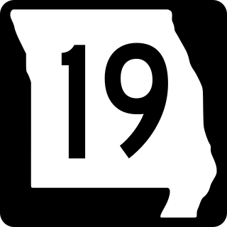
Route 19 is a long state highway in Missouri. Its northern terminus is at U.S. Route 61 in New London and its southern terminus is at U.S. Route 63 on the north side of Thayer. Route 19 is one of Missouri's original 1922 highways, though it initially had a northern terminus at Route 14 in Cuba and was later extended north.

Route 9 is a highway in the Kansas City, Missouri area. Its northern terminus is at Interstate 29/U.S. Route 71 in Kansas City North; its southern terminus is at Interstate 35/Interstate 70/U.S. Route 24/U.S. Route 40 in downtown Kansas City. Even though both termini are in Kansas City, it passes through other towns and cities. It is carried across the Missouri River by the Heart of America Bridge between downtown Kansas City, Missouri and North Kansas City, Missouri. In North Kansas City, the highway serves as a main thoroughfare, Burlington Street.
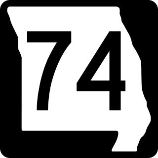
Route 74 is a highway in Cape Girardeau County, Missouri. The western terminus is at Route 25 in Dutchtown. Its eastern terminus is at the Illinois state line at the Mississippi River at Cape Girardeau. The road continues into Illinois as Illinois Route 146. No other towns are on the route.

Route 77 is a highway in southeastern Missouri. Its northern terminus is at Route 25 about four miles (6 km) south of Dutchtown; its southern terminus is at the Mississippi River in southeastern Mississippi County. The Dorena–Hickman Ferry connects the road with Kentucky Route 1354 in Kentucky.

Route 47 is a highway in eastern Missouri. Its northern terminus is at Route 79 near Winfield; its southern terminus is at U.S. Route 67 in Bonne Terre.
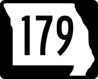
Route 179 is a highway in central Missouri. From its northern terminus at the interchange of Interstate 70 and Route 98, it winds its way Southeast over low rolling hills and through the flood plain along the Missouri River to Jefferson City, where it bypasses the city to the West via a four-lane divided highway between U.S. Route 50 and U.S. Route 54, its southern terminus. Towns on Route 179 are Overton, Wooldridge, Jamestown, Sandy Hook, Marion, and Jefferson City.
Route 180 is a highway in the St. Louis, Missouri area. Its western terminus is at Interstate 270 (I-270) in Bridgeton, running east into the western neighborhoods of St. Louis to its eastern terminus at Kingshighway Boulevard, the border of the St. Louis neighborhoods of Kingsway West and Kingsway East.

Interstate 155 (I-155) is an east–west auxiliary Interstate Highway that runs 26.77 miles (43.08 km) through the Bootheel of Missouri and the northwestern corner of Tennessee. It begins south of Hayti, Missouri at Interstate 55 (I-55) and passes eastward through Caruthersville, before crossing the Mississippi River on the Caruthersville Bridge into Tennessee. The route then proceeds to Dyersburg, where it terminates at an interchange with U.S. Route 51 (US 51). I-155 is the only piece of surface transportation infrastructure that directly connects Missouri and Tennessee, and is concurrent with US 412 for its entire length.
U.S. Route 78 (US 78) is an east–west United States Numbered Highway that runs for 843.3 miles (1,357.2 km) from Cash, Arkansas, to Charleston, South Carolina. From Byhalia, Mississippi to Birmingham, Alabama, US 78 runs concurrently with Interstate 22 (I-22). The highway’s western terminus is at US 67 /Arkansas Highway 226 (AR 226) near Cash, and its eastern terminus is on Line Street, in Charleston. Prior to November 2023, before the western extension, the highway's former western terminus was at US 64/US 70/US 79 in Memphis, Tennessee.

Interstate 680 (I-680) in Nebraska and Iowa is the northern bypass of the Omaha–Council Bluffs metropolitan area. I-680 spans 16.49 miles (26.54 km) from its southern end in western Omaha, Nebraska, to its eastern end near Crescent, Iowa. The freeway passes through a diverse range of scenes and terrains—the urban setting of Omaha, the Missouri River and its valley, the rugged Loess Hills, and the farmland of Pottawattamie County, Iowa.
State Route 79 is a 10.37-mile-long (16.69 km) state highway in southwestern Lake County, Tennessee. SR 79 has a dual primary and secondary designation and is one of a few state routes in Tennessee to have an aggregate (gravel) road surface.

In the US state of Iowa, Interstate 29 (I-29) is a north–south Interstate Highway which closely parallels the Missouri River. I-29 enters Iowa from Missouri near Hamburg and heads to the north-northwest through the Omaha–Council Bluffs and the Sioux City areas. It exits the state by crossing the Big Sioux River into South Dakota. For its entire distance through the state, it runs on the flat land between the Missouri River and the Loess Hills.

Interstate 55 (I-55) is a north–south Interstate Highway that has a 72.22-mile (116.23 km) section in the US state of Arkansas connecting sections in Tennessee and Missouri. The route enters Arkansas on the Memphis & Arkansas Bridge over the Mississippi River from Memphis, Tennessee. It travels northward through northeast Arkansas, connecting the cities of West Memphis and Blytheville. I-55 continues into Missouri heading to St. Louis, Missouri. The highway overlaps I-40 in West Memphis and has a junction with I-555, a spur route to Jonesboro, in Turrell. For the majority of its routing through Arkansas, I-55 generally follows U.S. Highway 61 (US 61) and has a 67.08-mile (107.95 km) long concurrency with US 78 from the Tennessee state line in Memphis to Blytheville for most of its length.
Route 84 is a state highway in the Missouri bootheel. The route starts at Arkansas Highway 90 over the St. Francis River on the Arkansas–Missouri state line. The road travels eastward to Kennett, where it becomes concurrent with U.S. Route 412. East of Kennett, the concurrent routes travel eastward on a divided highway to Hayti Heights, where the concurrency ends. Route 84 travels through Hayti Heights and Hayti, and it crosses Interstate 55 (I-55) and US 61. The route then travels southeastwards to Caruthersville, and bypasses the central area of the city. In the southern part of Caruthersville, Route 84 ends at an interchange with I-155 and US 412.


