Moeville, Wisconsin | |
|---|---|
 Moeville, Wisconsin  Moeville, Wisconsin | |
| Coordinates: 44°41′19″N92°31′39″W / 44.68861°N 92.52750°W | |
| Country | |
| State | |
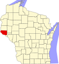
| County | Pierce |
| Elevation | 988 ft (301 m) |
| Time zone | UTC-6 (Central (CST)) |
| • Summer (DST) | UTC-5 (CDT) |
| Area codes | 715 & 534 |
| GNIS feature ID | 1569634 [1] |
Moeville is an unincorporated community located in the towns of Trenton and Trimbelle, in Pierce County, Wisconsin, United States. [1]