
Potaro-Siparuni is a region of Guyana. It borders the region of Cuyuni-Mazaruni to the north, the regions of Upper Demerara-Berbice and East Berbice-Corentyne to the east, the region of Upper Takutu-Upper Essequibo to the south and Brazil to the west.

The Patamona are an Amerindian people native to the Pakaraima Mountains of Guyana and northern Brazil. They speak a Cariban language, Kapóng, and have often been referred to interchangeably as Akawaio or Ingariko. Patamona are considered a sub-group of Kapon people.

Kaieteur Airport is an airport serving Kaieteur National Park in the Potaro-Siparuni region of Guyana.

Lethem Airport is an airport serving Lethem, a town in the Upper Takutu-Upper Essequibo region of Guyana. The airport has an 1,825-meter long, asphalt-surface runway.
Linden Airport is an airport serving Linden, the capital of the Upper Demerara-Berbice region of Guyana.
Baramita Airport is an airport serving the Amerindian village of Baramita, in the Barima-Waini Region of Guyana. The solitary, 914-meter runway of the airport is a grass surface.
Bartica Airport is an airport serving the town of Bartica, in the Cuyuni-Mazaruni Region of Guyana. The airport's only runway is a 760-meter asphalt strip.
Imbaimadai Airport is an airport serving the village of Imbaimadai, in the Cuyuni-Mazaruni Region of Guyana. The airport's only runway is a grass-surface, 1,219-meter strip.
Karanambo Airport is an airport serving the village of Karanambo, in the Upper Takutu-Upper Essequibo Region of Guyana. The 1,372-meter long runway is a dirt surface.
Mabaruma Airport is an airport serving the town of Mabaruma, capital of the Barima-Waini Region of Guyana.

Mahdia Airport is an airport serving the village of Mahdia, in the Potaro-Siparuni Region of Guyana. The airport's only runway is a 1,067-meter grass strip.
Mountain Point Airport is an airport in the Upper Takutu-Upper Essequibo Region of Guyana. The nearest community is Sand Creek.
Paruima Airport is an airport serving the community of Paruima in the Cuyuni-Mazaruni Region of Guyana.
Ebini Airport is an airport serving the community of Ebini in the Upper Demerara-Berbice Region of Guyana. The 1-kilometer-long runway has a gravel surface.
Karasabai Airport is an airport serving the Macushi community of Karasabai in the Upper Takutu-Upper Essequibo Region of Guyana. A 1,067 meters long gravel strip is the airport's only runway.
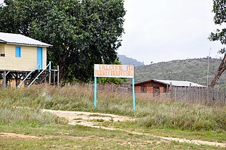
Monkey Mountain is an indigenous village in the Potaro-Siparuni Region of Guyana. The village is inhabited by the Patamona and Macushi tribes. Monkey Mountain is located near the Brazilian border. The village shares its name with the nearby mountain with a height of 591 metres (1,939 ft). The name is derived from the seasonal migration of monkeys on and around the nearby mountains.
Karasabai is an indigenous village of Macushi Amerindians in the Upper Takutu-Upper Essequibo Region of Guyana. It is located in the South Pakaraima Mountains, and near the Ireng River which flows south to the Amazon River.
Port Kaituma Airport is an airport serving the village of Port Kaituma, in the Barima-Waini Region of Guyana.
Paramakatoi Airport is an airport serving the village of Paramakatoi, in the Potaro-Siparuni Region of Guyana.

Kato is an indigenous village in the Potaro-Siparuni Region of Guyana. The village is mainly inhabited by Patamona people. The village is located in the Pacaraima Mountains.
