Monterey, Tennessee

Last updated

Monterey, Tennessee
Town of Monterey
Monterey-Commercial-Ave-tn1.jpg
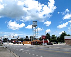
East Commercial Avenue
Motto(s): 
"", [1] "Where Hilltops Kiss the Sky" [1]
Putnam County Tennessee Incorporated and Unincorporated areas Monterey Highlighted 4749760.svg
Location of Monterey in Putnam County, Tennessee.
Coordinates: 36°8′43″N85°15′57″W / 36.14528°N 85.26583°W / 36.14528; -85.26583
Country United States
State Tennessee
County Putnam
Incorporated 1893 [2]
Named for Spanish for "King of the Mountain" [2]
Government
[3]
  Type Mayor-council
   Mayor Nathan Walker
   Vice Mayor Mark Farley
   Town Council
Aldermen
Area
[4]
  Total3.03 sq mi (7.85 km2)
  Land3.03 sq mi (7.84 km2)
  Water0.00 sq mi (0.01 km2)
Elevation
[5]
1,880 ft (570 m)
Population
 (2020) [6]
  Total2,746
  Density906.87/sq mi (350.18/km2)
Time zone UTC-6 (Central (CST))
  Summer (DST) UTC-5 (CDT)
ZIP code
38574
Area code 931
FIPS code 47-49760 [7]
GNIS feature ID1294185 [5]
Website www.exploremontereytn.com

Monterey is a town in Putnam County, Tennessee, United States. The population was 2,850 at the 2010 census. It is part of the Cookeville, Tennessee Micropolitan Statistical Area.

Contents

History

Monterey is rooted in a settlement that developed around a landmark known as the "Standing Stone" in the late 18th and early 19th centuries. The stone was as a guidepost for travelers along Avery's Trace, and is believed to have earlier served as a boundary marker between the territories of the Cherokee and Shawnee. [2] By 1805, three families had settled permanently in area, and the Standing Stone Inn was established to cater to westward-bound migrants. [2]

The Standing Stone Monument Montereystandingstone.jpg
The Standing Stone Monument

In the Spring of 1864, during the Civil War, 200 Union soldiers led by Colonel William B. Stokes entered the Monterey area with orders to root out Confederate guerrilla activity. On the morning of March 12 of that year, Stokes' men entered the home of William Alexander Officer near Monterey and killed six of his guests, having accused them of being Confederate guerrillas. [8] A Tennessee Historical Commission marker on Commercial Avenue in Monterey remembers the event.

With the progress of rail road coming up the mountain from Cookeville, the Cumberland Mountain Coal Company, a group of 10 investors, bought property that contained coal from T.J. Whittaker. The company was interested in building a new company town to provide housing and commercial ventures for the workers. They hired Maj. Robert John Moscrip to lay out the new town. A contest was held to name it. Moscrip won. The new town was to be named “Monterey”, which meant “King of the Mountains”, and coal was king. Moscrip continued engineering the railroad tracks out the Crawford Branch into Overton County. That line opened by 1894. He was also hired to open coal lands for the Alexander Crawford family up to 1904. A female contractor was hired, which was unheard of at the time, to build a portion of that line. [9]

On the evening of April 3, 2020, the National Weather Service issued a flash flood warning for the watershed of the Calfkiller River due to the failure of the dam confining the town's municipal lake. [10]

Geography

Monterey is located at 36°8′43″N85°15′57″W / 36.14528°N 85.26583°W / 36.14528; -85.26583 (36.145291, -85.265757). [11] The town is situated at the western edge of the Cumberland Plateau in eastern Putnam County, just north of the point where the counties of Putnam, White, and Cumberland meet, and just southwest of the point where Putnam, Overton, and Fentress meet. It is located approximately 90 miles (140 km) east of Nashville and the same distance west of Knoxville, and is connected with these two cities by Interstate 40 (exits 300 and 301) and U.S. Route 70. State Route 84 connects Monterey with Livingston to the northwest and Sparta to the southwest. State Route 62 connects Monterey with Clarkrange along U.S. Route 127 to the east, and State Route 164 connects the town with Crawford and the rural areas of the western Plateau to the north.

The sources of the Calfkiller River and the Falling Water River are both located just west of Monterey, on opposite sides of I-40.

According to the United States Census Bureau, the town has a total area of 3.0 square miles (7.8 km2), of which, 3.0 square miles (7.8 km2) is land and 0.34% is water.

Climate

Climate data for Monterey, Tennessee (1991–2020 normals, extremes 1904–present)
MonthJanFebMarAprMayJunJulAugSepOctNovDecYear
Record high °F (°C)75
(24)
78
(26)
82
(28)
86
(30)
90
(32)
103
(39)
102
(39)
99
(37)
99
(37)
93
(34)
82
(28)
73
(23)
103
(39)
Mean maximum °F (°C)64.2
(17.9)
67.6
(19.8)
74.4
(23.6)
81.2
(27.3)
84.8
(29.3)
89.5
(31.9)
90.8
(32.7)
90.3
(32.4)
87.8
(31.0)
81.3
(27.4)
73.4
(23.0)
64.7
(18.2)
92.3
(33.5)
Mean daily maximum °F (°C)43.1
(6.2)
47.4
(8.6)
56.2
(13.4)
66.5
(19.2)
74.5
(23.6)
81.1
(27.3)
84.2
(29.0)
83.3
(28.5)
78.0
(25.6)
67.6
(19.8)
55.7
(13.2)
46.6
(8.1)
65.4
(18.5)
Daily mean °F (°C)35.2
(1.8)
38.8
(3.8)
46.7
(8.2)
56.4
(13.6)
65.0
(18.3)
72.1
(22.3)
75.4
(24.1)
74.4
(23.6)
68.7
(20.4)
57.7
(14.3)
46.9
(8.3)
39.0
(3.9)
56.4
(13.6)
Mean daily minimum °F (°C)27.2
(−2.7)
30.1
(−1.1)
37.3
(2.9)
46.3
(7.9)
55.6
(13.1)
63.2
(17.3)
66.6
(19.2)
65.6
(18.7)
59.4
(15.2)
47.8
(8.8)
38.2
(3.4)
31.4
(−0.3)
47.4
(8.5)
Mean minimum °F (°C)5.2
(−14.9)
11.5
(−11.4)
18.6
(−7.4)
29.5
(−1.4)
38.7
(3.7)
50.5
(10.3)
57.1
(13.9)
56.2
(13.4)
44.2
(6.8)
31.3
(−0.4)
20.8
(−6.2)
13.0
(−10.6)
3.3
(−15.9)
Record low °F (°C)−6
(−21)
−11
(−24)
2
(−17)
18
(−8)
31
(−1)
42
(6)
51
(11)
49
(9)
35
(2)
22
(−6)
−7
(−22)
−6
(−21)
−11
(−24)
Average precipitation inches (mm)5.72
(145)
5.75
(146)
6.00
(152)
5.82
(148)
5.42
(138)
5.48
(139)
5.63
(143)
4.51
(115)
4.79
(122)
3.80
(97)
4.73
(120)
6.69
(170)
64.34
(1,635)
Average snowfall inches (cm)4.8
(12)
5.0
(13)
2.8
(7.1)
0.3
(0.76)
0.0
(0.0)
0.0
(0.0)
0.0
(0.0)
0.0
(0.0)
0.0
(0.0)
0.0
(0.0)
0.2
(0.51)
2.9
(7.4)
16.0
(41)
Average precipitation days (≥ 0.01 in)15.113.514.212.513.012.612.410.89.510.110.814.1148.6
Average snowy days (≥ 0.1 in)3.33.01.60.20.00.00.00.00.00.00.31.710.1
Source 1: NOAA [12]
Source 2: National Weather Service [13]

Demographics

Historical population
CensusPop.Note
1910 1,107
1920 1,44530.5%
1930 1,73119.8%
1940 1,7420.6%
1950 2,04317.3%
1960 2,0691.3%
1970 2,35113.6%
1980 2,61011.0%
1990 2,559−2.0%
2000 2,7176.2%
2010 2,8504.9%
2020 2,746−3.6%
Sources: [14] [15] [6]

2020 census

Monterey racial composition [16]
RaceNumberPercentage
White (non-Hispanic)1,86367.84%
Black or African American (non-Hispanic)100.36%
Native American 20.07%
Other/Mixed 893.24%
Hispanic or Latino 78228.48%

As of the 2020 United States census, there were 2,746 people, 877 households, and 616 families residing in the town.

2000 census

As of the census [7] of 2000, there were 2,717 people, 1,029 households, and 697 families residing in the town. The population density was 920.9 inhabitants per square mile (355.6/km2). There were 1,141 housing units at an average density of 386.7 per square mile (149.3/km2). The racial makeup of the town was 88.81% White, 0.92% African American, 0.04% Native American, 0.18% Asian, 9.09% from other races, and 0.96% from two or more races. Hispanic or Latino of any race were 16.34% of the population.

Railroad cars at the Monterey Depot Rail-cars-Monterey-tn1.jpg
Railroad cars at the Monterey Depot

There were 1,029 households, out of which 31.4% had children under the age of 18 living with them, 50.0% were married couples living together, 12.9% had a female householder with no husband present, and 32.2% were non-families. 28.4% of all households were made up of individuals, and 13.9% had someone living alone who was 65 years of age or older. The average household size was 2.54 and the average family size was 3.06.

In the town, the population was spread out, with 24.7% under the age of 18, 9.7% from 18 to 24, 26.8% from 25 to 44, 21.8% from 45 to 64, and 16.9% who were 65 years of age or older. The median age was 37 years. For every 100 females, there were 95.0 males. For every 100 females age 18 and over, there were 89.1 males.

The median income for a household in the town was $23,550, and the median income for a family was $28,603. Males had a median income of $21,772 versus $18,895 for females. The per capita income for the town was $12,265. About 22.1% of families and 27.6% of the population were below the poverty line, including 38.4% of those under age 18 and 16.5% of those age 65 or over.

Notable people

Related Research Articles

<span class="mw-page-title-main">Putnam County, Tennessee</span> County in Tennessee, United States

Putnam County is a county located in the U.S. state of Tennessee. As of the 2020 census, the population was 79,854. Its county seat is Cookeville. Putnam County is part of the Cookeville, TN Micropolitan Statistical Area.

<span class="mw-page-title-main">Clay County, Tennessee</span> County in Tennessee, United States

Clay County is a county in the U.S. state of Tennessee. As of the 2020 census, the population was 7,581. Its county seat and only incorporated city is Celina. Clay County is named in honor of American statesman Henry Clay, member of the United States Senate from Kentucky and United States Secretary of State in the 19th century.

<span class="mw-page-title-main">White County, Tennessee</span> County in Tennessee, United States

White County is a county located in the U.S. state of Tennessee. As of the 2020 census, the population was 27,351. Its county seat is Sparta.

<span class="mw-page-title-main">Pickett County, Tennessee</span> County in Tennessee, United States

Pickett County is a county located in the U.S. state of Tennessee. As of the 2020 census, the population was 5,001, making it the least populous county in Tennessee. Its county seat is Byrdstown. The city of Byrdstown and the Kentucky town of Albany, 11 miles (18 km) to the northeast, are positioned between two Army Corps of Engineers lakes: Dale Hollow Lake, mainly in Tennessee, and Lake Cumberland, in Kentucky. The area is known as "Twin Lakes" and Byrdstown is noted as "The Gateway To Dale Hollow Lake". Every year thousands of people vacation at the many resorts situated along the lakes.

<span class="mw-page-title-main">Overton County, Tennessee</span> County in Tennessee, United States

Overton County is a county located in the U.S. state of Tennessee. As of the 2020 census, the population was 22,511. Its county seat is Livingston. Overton County is part of the Cookeville, TN Micropolitan Statistical Area.

<span class="mw-page-title-main">Jackson County, Tennessee</span> County in Tennessee, United States

Jackson County is a county located in the U.S. state of Tennessee. The population was 11,617 at the 2020 census. Its county seat is Gainesboro. Jackson is part of the Cookeville Micropolitan Statistical Area.

<span class="mw-page-title-main">Fentress County, Tennessee</span> County in Tennessee, United States

Fentress County is a county located in the U.S. state of Tennessee. As of the 2020 census, the population was 18,489. Its county seat is Jamestown.

<span class="mw-page-title-main">Cumberland County, Tennessee</span> County in Tennessee, United States

Cumberland County is a county located in the U.S. state of Tennessee. As of the 2020 census, the population was 61,145. Its county seat is Crossville. Cumberland County comprises the Crossville, TN micropolitan statistical area.

<span class="mw-page-title-main">Gainesboro, Tennessee</span> Town in Tennessee, United States

Gainesboro is a town in Jackson County, Tennessee, United States. The population was 920 at the 2020 census. It is the county seat of Jackson County.

<span class="mw-page-title-main">Livingston, Tennessee</span> Town in Tennessee, United States

Livingston is a town in Overton County, Tennessee, United States, and serves as the county seat. The population was 3,905 at the 2020 census and 4,058 at the 2010 census. The current mayor, Curtis Hayes, began serving his mayoral position in September 2006.

<span class="mw-page-title-main">Algood, Tennessee</span> City in Tennessee, United States

Algood is a city in Putnam County, Tennessee, United States. The population was 3,963 at the 2020 census. It is part of the Cookeville Micropolitan Statistical Area.

<span class="mw-page-title-main">Baxter, Tennessee</span> City in Tennessee, United States

Baxter is a city in Putnam County, Tennessee, United States. The population was 1,578 at the 2020 census. It is part of the Cookeville, Tennessee Micropolitan Statistical Area.

<span class="mw-page-title-main">Cookeville, Tennessee</span> Largest city and county seat of Putnam County, Tennessee, United States

Cookeville is the county seat and largest city of Putnam County, Tennessee, United States. As of the 2020 United States census, its population was reported to be 34,842. It is recognized as one of the country's micropolitan areas, or smaller cities which function as significant regional economic hubs. Of the twenty micropolitan areas in Tennessee, Cookeville is the largest. The Cookeville micropolitan area's 2010 Census population was 106,042. The U.S. Census Bureau ranked the Cookeville micropolitan area as the 7th largest-gaining micropolitan area in the country between 2018 and 2019, with a one-year gain of 1,796 and a 2019 population of 114,272. The city is a college town, home to Tennessee Technological University.

<span class="mw-page-title-main">Graysville, Tennessee</span> Town in Tennessee, United States

Graysville is a town in Rhea County, Tennessee, United States. The population was 1,471 at the 2020 census and 1,502 at the 2010 census.

<span class="mw-page-title-main">Carthage, Tennessee</span> Town in Tennessee, United States

Carthage is a town in and the county seat of Smith County, Tennessee, United States; it is part of the Nashville Metropolitan Statistical Area. The population was 2,306 at the 2010 census. It is located on the Cumberland River, which was important to its early development. It is likely best known as the hometown of former Vice President and Senator Al Gore of the Democratic Party and his father, Senator Albert Gore, Sr. The younger Gore announced his 1988 and 2000 presidential bids, as well as his 1992 vice-presidential bid, from the steps of the Smith County Courthouse.

<span class="mw-page-title-main">Sparta, Tennessee</span> City in Tennessee, United States

Sparta is a city in and the county seat of White County, Tennessee, United States. The population was 5,001 in 2020.

<span class="mw-page-title-main">Monterey, Virginia</span> Town in Virginia, United States

Monterey is a town in Highland County, Virginia, United States. The population was 165 at the 2020 census. It is the county seat of Highland County.

<span class="mw-page-title-main">Alpine, Tennessee</span> Unincorporated community in Tennessee, United States

Alpine is a small unincorporated community in Overton County, Tennessee, United States. It is served by the ZIP Code of 38543, for which the ZCTA had a population of 497 at the 2000 census.

<span class="mw-page-title-main">Cookeville micropolitan area</span> Micropolitan statistical area in Tennessee, United States

The Cookeville Micropolitan Statistical Area as defined by the United States Census Bureau, is an area consisting of four counties in central Tennessee, anchored by the city of Cookeville.

<span class="mw-page-title-main">Tennessee's 15th Senate district</span> American legislative district

Tennessee's 15th Senate district is one of 33 districts in the Tennessee Senate. It has been represented by Republican Paul Bailey since 2014, succeeding retiring Democrat Charlotte Burks.

References

  1. 1 2 "Welcome Page". Town of Monterey. Retrieved October 22, 2020.
  2. 1 2 3 4 Monterey, Tennessee - History. Retrieved: January 23, 2013. Accessed at Archive.org July 17, 2016.
  3. "Monterey". Municipal Technical Advisory Service. University of Tennessee . Retrieved October 22, 2020.
  4. "ArcGIS REST Services Directory". United States Census Bureau. Retrieved October 15, 2022.
  5. 1 2 U.S. Geological Survey Geographic Names Information System: Monterey, Tennessee
  6. 1 2 "Census Population API". United States Census Bureau. Retrieved October 15, 2022.
  7. 1 2 "U.S. Census website". United States Census Bureau . Retrieved January 31, 2008.
  8. Op Walker, "Union Forces Massacred Several at Officer House 150 Years Ago," AJLambert.com. Originally published in the Cookville Herald-Citizen, April 13, 2014.
  9. "Moscrip made mark on Upper Cumberland". Overton County News. Retrieved December 30, 2021.
  10. WTVF-DT, Newschannel 5 at 6 PM, April 3, 2020
  11. "US Gazetteer files: 2010, 2000, and 1990". United States Census Bureau. February 12, 2011. Retrieved April 23, 2011.
  12. "U.S. Climate Normals Quick Access – Station: Monterey, TN". National Oceanic and Atmospheric Administration. Retrieved June 16, 2023.
  13. "NOAA Online Weather Data – NWS Nashville". National Weather Service. Retrieved June 16, 2023.
  14. "Census of Population and Housing: Decennial Censuses". United States Census Bureau . Retrieved March 4, 2012.
  15. "Incorporated Places and Minor Civil Divisions Datasets: Subcounty Resident Population Estimates: April 1, 2010 to July 1, 2012". Population Estimates. U.S. Census Bureau. Archived from the original on June 11, 2013. Retrieved December 11, 2013.
  16. "Explore Census Data". data.census.gov. Retrieved December 27, 2021.