
The Sonoran Desert is a North American desert and ecoregion that covers large parts of the southwestern United States, as well as Sonora in northwestern Mexico in, Baja California, and Baja California Sur. It is the hottest desert in Mexico. It has an area of 260,000 square kilometers (100,000 sq mi).

Anza-Borrego Desert State Park (ABDSP) is a California State Park located within the Colorado Desert of southern California, United States. The park takes its name from 18th century Spanish explorer Juan Bautista de Anza and borrego, a Spanish word for sheep. With 585,930 acres (237,120 ha) that includes one-fifth of San Diego County, it is the largest state park in California.

The Santa Rosa Mountains are a short mountain range in the Peninsular Ranges system, located east of the Los Angeles Basin and northeast of the San Diego metropolitan area of southern California, in the southwestern United States.

California's Colorado Desert is a part of the larger Sonoran Desert. It encompasses approximately 7 million acres, including the heavily irrigated Coachella and Imperial valleys. It is home to many unique flora and fauna.

Washingtonia filifera, also known as desert fan palm, California fan palm, or California palm, is a flowering plant in the palm family (Arecaceae) native to the far southwestern United States and Baja California. Growing to 15–20 m (49–66 ft) tall by 3–6 m (10–20 ft) broad, it is an evergreen monocot with a tree-like growth habit. It has a sturdy, columnar trunk and waxy, fan-shaped (palmate) leaves.

The Chocolate Mountains of California are located in Imperial and Riverside counties in the Colorado Desert of Southern California. The mountains stretch more than 60 miles (100 km) in a northwest to southeast direction, and are located east of the Salton Sea and south and west of the Chuckwalla Mountains and the Colorado River. To the northwest lie the Orocopia Mountains.

The Chemehuevi Mountains are found at the southeast border of San Bernardino County in southeastern California adjacent the Colorado River. Located south of Needles, California and northwest of the Whipple Mountains, the mountains lie in a north-south direction in general, and are approximately 15 miles in length.

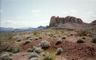
The Orocopia Mountains are located in Riverside County in southern California, United States, east of the Coachella Valley, west of the Chuckwalla Mountains, and south of Interstate 10 in the Colorado Desert. The range lies in an east-west direction, and is approximately 18 miles long. The Orocopia Mountains are north of and overlooking the Salton Sea and south of Joshua Tree National Park, with the Chocolate Mountains to the southeast and the scenic Mecca Hills just northwest.

The Turtle Mountains, are located in northeastern San Bernardino County, in the southeastern part of California. The colorful Turtle Mountains vary from deep reds, browns, tans and grays, to black. The area has numerous springs and seeps. The Turtle Mountains are also a National Natural Landmark, with two mountain sections of entirely different composition.

The Whipple Mountains are located in eastern San Bernardino County, California. They are directly west of the Colorado River, Parker Dam, and Lake Havasu; south of Needles, California; north of Parker, Arizona and Vidal, California; and northeast of Vidal Junction, California.
The Stepladder Mountains are located in southeastern California in the United States. The range, found in San Bernardino County, is home to the 84,199-acre (approximate) Stepladder Mountains Wilderness, which protects the Desert tortoise, California's state reptile. The mountains are located east of the Old Woman Mountains and north of the Turtle Mountains, about 29 miles (47 km) southeast of the town of Essex.

The Santa Rosa and San Jacinto Mountains National Monument is a National Monument in southern California. It includes portions of the Santa Rosa and San Jacinto mountain ranges, the northernmost ones of the Peninsular Ranges system. The national monument covers portions of Riverside County, west of the Coachella Valley, approximately 100 miles (160 km) southeast of downtown Los Angeles.

The Lower Colorado River Valley (LCRV) is the river region of the lower Colorado River of the southwestern United States in North America that rises in the Rocky Mountains and has its outlet at the Colorado River Delta in the northern Gulf of California in northwestern Mexico, between the states of Baja California and Sonora. This north–south stretch of the Colorado River forms the border between the U.S. states of California/Arizona and Nevada/Arizona, and between the Mexican states of Baja California/Sonora.

The Muggins Mountains is a mountain range in southwest Arizona east of Yuma, Arizona, northeast of the Gila Mountains, and east of the Laguna Mountains. The Castle Dome Mountains lie to the northeast across the broad Castle Dome Plain. The Muggins Mountains Wilderness occupies the southwest portion of the range.

The Deserts of California have unique ecosystems and habitats, a sociocultural and historical "Old West" collection of legends, districts, and communities, and they also form a popular tourism region of dramatic natural features and recreational development. All of the deserts are located in eastern Southern California, in the Western United States.
The Palo Verde Mountains are a mountain range in northeastern Imperial County, California. They are located along the west side of the Colorado River in the Lower Colorado River Valley and Colorado Desert. Palo Verde Peak, which rises to about 1,800 feet in the southern portion, is the highest point in the area. Thumb Peak stands to the north. Clapp Spring, a palm oasis, is located east of Thumb Peak. Clapp Spring is the only permanent water source in the area for wildlife species.

The Whipple Mountains Wilderness is a 76,122-acre (30,805 ha) wilderness administered by the Bureau of Land Management (BLM). Most of the Whipple Mountains are within the wilderness area. It is located in the northeastern Colorado Desert near the Colorado River. Lake Havasu and Lake Havasu City are 25 miles (40 km) to the North. Earp, California and Parker, Arizona are 20 miles (32 km) to the South. The Parker Dam is 8 miles (13 km) due east.

Flora of the Colorado Desert, located in Southern California. The Colorado Desert is a sub-region in the Sonoran Desert ecoregion of southwestern North America. It is also known as the Low Desert, in contrast to the higher elevation Mojave Desert or High Desert, to its north.
Tres Alamos Wilderness is a protected wilderness area centered around the southern portion of the Black Mountains and the range high point of Sawyer Peak in the U.S. state of Arizona. The namesake feature, Tres Alamos, is a prominent and colorful monolith in the mountains. Established in 1990 under the Arizona Desert Wilderness Act the area is managed by the Bureau of Land Management.
