Motheo District Municipality

Last updated
Motheo District Municipality
Map of the Free State with Motheo highlighted.svg
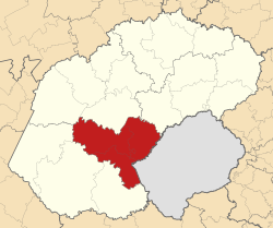
A map of the Free State showing Motheo (red)
Coordinates: 29°07′S26°13′E / 29.117°S 26.217°E / -29.117; 26.217 Coordinates: 29°07′S26°13′E / 29.117°S 26.217°E / -29.117; 26.217
Country South Africa
Province Free State
Seat Bloemfontein
Local municipalities
Government
  MayorM. E. Moilwa
  ManagerMr G. Ramathebane
Area
[1]
  Total13,950.18 km2 (5,386.19 sq mi)
Population
 (2007) [2]
  Total837,379
  Density60/km2 (160/sq mi)
Racial makeup
(2007) [2]
   Black African 82.4%
   White 12.8%
   Coloured 4.7%
   Indian or Asian 0.2%
Languages
(2001) [3]
   Sesotho 53.55%
   Setswana 16.57%
   Afrikaans 15.32%
   IsiXhosa 11.01%
   English 1.76%
Time zone UTC+2 (SAST)
District codeDC17
Website http://www.motheo.co.za/

Motheo ( Sesotho , meaning "foundation" or "cornerstone") was, until the municipal elections of 18 May 2011, a district of the Free State province of South Africa. At the time of the 2011 elections it was disestablished as a consequence of Mangaung Local Municipality being upgraded to a metropolitan municipality.

Contents

The Motheo District Municipality Head Office was based in Bloemfontein, which also serves as the capital of the Free State Province and as the judicial capital of South Africa. [1]

Disestablishment

The Motheo District was disestablished on 18 May 2011. When this happened, of its three constituent local municipalities, Mangaung was upgraded to become an autonomous metropolitan municipality, Naledi became part of Xhariep, and Mantsopa became part of Thabo Mofutsanyane. [4]

Geography

Neighbours

Motheo was surrounded by:

Local municipalities

The district was divided into three local municipalities: Mangaung, Mantsopa, and Naledi.

Of these, Mangaung Local Municipality — now Mangaung Metropolitan Municipality — is the most densely populated; it features the greatest concentration of well-developed infrastructure and services in the Bloemfontein area, which offers a wide range of amenities to the surrounding rural communities. As of 2007, Mangaung Municipality had a population of 752,906 (roughly 90% of Motheo's total population).

Mantsopa Local Municipality, located to the east of Mangaung, is a mixed agricultural area, with a population of 59,028 (7% of the total).

Naledi Local Municipality, located to the southeast of Mangaung, is largely characterized by livestock-oriented farming, and has a population of 25,445 (3% of the total). [1]

Settlements

In Mangaung Local Municipality:

In Mantsopa Local Municipality:

In Naledi Local Municipality:

Demographics

The Black African population group constituted 82.4% of the district's population. [2] Sesotho was the native language of over 50% of the district's residents. [3]

Gender

As of 2007, 52.3% of the population were female, and 47.7% were male. [2]

Age

As of 2007, 27.6% of the population were between the age of 0 and 14; 29.6% were between 15 and 29 years old; 21.4% were between 30 and 44 years old; 13.5% were between 45 and 59 years old; 5.9% were between 60 and 74 years old; and 2.0% were 75 or older. [2]

Related Research Articles

Bloemfontein Judicial Capital of South Africa

Bloemfontein, also known as Bloem, is one of South Africa's three capital cities and the capital of the Free State province. It serves as the judicial capital of the country, along with legislative capital Cape Town and administrative capital Pretoria. Bloemfontein is the seventh-largest city in South Africa.

Sotho people Bantu ethnic group of Southern Africa

The Sotho people, also known as the Basuto or Basotho, are a Bantu nation native to southern Africa. They split into different ethnic groups over time, due to regional conflicts and colonialism, which resulted in the modern Basotho, who have inhabited the region of Lesotho, South Africa since around the fifth century CE.

Free State (province) Province of South Africa

The Free State is a province of South Africa. Its capital is Bloemfontein, which is also South Africa's judicial capital. Its historical origins lie in the Boer republic called the Orange Free State and later Orange Free State Province.

Thaba Nchu Place in Free State, South Africa

Thaba 'Nchu is a town in Free State, South Africa, 63 km east of Bloemfontein and 17 km east of Botshabelo. The population is largely made up of Tswana and Sotho people. The town was settled in December 1833 and officially established in 1873. The town grew larger following the 1913 Natives' Land Act that stated Thaba 'Nchu as a homeland for Tswana people. It was known among the Voortrekkers as Blesberg.

Thabo Mofutsanyana District Municipality District municipality in Free State, South Africa

Thabo Mofutsanyana is one of the 5 districts of the Free State province of South Africa. The seat of Thabo Mofutsanyana is Witsieshoek. The majority of its 725 932 people speak Sesotho. The district code is DC19

Lejweleputswa District Municipality District municipality in Free State, South Africa

Lejweleputswa is one of the 5 districts of Free State province of South Africa. The seat of Lejweleputswa is Welkom. The majority of its 657 019 people speak Sotho. The district code is DC18.

Xhariep District Municipality District municipality in Free State, South Africa

Xhariep is one of the 5 districts of Free State province of South Africa.The District is the largest in the Free State Geographically and is known for its vast land. The District is home to the largest dam in the Country, the Gariep Dam and has two mines,situated in Jagersfontein and Koffifontein. The natural resources and the geographical position of the District make it a site with the best potential for investment and development. Xhariep has prominent towns such as Rouxville. The seat of Xhariep is Trompsburg. The largest language group is Sotho who make up 45.3% of the total population of 146,259. The district code is DC16.

Uthukela District Municipality District municipality in KwaZulu-Natal, South Africa

uThukela is one of the 11 districts of the KwaZulu-Natal province of South Africa. The seat of uThukela is the city of Ladysmith. The majority of its 668,848 people speak IsiZulu. The district code is DC23.

Fezile Dabi District Municipality District municipality in Free State, South Africa

Fezile Dabi District Municipality, formerly known as Northern Free State District Municipality, is one of the 5 districts of Free State province of South Africa. The seat of Northern Free State is Sasolburg. The majority of its 460 289 people speak Sesotho. The district code is DC20.

N8 (South Africa)

The N8 is a national route in South Africa that connects Groblershoop with Maseru in Lesotho via Kimberley and Bloemfontein. It is maintained by the South African National Roads Agency.

The Diocese of the Free State is a diocese in the Anglican Church of Southern Africa.

Mangaung Metropolitan Municipality Metropolitan municipality in Free State, South Africa

Mangaung Metropolitan Municipality is a metropolitan municipality which governs Bloemfontein and surrounding towns in the Free State province of South Africa. Mangaung is a Sesotho name meaning "place of cheetahs", as it was not uncommon for the Basotho to name warrior regiments after ferocious animals.

Dihlabeng Local Municipality Local municipality in Free State, South Africa

Dihlabeng Local Municipality is an administrative area in the Thabo Mofutsanyane District of the Free State in South Africa. It was established in terms of Section 12 of the Local Government Structures Act, 117 of 1998, after the first general local government elections of 5 December 2000 which heralded the final phase of local government reform as envisaged in 1994 at the onset of the process of democratisation.

Setsoto Local Municipality Local municipality in Free State, South Africa

Setsoto Local Municipality is an administrative area in the Thabo Mofutsanyane District of the Free State in South Africa. The name is a Sesotho word meaning "beauty". Setsoto is headed by Ficksburg, followed by Senekal, Clocolan and Marquard. It is the getaway municipality to the Kingdom of Lesotho through Ficksburg. Setsoto is rich in agriculture as well as producing cherries.

Naledi Local Municipality, Free State Disestablshed local municipality in Free State, South Africa

Naledi Local Municipality was a local municipality in the Free State province in South Africa. On 3 August 2016 it was disestablished and merged into the Mangaung Metropolitan Municipality. The name Naledi is a Sesotho word meaning "a star". The principal towns in the area of the disestablished municipality are Dewetsdorp and Wepener.

Thaba Phatswa is a town in Thabo Mofutsanyane District Municipality in the Free State province of South Africa.

The R702 is a Regional Route in South Africa that connects Bloemfontein with the Lesotho border at Van Rooyen's Gate via Dewetsdorp and Wepener.

Mangaung like most South African metropolitan areas, uses Metropolitan or "M" routes for important intra-city routes, a layer below National (N) roads and Regional (R) roads. Each city's M roads are independently numbered.

Walton Zacharias Fenyang was a South African politician. He was a central figure of the political establishment of Thaba Nchu as an independent reserve in South Africa. He was one of the Barolong members of the Thaba Nchu board.

References

  1. 1 2 3 "Integrated Development Plan: 2008/2009 Review" (PDF). Motheo District Municipality. Retrieved 2009-10-24.[ dead link ]
  2. 1 2 3 4 5 "Community Survey 2007 interactive data". Statistics South Africa. Archived from the original on 5 August 2012. Retrieved 24 October 2009.
  3. 1 2 Stats SA Census 2001 page Archived August 10, 2007, at the Wayback Machine
  4. Dlodlo, Cathy (4 February 2011). "Mangaung municipality to become metro after elections". The New Age. Archived from the original on 18 July 2011. Retrieved 9 March 2011.