Mount Gay-Shamrock, West Virginia

Last updated

Mount Gay-Shamrock, West Virginia
WVMap-doton-MountGay-Shamrock.PNG
Location of Mount Gay-Shamrock, West Virginia
Coordinates: 37°50′45″N82°0′52″W / 37.84583°N 82.01444°W / 37.84583; -82.01444
Country United States
State West Virginia
County Logan
Area
[1]
  Total7.56 sq mi (19.58 km2)
  Land7.55 sq mi (19.55 km2)
  Water0.01 sq mi (0.03 km2)
Elevation
668 ft (204 m)
Population
 (2010) [2]
  Total1,779
  Density236/sq mi (91.0/km2)
Time zone UTC-5 (Eastern (EST))
  Summer (DST) UTC-4 (EDT)
ZIP Codes
25637 (Mount Gay)
25601 (Logan)
Area code 304
FIPS code 54-56342 [3]
GNIS feature ID2389511

Mount Gay-Shamrock is a census-designated place (CDP) in Logan County, West Virginia, United States.

Contents

Mount Gay-Shamrock has a 2020 population of 1,360. Mount Gay-Shamrock is currently declining at a rate of -2.51% annually. The population was 1,779 at the 2010 census. [2]

The CDP includes the unincorporated communities of Mount Gay, Shamrock, Black Bottom, Whites Addition, Lintz Addition, Thompson Town, Hedgeview, Ridgeview, Logan Heights, Cora, and Whitman Junction. [4] [5]

A post office was established as Mount Gay in 1916. [6]

Geography

Mount Gay-Shamrock is located in west-central Logan County, [1] with the village of Mount Gay in the eastern part of the CDP at the confluence of Island Creek and the Copperas Mine Fork, [7] and the village of Shamrock just to the west in the valley of the Copperas Mine Fork. Settlements in the CDP run south up the valley of Island Creek, southwest up the valley of the Copperas Mine Fork, and west up the valley of the Mud Fork. The CDP is bordered to the east by the city of Logan, the county seat, and to the west by U.S. Route 119, a four-lane freeway which separates Mount Gay-Shamrock from Verdunville.

West Virginia Route 73 is the main road through the CDP, following the valley of the Mud Fork and connecting US-119 to the west with Logan to the east. West Virginia Route 44 leads south from Mount Gay up the valley of Island Creek. Old US Highway 119 runs up the valley of the Copperas Mine Fork, joining current US-119 at Holden.

According to the United States Census Bureau, the CDP has a total area of 7.6 square miles (19.6 km2), of which 0.01 square miles (0.03 km2), or 0.15%, are water. [1] The entire CDP is part of the Island Creek watershed, feeding the Guyandotte River in Logan and thence leading north to the Ohio River.

Demographics

As of the census [3] of 2000, there were 2,623 people, 1,065 households, and 726 families living in the CDP. The population density was 219.3 people per square mile (84.7/km2). There were 1,216 housing units at an average density of 101.6/sq mi (39.3/km2). The racial makeup of the CDP was 90.43% White, 8.27% African American, 0.30% Native American, 0.11% Asian, 0.04% Pacific Islander, 0.15% from other races, and 0.69% from two or more races. Hispanic or Latino of any race were 0.38% of the population.

There were 1,065 households, out of which 27.9% had children under the age of 18 living with them, 48.2% were married couples living together, 14.9% had a female householder with no husband present, and 31.8% were non-families. 28.6% of all households were made up of individuals, and 11.2% had someone living alone who was 65 years of age or older. The average household size was 2.46 and the average family size was 3.02.

In the CDP, the population was spread out, with 22.6% under the age of 18, 9.2% from 18 to 24, 27.7% from 25 to 44, 26.5% from 45 to 64, and 14.0% who were 65 years of age or older. The median age was 40 years. For every 100 females, there were 96.0 males. For every 100 females age 18 and over, there were 90.5 males.

The median income for a household in the CDP was $18,975, and the median income for a family was $22,946. Males had a median income of $21,328 versus $23,021 for females. The per capita income for the CDP was $12,532. About 29.3% of families and 34.2% of the population were below the poverty line, including 49.0% of those under age 18 and 29.0% of those age 65 or over.

Related Research Articles

<span class="mw-page-title-main">Wyoming County, West Virginia</span> County in West Virginia, United States

Wyoming County is a county in the U.S. state of West Virginia. As of the 2020 census, the population was 21,382. Its county seat is Pineville. The county was created in 1850 from Logan County and named for the Lenape word meaning "large plains".

<span class="mw-page-title-main">Mingo County, West Virginia</span> County in West Virginia, United States

Mingo County is a county in the U.S. state of West Virginia. As of the 2020 census, the population was 23,568. Its county seat and largest city is Williamson. Created in 1895, Mingo is West Virginia's newest county, named for the historic Iroquoian Mingo people.

<span class="mw-page-title-main">Logan County, West Virginia</span> County in West Virginia, United States

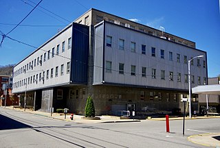
Logan County is a county in the U.S. state of West Virginia. As of the 2020 census, the population was 32,567. Its county seat is Logan. Logan County comprises the Logan, WV Micropolitan Statistical Area, which is also included in the Charleston–Huntington–Ashland, WV–OH–KY Combined Statistical Area.

<span class="mw-page-title-main">Boone County, West Virginia</span> County in West Virginia, United States

Boone County is a county in the U.S. state of West Virginia. As of the 2020 census, the population was 21,809. Its county seat is Madison. Boone County is part of the Charleston, WV Metropolitan Statistical Area. Leading industries and chief agricultural products in Boone County include coal, lumber, natural gas, tobacco, and strawberries.

<span class="mw-page-title-main">Healy, Alaska</span> Census-designated place in Alaska, United States

Healy is a census-designated place (CDP) and the borough seat of Denali Borough in the U.S. state of Alaska. The population was 966 at the time of the 2020 census, down from 1,021 in 2010.

<span class="mw-page-title-main">Fox, Alaska</span> Census-designated place in Alaska, United States

Fox is a census-designated place (CDP) in Fairbanks North Star Borough, Alaska, United States. It is part of the Fairbanks, Alaska Metropolitan Statistical Area. At the 2010 census the population was 417, up from 300 in 2000.

<span class="mw-page-title-main">Top-of-the-World, Arizona</span> CDP in Gila County, Arizona

Top-of-the-World is a census-designated place (CDP) in Gila and Pinal counties in the U.S. state of Arizona. The population was 274 at the 2020 census, up from 231 at the 2010 census, and down from 330 at the 2000 census.

<span class="mw-page-title-main">Mariposa, California</span> Census-designated place in California, United States

Mariposa is an unincorporated community and census-designated place (CDP) in and the county seat of Mariposa County, California, United States. The population was 1,526 at the 2020 census. The community is named after the flocks of monarch butterflies seen overwintering there by early explorers.

<span class="mw-page-title-main">Clarence, Pennsylvania</span> Census-designated place in Pennsylvania, United States

Clarence is a census-designated place (CDP) in Centre County, Pennsylvania, United States. It is part of the State College, Pennsylvania Metropolitan Statistical Area. The population was 626 at the 2010 census.

<span class="mw-page-title-main">Hybla Valley, Virginia</span> Census-designated place in Virginia, United States

Hybla Valley is a census-designated place (CDP) in Fairfax County, Virginia, United States, south of Alexandria. The population was 15,801 at the 2010 census, down from 16,721 in 2000 due to a reduction in area, resulting from some of the eastward neighborhoods including much of Hollin Hills being moved to the Fort Hunt CDP. The population increased to 16,319 in the 2020 census.

<span class="mw-page-title-main">Mount Vernon, Virginia</span> Census-designated place in Virginia, United States

Mount Vernon is a census-designated place (CDP) and unincorporated community in Fairfax County, Virginia, United States. The population was 12,416 at the 2010 census. Primarily due to its historical significance and natural recreation and beauty, the Mount Vernon area receives over one million tourists each year.

<span class="mw-page-title-main">Powellton, West Virginia</span> CDP in West Virginia, United States

Powellton is a census-designated place (CDP) in Fayette County, West Virginia, United States. The population was 619 at the 2010 census.

<span class="mw-page-title-main">Coal Fork, West Virginia</span> Census-designated place in West Virginia, United States

Coal Fork is an unincorporated census-designated place (CDP) in Kanawha County, West Virginia, United States. It is part of a larger unincorporated community known as Campbells Creek, approximately 10 minutes east of Charleston. The population was 1,233 at the 2010 census.

<span class="mw-page-title-main">Alum Creek, West Virginia</span> Census-designated place in West Virginia, United States

Alum Creek is a census-designated place (CDP) in Kanawha and Lincoln counties along the Coal River in the U.S. state of West Virginia. It includes the unincorporated communities of Alum Creek, Forks of Coal, and Priestley. The CDP had a population of 1,749 at the 2010 census, down from 1,839 at the 2000 census.

<span class="mw-page-title-main">Harts, West Virginia</span> Census-designated place in West Virginia, United States

Harts is a census-designated place (CDP) at the mouth of Big Harts Creek in Lincoln County, West Virginia, United States, situated along the Guyandotte River. As of the 2010 census, its population was 656. Harts is a part of the Huntington-Ashland, WV-KY-OH, Metropolitan Statistical Area (MSA). The Harts CDP includes the unincorporated communities of Harts, Atenville, Ferrellsburg, and Sand Creek.

<span class="mw-page-title-main">Holden, West Virginia</span> Census-designated place in West Virginia, United States

Holden is a census-designated place (CDP) in Logan County, West Virginia, United States. The population was 876 at the 2010 census, down from 1,105 in 2000. The CDP contains the unincorporated communities of Holden, Beebe, Frogtown, Sycamore, Diamond, and Davis, all in the valley of Copperas Mine Fork.

<span class="mw-page-title-main">Mallory, West Virginia</span> Census-designated place in West Virginia, United States

Mallory is a census-designated place (CDP) in Logan County, West Virginia, United States. The population was 1,654 at the 2010 census. The CDP contains the unincorporated communities, from west to east, of Huff Junction, Mallory, Davin, Mineral City, Claypool, Combs Addition, and Gillman Bottom.

<span class="mw-page-title-main">Switzer, West Virginia</span> Census-designated place in West Virginia, United States

Switzer is an unincorporated community and census-designated place (CDP) in Logan County, West Virginia, United States. The CDP includes the neighboring unincorporated community of Micco. The total CDP population was 595 at the 2010 census.

<span class="mw-page-title-main">Matewan, West Virginia</span> Town in West Virginia, United States

Matewan is a town in Mingo County, West Virginia, United States at the confluence of the Tug Fork River and Mate Creek. The population was 499 at the 2010 census. The Norfolk Southern Railway's Pocahontas District passes through the town. It was a key site of the Coal Wars and the location of the Battle of Matewan in 1920.

Verdunville is an unincorporated community and census-designated place (CDP) in Logan County, West Virginia, United States. It is 3.5 miles (5.6 km) west of Logan, the county seat. Verdunville has a post office with ZIP code 25649. The Verdunville CDP includes the neighboring community of Shegon. As of the 2010 census, the total CDP population was 687.

References

  1. 1 2 3 "2020 U.S. Gazetteer Files – West Virginia". United States Census Bureau. Retrieved March 16, 2021.
  2. 1 2 "Total Population: 2010 Census DEC Summary File 1 (P1), Mount Gay-Shamrock CDP, West Virginia". data.census.gov. U.S. Census Bureau. Retrieved March 16, 2021.
  3. 1 2 "U.S. Census website". United States Census Bureau . Retrieved January 31, 2008.
  4. "TIGERweb: Mount Gay-Shamrock CDP, West Virginia". Geography Division, U.S. Census Bureau. Retrieved March 16, 2021.
  5. "U.S. Geological Survey 7.5-minute topographic map series: Holden quadrangle". ACME Mapper. Retrieved March 16, 2021.
  6. "Logan County". Jim Forte Postal History. Retrieved October 2, 2014.
  7. West Virginia Atlas & Gazetteer. Yarmouth, Me.: DeLorme. 1997. p. 51. ISBN   0-89933-246-3.