Mount Hermon, Virginia

Last updated

Mount Hermon
USA Virginia location map.svg
Red pog.svg
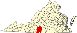
Mount Hermon
Location of Mount Hermon within the state of Virginia
Coordinates: 36°40′42″N79°25′20″W / 36.67833°N 79.42222°W / 36.67833; -79.42222
Country Flag of the United States.svg United States
State Flag of Virginia.svg Virginia
County Pittsylvania
Population
 (2010)
3,966 [1]
ZIP code
53944 [1]

Mount Hermon is a census-designated place (CDP) in Pittsylvania County, Virginia, United States. The population as of the 2010 Census was 3,966.

Mount Hermon is located approximately 3 miles northwest of the city limits of Danville, Virginia.

Related Research Articles

<span class="mw-page-title-main">Shenandoah County, Virginia</span> County in Virginia, United States

Shenandoah County is a county located in the Commonwealth of Virginia. As of the 2020 United States Census, the population was 44,186. Its county seat is Woodstock. It is part of the Shenandoah Valley region of Virginia.

<span class="mw-page-title-main">Pittsylvania County, Virginia</span> County in Virginia, United States

Pittsylvania County is a county located in the Commonwealth of Virginia. As of the 2020 United States Census, the population was 60,501. Chatham is the county seat.

Hermon is a town in Penobscot County, Maine, United States. The population was 6,461 at the 2020 census.

<span class="mw-page-title-main">Gill, Massachusetts</span> Town in Massachusetts, United States

Gill is a town in Franklin County, Massachusetts, United States. The population was 1,551 at the 2020 census. It is part of the Springfield, Massachusetts Metropolitan Statistical Area. The campus of Northfield Mount Hermon School is located in the Mount Hermon section of the town.

<span class="mw-page-title-main">Northfield, Massachusetts</span> Town in Massachusetts, United States

Northfield is a town in Franklin County, Massachusetts, United States. Northfield was first settled in 1673. The population was 2,866 at the 2020 census. It is part of the Springfield, Massachusetts Metropolitan Statistical Area. The Connecticut River runs through the town, dividing West Northfield from East Northfield and the village of Northfield, where the town hall is located.

<span class="mw-page-title-main">Hermon, New York</span> Town in New York, United States

Hermon is a town in St. Lawrence County, New York, United States. The population was 1,108 at the 2010 census. Hermon is named after Mount Hermon in Israel, which is the name corresponding to Mount Jabal al-Sheikh in Syria. The town contains a hamlet also called Hermon, and is in the south-central part of the county, southwest of Canton.

<span class="mw-page-title-main">Mount Hermon</span> Mountain range in Syria and Lebanon

Mount Hermon is a mountain cluster constituting the southern end of the Anti-Lebanon mountain range. Its summit straddles the border between Syria and Lebanon and, at 2,814 m (9,232 ft) above sea level, is the highest point in Syria. On the top, in the United Nations buffer zone between Syrian and Israeli-occupied territories, is the highest permanently manned UN position in the world, known as "Hermon Hotel", located at 2814 metres altitude. The southern slopes of Mount Hermon extend to the Israeli-occupied portion of the Golan Heights, where the Mount Hermon ski resort is located with a top elevation of 2,040 m (6,690 ft). A peak in this area rising to 2,236 m (7,336 ft) is the highest elevation in Israeli-controlled territory.

<span class="mw-page-title-main">Northfield Mount Hermon School</span> Private, boarding school in Gill, Massachusetts, United States

Northfield Mount Hermon School, often abbreviated as NMH, is a co-educational college-preparatory school for boarding and day students in grades 9–12, along with a post-graduate year. Located in Gill, Massachusetts, it is a member of the Eight Schools Association and Six Schools League.

<span class="mw-page-title-main">Danville, Virginia micropolitan area</span>

The Danville Micropolitan Statistical Area is a Micropolitan Statistical Area (μSA) in Virginia as defined by the United States Office of Management and Budget (OMB). As of the 2010 census, the μSA had a population of 106,561

<span class="mw-page-title-main">Mount Hermon, California</span> Unincorporated community in California, United States

Mount Hermon is an unincorporated community and census-designated place (CDP) in Santa Cruz County, California.

<span class="mw-page-title-main">Palestine, Hampshire</span> Village in Hampshire, England

Rakhlah, previously known as Zenopolis, is a village situated 31 kilometres (19 mi) west of Damascus, Syria. also known as "The town of Wine and Poetry".

Qal'at Bustra or Qalat Bustra is an archaeological site in Lebanon, close to the border of the Sheba Farms region of the Israeli-occupied Golan Heights, about 5 km ENE of Ghajar. It is situated on a peak of height 786m with a panoramic westward view. Qal'at Bustr is believed to be an ancient Roman sanctuary and was excavated by Israeli archaeologists. Remains found at the site include a farmhouse and temple dating from the Hellenistic and Roman period.

Kafr Hawr is a Syrian village situated 35 kilometres (22 mi) southwest of Damascus. According to the Syria Central Bureau of Statistics, the village had a population of 2,957 in the 2004 census.

Mount Hermon is an unincorporated community and census-designated place (CDP) located within Hope Township in Warren County, in the U.S. state of New Jersey, that was defined as part of the 2010 United States Census. As of the 2010 Census, the CDP's population was 141.

Darbal is a Syrian village in the Qatana District of the Rif Dimashq Governorate. According to the Syria Central Bureau of Statistics (CBS), Darbal had a population of 2,049 in the 2004 census. Its inhabitants are predominantly Muslims.

Arnah is a Syrian village in the Qatana District of the Rif Dimashq Governorate. According to the Syria Central Bureau of Statistics (CBS), Arnah had a population of 3,146 in the 2004 census. Its inhabitants are predominantly Druze.

Qalaat al-Jandal is a Syrian village in the Qatana District of the Rif Dimashq Governorate. According to the Syria Central Bureau of Statistics (CBS), Qalaat al-Jandal had a population of 3,251 in the 2004 census. Its inhabitants are predominantly Druze.

Beqaasem is a Syrian village in the Qatana District of the Rif Dimashq Governorate. According to the Syria Central Bureau of Statistics (CBS), Beqaasem had a population of 2,268 in the 2004 census. Its inhabitants are predominantly Druze.

References

  1. 1 2 Virginia Trend Report 2: State and Complete Places. Archived August 16, 2017 at the Wayback Machine. Retrieved September 4, 2022.