Related Research Articles

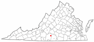
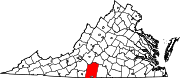
Pittsylvania County is a county located in the Commonwealth of Virginia. As of the 2020 United States Census, the population was 60,501. Chatham is the county seat.
Stanley is a town in Page County, Virginia, United States. The population was 1,689 at the 2010 census.
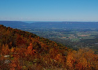
Mount Airy is an unincorporated community in northeastern Pittsylvania County, Virginia, United States. Its altitude is 643 feet (196 m), and it is located at 36°56′35″N79°11′32″W, along State Route 40 between Gretna and Brookneal. It is included in the Danville, Virginia Metropolitan Statistical Area.
Ashby is an unincorporated community in Cumberland County, Virginia. It sits at an elevation of 433 feet.
The Iron River is a 17.1-mile-long (27.5 km) river in Iron County, Michigan, in the United States. It flows from northwest to southeast through the city of Iron River to the Brule River. It is part of the Menominee River watershed, flowing to Lake Michigan.

Cherokee City is an unincorporated census-designated place (CDP) in Benton County, Arkansas, United States. Per the 2020 census, the population was 73. It is the location of Coon Creek Bridge, which is located on Cty Rd. 24 and is listed on the National Register of Historic Places. The community was named for the Cherokee, since the Trail of Tears crossed the landscape when the Cherokee migrated west to Indian territory, now Oklahoma in the late 1830s. The town is within the Northwest Arkansas region, located about 5 miles east of Oklahoma and 4 miles south of the Missouri state line.
Brosville is an unincorporated community in Pittsylvania County, in the U.S. state of Virginia.
Buford is an unincorporated community in Pittsylvania County, in the U.S. state of Virginia. It is mentioned in the Beale ciphers.

Dry Fork is an unincorporated community in Pittsylvania County, in the U.S. state of Virginia.
Hollywood, Pittsylvania County is an unincorporated community in Pittsylvania County, in the U.S. state of Virginia.
Motleys Mill is an unincorporated community in Pittsylvania County, in the U.S. state of Virginia.
Mount Cross is an unincorporated community in Pittsylvania County, in the U.S. state of Virginia.
Natal is an unincorporated community in Pittsylvania County, in the U.S. state of Virginia.
Pickaway is an unincorporated community in Pittsylvania County, in the U.S. state of Virginia.
Pickerel is an unincorporated community in Pittsylvania County, in the U.S. state of Virginia.
Sandy River is an unincorporated community in Pittsylvania County, in the U.S. state of Virginia.

Whitmell is an unincorporated community in Pittsylvania County, in the U.S. state of Virginia. It is the location of the now-closed historic Whitmell Farm-Life School named for Whitmell P. Tunstall, a lawyer and state legislator.
Ransons is an unincorporated community in Buckingham County, in the U.S. state of Virginia.
Noxall is an unincorporated community in New Madrid County, in the U.S. state of Missouri.
Griswold is an unincorporated community in the southeast corner of Oregon County, in the Ozarks of southern Missouri.
References
36°34′40″N79°30′41″W / 36.57778°N 79.51139°W
| | This Pittsylvania County, Virginia state location article is a stub. You can help Wikipedia by expanding it. |