The East Sudanian savanna is a hot, dry, tropical savanna ecoregion of Central and East Africa.

The Northern Congolian forest–savanna mosaic is a forest and savanna ecoregion of central Africa. It extends east and west across central Africa, covering parts of Cameroon, Central African Republic, Democratic Republic of the Congo, South Sudan, and Uganda. It is part of the belt of transitional forest-savanna mosaic that lie between Africa's moist equatorial Guineo-Congolian forests and the tropical dry forests, savannas, and grasslands to the north and south.

Mount Elgon National Park is a national park 140 kilometres (87 mi) northeast of Lake Victoria. The park covers an area of 1,279 square kilometres (494 sq mi) and is bisected by the border of Kenya and Uganda. The Ugandan part of the park covers 1,110 km2 (430 sq mi) while the Kenyan part covers 169 km2 (65 sq mi). The Kenyan part of the park was gazetted in 1968, the Ugandan part in 1992.

The wildlife of the Gambia is dictated by several habitat zones over the Gambia's land area of about 10,000 km2. It is bound in the south by the savanna and on the north by the Sudanian woodlands. The habitats host abundant indigenous plants and animals, in addition to migrant species and newly planted species. They vary widely and consist of the marine system, coastal zone, estuary with mangrove vegetation coupled with Banto Faros, river banks with brackish and fresh water zones, swamps covered with forests and many wetlands.

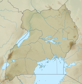
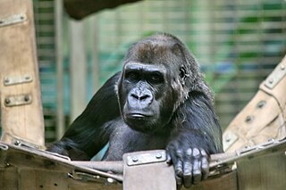
The wildlife of Uganda is composed of its flora and fauna. Uganda has a wide variety of different habitats, including mountains, hills, tropical rainforest, woodland, freshwater lakes, swamps and savanna with scattered clumps of trees. The country has a biodiverse flora and fauna reflecting this range of habitats and is known for its primates, including gorillas and chimpanzees. There are ten national parks and thirteen wildlife reserves; some 345 species of mammal and 1020 species of bird have been recorded in the country.
Today, forest and woodland cover in Uganda stands at 49,000 km² or 24% of the total land area. Of these 9,242.08 km² is tropical rainforest, 350.60 km² are forest plantations and 39,741.02 km² is woodland. 30% of these areas are protected as national parks, wildlife reserves or central forest reserves.
The wildlife of the Central African Republic is in the vast natural habitat in the Central African Republic (CAR) located between the Congo Basin's rain forests and large savannas, where the human density was smaller than 0.5 per km2 prior to 1850. The forest area of 22.755 million, considered one of the richest storehouses of wildlife spread over national parks, hunting reserves and community hunting areas, experienced an alarming loss of wildlife because of greed for ivory and bushmeat exploitation by hunters – mostly Arab slavers from across the borders of the Central African Republic with Chad and Sudan.

The Imatong Mountains are mainly located in Eastern Equatoria in southeastern South Sudan, and extend into the Northern Region of Uganda. Mount Kinyeti is the highest mountain of the range at 3,187 metres (10,456 ft), and the highest point of South Sudan.

The Budongo Forest in Uganda is northwest of the capital city Kampala on the way to Murchison Falls National Park and is located on the escarpment northeast of Lake Albert. It covers parts of Hoima and Kikuube. It is known for its former abundance of East African mahogany trees as well as being home to a population of chimpanzees. An exceptionally large mahogany tree is still found here and is more than 80 meters tall and some 20 meters in circumference. The forest covers 82,530 hectares and is a catchment for Lake Albert. It is managed by National Forestry Authority (NFA).

The West Sudanian savanna is a tropical savanna ecoregion that extends across West Africa.

The Victoria Basin forest–grassland mosaic is an ecoregion that lies mostly in Uganda and extends into neighboring countries. The ecoregion is centered north and west of Lake Victoria, with an outlier on the border of Ethiopia and South Sudan.
Mafuga Central Forest Reserve is a protected area nestled within the landscapes of Rubanda district and Rukungiri district in Western Uganda. This forest reserve, managed by the National Forestry Authority (NFA), is renowned for its biodiversity, stunning mountain scenery, and ecological features. As a key component of Uganda's Central Forest Reserves system, Mafuga Central Forest Reserve plays a crucial role in conservation efforts and serves as a haven for numerous plant and animal species.

Kalinzu Central Forest Reserve is a protected area located in Bushenyi district in south-western Uganda. Covering an area of 137 square kilometers, the reserve is characterized by its diverse ecosystem consisting of dense tropical rainforest vegetation and a wide range of wildlife.
Kasagala Central Forest Reserve is a protected area located in central Uganda. It was reserved in 1963 and is known for its diverse ecosystem and significant contribution to the region's biodiversity conservation efforts. Kasagala forest reserve was established to provide ecosystem services and watershed protection to Lake Kyoga, an inland body of water that is slowly drying up owing to loss of surrounding plant cover.
Kasyoha-Kitomi Central Forest Reserve is located in Western Uganda, and has an area of 433-square-kilometre (107,000-acre). It is located south of Lake George and the Kazinga channel in the Albertine Rift eco-region, which is known for its abundance of endemic species. The forest reserve lies within the counties of Bunyaruguru, Igara and Buhweju in the administrative districts of Bushenyi, Ibanda and Kamwenge It was officially gazetted in 1932 and is controlled by Uganda's National Forestry Authority (NFA).
Taala Central Forest Reserve is a protected forest reserve located in Kyankwanzi district in the Central region of Uganda. It is surrounded by the local (rural) communities thus it satisfies the subsistence needs of local people for forest products. Also it supports commercial use especially timber harvesting and environmental protection.
Kapchorwa Central Forest Reserve is a forest reserve located in Kapchorwa district found in the eastern part of Uganda at the slopes of Mount Elgon. It is bordered by Mbale, Bulambuli, and Sironko in the south-west, Nakapiripit and Moroto in the north, and the republic of Kenya in the east. The area largely comprises the sabiny, pokot and the nandi communities of western Kenya. The 0.06 square kilometer forest reserve is located at an Altitude of 2,100 to 2,400 meters above sea level.
Lutoboka Central Forest Reserve is a protected area in Uganda's Eastern district of Kalangala. The 174 hectares Lutoboka Forest Reserve is located in Kalangala Town Council on Bugala Island.
Mount Otzi Central Forest Reserve is a 188 square kilometer forest reserve located in Moyo District, West Nile Region, Uganda. It is situated on an escarpment that overlooks the confluence of River Achwa and the White Nile as it flows into South Sudan. The reserve is bordered on the North by the International border of South Sudan and to the South by the Moyo-Adjumani District border. Mount Otzi Forest Reserve is an important place for the surrounding people because bamboo poles and other non-timber goods are crucial for building materials and also provide lumber. Not only that, but the National Forestry Authority Department has designated it as an Important Biodiversity Conservation Area due to its importance as a large water catchment area.