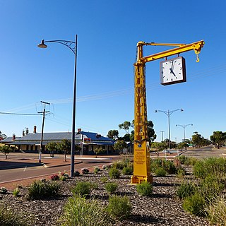
Narembeen is a town in the Wheatbelt region of Western Australia. It is 286 km, almost due east, from Perth, the capital of WA. It is the major settlement in the Shire of Narembeen, in which the major industries are growing cereal crops and raising cattle and sheep. The surrounding areas produce wheat and other cereal crops. The town is a receival site for Cooperative Bulk Handling.

Cranbrook is a small town in the Shire of Cranbrook in the Great Southern region of Western Australia between Katanning, Kojonup and Mount Barker, situated 320 km south of Perth. It is billed as "The Gateway to the Stirlings", referring to the nearby Stirling Range National Park. At the 2006 census, Cranbrook had a population of 280.

Corrigin is a town in the central Wheatbelt region of Western Australia, 229 kilometres (142 mi) east-southeast of the state capital, Perth, Western Australia, along State Route 40. It is mostly a farming community focused on crops and sheep, and holds the world record of "the most dogs in a ute".

Perenjori is a townsite in the northern agricultural region, 348 kilometres (216 mi) north of Perth and 39 kilometres (24 mi) south-east of Morawa. It is located on the Wongan Hills to Mullewa railway line which was opened in 1915. Perenjori was approved as the name of a siding in April 1913, and later that year the government decided to establish a townsite there. Perenjori townsite was gazetted in 1916.

Boyup Brook is a town in the south-west of Western Australia, 269 kilometres (167 mi) south-southeast of Perth and 31 kilometres (19 mi) northeast of Bridgetown. The town lies on Kaniyang land within the Noongar nation.

Kojonup is a town 256 kilometres (159 mi) south-east of Perth, Western Australia along Albany Highway in the Great Southern region. The name Kojonup refers to the "Kodja" or stone axe made by Aboriginal Australians, from the local stone.

Arthur River is a small town located in the Wheatbelt region of Western Australia, between Williams and Kojonup on the Albany Highway.

The Shire of Kojonup is a local government area in the Great Southern region of Western Australia, about 250 kilometres (155 mi) southeast of the state capital, Perth, along Albany Highway. The Shire covers an area of 2,932 square kilometres (1,132 sq mi) and its seat of government is the town of Kojonup.

Trayning is a town in the north-eastern Wheatbelt region of Western Australia, 236 kilometres (147 mi) east of the state capital, Perth, on the Nungarin–Wyalkatchem Road. At the 2006 census, Trayning had a population of 122.

Koorda is a town in the north eastern Wheatbelt region of Western Australia, approximately 236 kilometres (147 mi) east of Perth and 43 kilometres (27 mi) north of Wyalkatchem at the northeastern end of the Cowcowing Lakes. It is the main town in the Shire of Koorda. At the 2016 census Koorda had a population of 414. The surrounding areas produce wheat and other cereal crops. The town is a receival site for Cooperative Bulk Handling.
Ajana is a townsite within the Shire of Northampton in Western Australia. It is located at the junction of Ajana-Kalbarri Road and Ajana Back Road, 53 kilometres (33 mi) by road north of Northampton, 61 kilometres (38 mi) by road southwest of Kalbarri, and 531 kilometres (330 mi) west-northwest of Perth in the Mid West region.

Gabbin is a small town in the Wheatbelt region of Western Australia.

Yelbeni is a small town 222 km east-northeast of Perth, Western Australia along the Nungarin-Wyalkatchem Road situated in the Wheatbelt region of Western Australia. At the 2006 census, Yelbeni had a population of 118.
Westdale or West Dale is a locality near the Beverley-Westdale road in the Wheatbelt region of Western Australia, 93 kilometres (58 mi) from Perth. The locality was referred to as West Dale, Beverley in publications in the twentieth century.
Yandanooka is a small town in the Mid West region of Western Australia. The town is located between Mingenew and Three Springs on the Midlands Road.
Mayanup is a small town in the South West region of Western Australia. It is between Boyup Brook and Kojonup. At the 2006 census, Mayanup had a population of 323.
Walgoolan is a small town located in the eastern Wheatbelt region of Western Australia. It is situated between Merredin and Bodallin along the Great Eastern Highway.
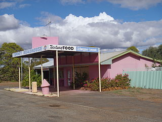
Tunney is a town located along the Albany Highway between Kojonup and Cranbrook, in the Shire of Broomehill-Tambellup in the Great Southern region of Western Australia.
Yoweragabbie is a small town in the Mid West region of Western Australia between the towns of Mount Magnet and Yalgoo.

Pintharuka is an abandoned townsite in the Mid West region of Western Australia. The town is located between the towns of Morawa and Mullewa on the Mullewa-Wubin Road

