
Eyre Highway is a 1,664-kilometre (1,034 mi) highway linking Western Australia and South Australia via the Nullarbor Plain. Signed as National Highways 1 and A1, it forms part of Highway 1 and the Australian National Highway network linking Perth and Adelaide. It was named after explorer Edward John Eyre, who was the first European to cross the Nullarbor by land, in 1840–1841. Eyre Highway runs from Norseman in Western Australia, past Eucla, to the state border. Continuing to the South Australian town of Ceduna, it crosses the top of the Eyre Peninsula before reaching Port Augusta.

Great Northern Highway is an Australian highway that links Western Australia's capital city Perth with its northernmost port, Wyndham. With a length of almost 3,200 kilometres (2,000 mi), it is the longest highway in Australia, with the majority included as part of the Perth Darwin National Highway. The highway, which travels through remote areas of the state, is constructed as a sealed, predominantly two-lane single carriageway, but with some single-lane bridges in the Kimberley. Economically, it provides vital access through the Wheatbelt and Mid West to the resource-rich regions of the Pilbara and Kimberley. In these areas, the key industries of mining, agriculture and pastoral stations, and tourism are all dependent on the highway.

North West Coastal Highway is a generally north-south Western Australian highway which links the coastal city of Geraldton with the town of Port Hedland. The 1,300-kilometre-long (808 mi) road, constructed as a sealed two-lane single carriageway, travels through remote and largely arid landscapes. Carnarvon is the only large settlement on the highway, and is an oasis within the harsh surrounding environment. The entire highway is allocated National Route 1, part of Australia's Highway 1, and parts of the highway are included in tourist routes Batavia Coast Tourist Way and Cossack Tourist Way. Economically, North West Coastal Highway is an important link to the Mid West, Gascoyne and Pilbara regions, supporting the agricultural, pastoral, fishing, and tourism industries, as well as mining and offshore oil and gas production.
Port Wakefield Highway is an important South Australian highway, connecting Adelaide to the Yorke Peninsula, Port Augusta, northern and western South Australia, the Northern Territory and Western Australia. It is designated National Highway A1 and a part of the National Highway. It is named after Port Wakefield, the first government town north of Adelaide.

The Shire of Ngaanyatjarraku is a remote local government area in Western Australia near the Northern Territory/South Australian border. It is 1,542 km (958 mi) from Perth.
Yellowdine is a town located 402 kilometres (250 mi) east of Perth, Western Australia on the Great Eastern Highway. The townsite is in the Goldfields-Esperance region, situated in the Shire of Yilgarn.

North Fremantle is a suburb of Perth, Western Australia, located within the City of Fremantle, a local government area of the state. Its postcode is 6159.

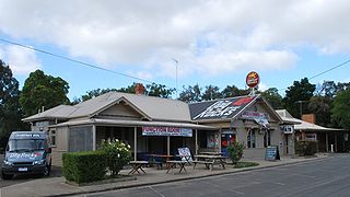
Mundrabilla is in a very sparsely populated area in the far south east of Western Australia. The two significant features are Mundrabilla Roadhouse and Mundrabilla Station, which are approximately 35 kilometres (22 mi) apart. At the 2016 census, Mundrabilla had a population of 23, 32% male and 68% female. The time zone in use is UTC+08:45.
The Gateway Motorway is a major tolled motorway in Brisbane, Queensland, Australia which includes the Sir Leo Hielscher Bridges. The motorway is operated by toll road operator Transurban.

Gloucester Park is a harness racing course in Perth, Western Australia. In the suburb of East Perth, the oval course is adjacent to the WACA Ground. The track is lit, and Friday night pacing events are popular. As of 2006 the Western Australian Trotting Association have used Gloucester Park for more than 70 years, starting with the first Inter Dominion Championship held in February 1936. Gloucester Park has also been used for Telstra Rally Australia. Between 1977 and 1979 Gloucester Park was used as a venue for World Series Cricket matches. Between September 2015 and April 2017, the drop-in wickets for Optus Stadium were built and maintained in the centre of Gloucester Park.
Batesford is a town located approximately 10 kilometres west of Geelong and 67 kilometres south-west of the state capital, Melbourne.

Gascoyne Junction is a small town in the Gascoyne region of Western Australia, inland from Carnarvon on the junction of the Gascoyne River and Lyons River. At the 2006 census, Gascoyne Junction had a population of 149.

Badgingarra is a small town in the Wheatbelt region of Western Australia, about 205 kilometres (127 mi) north of Perth in the Shire of Dandaragan. It lies on the Brand Highway adjacent to the Badgingarra National Park.
Condamine is a rural town and locality in the Western Downs Region, Queensland, Australia. In the 2016 census, the locality of Condamine had a population of 384 people.

Forrest Highway is a 95-kilometre-long (59 mi) highway in Western Australia's Peel and South West regions, extending Perth's Kwinana Freeway from east of Mandurah down to Bunbury. Old Coast Road was the original Mandurah–Bunbury route, dating back to the 1840s. Part of that road, and the Australind Bypass around Australind and Eaton, were subsumed by Forrest Highway. The highway begins at Kwinana Freeway's southern terminus in Ravenswood, continues around the Peel Inlet to Lake Clifton, and heads south to finish at Bunbury's Eelup Roundabout. There are a number of at-grade intersections with minor roads in the shires of Murray, Waroona, and Harvey including Greenlands Road and Old Bunbury Road, both of which connect to South Western Highway near Pinjarra.

The Fortescue River is an ephemeral river in the Pilbara region of Western Australia. It is the third longest river in the state.
Nanutarra is a locality in Western Australia adjacent to where the Ashburton river is crossed by the North West Coastal Highway. It is also close to the turn-off for State Route 136 to Paraburdoo and Tom Price. It is 40 kilometres (25 mi) south of the Onslow turn-off in the Cane River conservation park where it is on either side of the highway.
Cosmo Newbery is a small Aboriginal community in Western Australia, 1,036 kilometres (644 mi) east of Perth between Laverton and Warburton in the Goldfields-Esperance region of Western Australia. In the 2011 census, Cosmo Newberry had a total population of 74, including 64 Aboriginal and Torres Strait Islander people.
Bornholm is a small township in the Great Southern region of Western Australia located between Albany and Denmark on the Lower Denmark Road.

