Related Research Articles

The Blackwood River is a major river and catchment in the South West of Western Australia.
The Kalgan River is a river in the Great Southern region of Western Australia.

The Carbunup River is located in the south-west corner of Western Australia. The mouth of the Carbunup River is approximately 20 kilometres (12 mi) west of Busselton where the river flows into Geographe Bay.

The King River is a river in the Great Southern region of Western Australia.
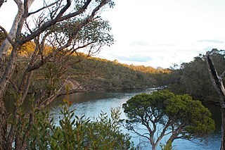
Deep River is a river located in the Great Southern region of Western Australia.
Bremer River is a river in Western Australia that rises near Jerramungup at the border of the Yilgarn plateau. The river flows in a generally south-easterly direction and the river valley becomes steadily deeper as the river approaches the coast, where it has eroded the Pallinup siltstone deposits that deposited over the underlying granite.

Balgarup River is a river in Western Australia that has its headwaters south-east of Kojonup just below Byenup Hill.
The Beaufort River is a river in the South West of Western Australia.

The Fitzgerald River is a river in the Great Southern region of Western Australia.

The Hay River is a river in the Great Southern region of Western Australia. The traditional owners of the area are the Noongar people, who know the river as Genulup.
The Walpole River is a river in the Great Southern region of Western Australia. The river was seen by Captain Thomas Bannister in 1831 and named by Governor James Stirling after Captain W. Walpole.

The Denmark River is located in the Great Southern region of Western Australia. The river rises near Pardelup and meanders in a southerly direction until it flows through Denmark into Wilson Inlet. The traditional owners of the area are the Noongar people, who know the river as Kwoorabup, meaning the place of the Western brush wallaby.

Gairdner River is a river located in the Great Southern region of Western Australia.
Pallinup River is a river located in the Great Southern region of Western Australia. It was previously known as Salt River.

The Avon River, a perennial river of the Hawkesbury-Nepean catchment, is located in the Southern Highlands and Macarthur districts of New South Wales, Australia.
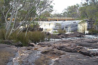
Shannon River is a river located in the Great Southern region of Western Australia.

The Fortescue River is an ephemeral river in the Pilbara region of Western Australia. It is the third longest river in the state.

Drysdale River is a river in the Kimberley region of Western Australia.

The Cordeaux River, a perennial river of the Hawkesbury-Nepean catchment, is located in the Southern Highlands and Macarthur regions of New South Wales, Australia.
Irwin Inlet is an inlet in the located on the Great Southern region of Western Australia.
References
- ↑ "Bonzle Digital Atlas - Map of Bow River, WA". 2008. Retrieved 23 November 2008.
- ↑ "History of river names – B". Western Australian Land Information Authority. Archived from the original on 19 April 2021. Retrieved 4 August 2008.
- ↑ "Aussie Heritage Bow River Area". 2007. Archived from the original on 10 September 2007. Retrieved 5 October 2007.
- ↑ "Bow River Floodplain management plan". 2008. Archived from the original on 19 February 2011. Retrieved 9 November 2010.
- ↑ "Australian Natural Resources Atlas - Biodiversity Assessment - Warren". 2007. Archived from the original on 23 August 2008. Retrieved 25 July 2008.
Rivers of Western Australia | |
|---|---|
| Rivers of the Gascoyne region | |
| Rivers of the Goldfields-Esperance region | |
| Rivers of the Great Southern region | |
| Rivers of the Kimberley region |
|
| Rivers of the Mid West region | |
| Rivers of the Peel and Perth regions | |
| Rivers of the Pilbara region | |
| Rivers of the South West region | |
| Rivers of the Wheatbelt region | |
34°58′29″S116°57′10″E / 34.97472°S 116.95278°E