Related Research Articles

The Eastern Continental Divide, Eastern Divide or Appalachian Divide is a hydrographic divide in eastern North America that separates the easterly Atlantic Seaboard watershed from the westerly Gulf of Mexico watershed. The divide nearly spans the United States from south of Lake Ontario through the Florida peninsula, and consists of raised terrain including the Appalachian Mountains to the north, the southern Piedmont Plateau and lowland ridges in the Atlantic Coastal Plain to the south. Water including rainfall and snowfall, lakes, streams and rivers on the eastern/southern side of the divide drains to the Atlantic Ocean; water on the western/northern side of the divide drains to the Gulf of Mexico. The ECD is one of six continental hydrographic divides of North America which define several drainage basins, each of which drains to a particular body of water.

The Clyde River is an open intermediate tide dominated drowned valley estuary, or perennial river that flows into the Tasman Sea, located in the South Coast region of New South Wales, Australia, on land traditionally occupied by the Walbunja people from the Yuin nation.

The Mary River is a major river system located in the South East and Wide Bay–Burnett regions of Queensland, Australia.
Hill River is a river in the Wheatbelt region of Western Australia.

The Green River is a tributary of the Lillooet River in southwestern British Columbia, Canada. Approximately 25 kilometres in length, it begins at the outflow of Green Lake in Whistler and flows northeast to join the Lillooet River about two kilometres above where the river flows into Lillooet Lake. Its main tributaries are the Soo River and the river-like Rutherford Creek, which is the location of one of only two artificial whitewater kayaking courses in Canada. Just below Rutherford Creek is Nairn Falls.
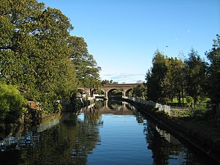
Johnstons Creek, formerly Johnston's Creek, is an urban gully, located in Sydney, Australia and situated in the Leichhardt local government area. The creek flows from Petersham, past Annandale, Camperdown, Forest Lodge and Harold Park, before spilling into Rozelle Bay, within Sydney Harbour.
Hutt River is a river in the Mid West region of Western Australia.

The Fortescue River is an ephemeral river in the Pilbara region of Western Australia. It is the third longest river in the state.
The Hann River is a river in the Kimberley region of Western Australia.
Johnston River is a river in the Kimberley region of Western Australia.
Elvire River is a river in the Kimberley region of Western Australia. The first European to see the Elvire River was government surveyor, Harry Johnston, who surveyed the river in 1884. The river is named after Margaret Elvire Forrest, the wife of the then Surveyor-General John Forrest.

Drysdale River is a river in the Kimberley region of Western Australia.
The Gibb River is a river in the Kimberley region of northern Western Australia.

The Margaret River is a river in the Kimberley region of Western Australia.

The King Edward River is a river in the Kimberley region of Western Australia.
The Adcock River is a river in the Kimberley region of Western Australia.

The Carson River is a river in the Kimberley region of Western Australia.
The Munglinup River is an ephemeral river in the Goldfields-Esperance region of Western Australia.
The Eagle Falls are on the Drysdale River in the Kimberley region of Western Australia.

Macumba River, once known as Treuer River, is an ephemeral freshwater stream in the far north of South Australia, that is part of the Lake Eyre Basin.
References
- ↑ "Bonzle Digital Atlas – Map of Mary River". 2009. Retrieved 10 July 2016.
- ↑ "History of river names – M". Western Australian Land Information Authority. Retrieved 7 September 2011.
- ↑ "AusAnthrop Australian Aboriginal tribal database". 2012. Archived from the original on 29 November 2014. Retrieved 6 May 2012.
Coordinates: 18°43′19″S126°50′14″E / 18.72194°S 126.83722°E
Rivers of Western Australia | |
|---|---|
| Rivers of the Gascoyne region | |
| Rivers of the Goldfields-Esperance region | |
| Rivers of the Great Southern region | |
| Rivers of the Kimberley region |
|
| Rivers of the Mid West region | |
| Rivers of the Peel and Perth regions | |
| Rivers of the Pilbara region | |
| Rivers of the South West region | |
| Rivers of the Wheatbelt region | |