Related Research Articles
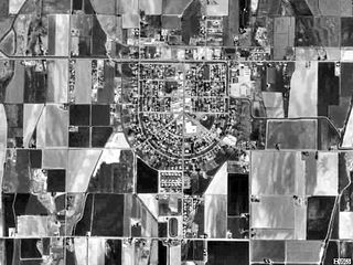
New Plymouth is a city in Payette County, Idaho. The population was 1,538 at the 2010 census, up from 1400 in 2000. It was incorporated on February 15, 1896. It is the host of the annual Payette County Fair and rodeo.

Brevort Township is a civil township of Mackinac County in the U.S. state of Michigan. As of the 2010 census, the township population was 594.

Wye is a census-designated place (CDP) in Missoula County, Montana, United States. It is part of the Missoula, Montana Metropolitan Statistical Area. The population was 511 at the 2010 census, an increase from its population of 381 in 2000. Wye is named for the "y"-shaped DeSmet Junction where US 93 and MT 200 met former US 10.

St Kilda Road is a street in Melbourne, Victoria, Australia. It is part of the locality of Melbourne which has the postcode of 3004, and along with Swanston Street forms a major spine of the city.

The River Tove is a river in England, a tributary of the River Great Ouse. Rising in Northamptonshire about a mile north of Greatworth, it flows for about 15 miles (24 km) north and east of the town of Towcester near Bury Mount before meeting the Ouse south-east of Cosgrove just north of Milton Keynes. Its final 5 miles (8 km) form part of the border between Northamptonshire and Buckinghamshire, running alongside the Grand Union Canal. The river ultimately flows into the North Sea.

King Sound is a large gulf in northern Western Australia. It expands from the mouth of the Fitzroy River, one of Australia's largest watercourses, and opens to the Indian Ocean. It is about 120 kilometres (75 mi) long, and averages about 50 kilometres (31 mi) in width. The port town of Derby lies near the mouth of the Fitzroy River on the eastern shore of King Sound. King Sound has the highest tides in Australia, and amongst the highest in the world, reaching a maximum tidal range of 11.8 metres (39 ft) at Derby. The tidal range and water dynamic were researched in 1997–1998.
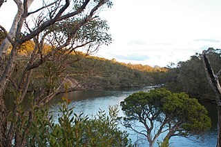
The Kalgan River is a river in the Great Southern region of Western Australia.
The McConnell River is located in the Kivalliq Region of northern Canada's territory of Nunavut. It drains into Hudson Bay and is the namesake for the McConnell River Migratory Bird Sanctuary.
Waki is a small town and commune in the Cercle of San in the Ségou Region of Mali. As of 1998 the commune had a population of 6,167.
The Meda River is a river in the Kimberley region of Western Australia.
The Fraser River is a river in the Kimberley region of Western Australia.
Iramaia is a municipality in the state of Bahia in the North-East region of Brazil.
Cariré is a municipality in the state of Ceará in the Northeast region of Brazil.
The Honaker Trail is a hiking trail located near Goosenecks State Park in southeastern Utah. Built in the late 1890s and early 1900s as a supply route for gold prospectors, the 2.5-mile (4.0 km) trail connects the deeply entrenched San Juan River with the canyon rim over 1,200 feet (370 m) above. Popular with geologists, the trail serves as the type locality for the Pennsylvanian Honaker Trail Formation. Fossilized crinoids and brachiopods, as well as trace fossils of other organisms are visible along portions of the trail.
The Berckelman River is a river in the Kimberley region of Western Australia.
The May River is a river in the Kimberley region of Western Australia.
The Old Steine is a thoroughfare in central Brighton, East Sussex, and is the southern terminus of the A23. The southern end leads to Marine Parade, the Brighton seafront and the Palace Pier. The Old Steine is also the site of a number of City Centre bus stops for Brighton buses. The Royal Pavilion is located immediately to the north of the Old Steine.
There are 20 lakes named Long Lake in British Columbia, Canada.

Rough and Ready Island is an island in the San Joaquin River, in the Sacramento–San Joaquin River Delta. It is in San Joaquin County, California, and its coordinates are 37°57′03″N121°21′41″W. The United States Geological Survey measured its elevation as 0 ft (0 m) in 1981. It appears on 1913 and 2015 USGS map of the area.
References
- ↑ "Bonzle Digital Atlas – Map of Robinson River". 2009. Retrieved 2 April 2009.
- ↑ "Modelled seabed response to possible climate change scenarios over the next 50 years in the Australian Northwest" (PDF). CSIRO. 1 March 2008. Retrieved 16 January 2014.
Coordinates: 16°49′14″S123°57′03″E / 16.82056°S 123.95083°E
Rivers of Western Australia | |
|---|---|
| Rivers of the Gascoyne region | |
| Rivers of the Goldfields-Esperance region | |
| Rivers of the Great Southern region | |
| Rivers of the Kimberley region |
|
| Rivers of the Mid West region | |
| Rivers of the Peel and Perth regions | |
| Rivers of the Pilbara region | |
| Rivers of the South West region | |
| Rivers of the Wheatbelt region | |