Related Research Articles

North West Coastal Highway is a generally north-south Western Australian highway which links the coastal city of Geraldton with the town of Port Hedland. The 1,300-kilometre-long (808 mi) road, constructed as a sealed two-lane single carriageway, travels through remote and largely arid landscapes. Carnarvon is the only large settlement on the highway, and is an oasis within the harsh surrounding environment. The entire highway is allocated National Route 1, part of Australia's Highway 1, and parts of the highway are included in tourist routes Batavia Coast Tourist Way and Cossack Tourist Way. Economically, North West Coastal Highway is an important link to the Mid West, Gascoyne and Pilbara regions, supporting the agricultural, pastoral, fishing, and tourism industries, as well as mining and offshore oil and gas production.

The Murchison River is the second longest river in Western Australia. It flows for about 820 km (510 mi) from the southern edge of the Robinson Ranges to the Indian Ocean at Kalbarri. The Murchison-Yalgar-Hope river system is the longest river system in Western Australia. It has a mean annual flow of 208 gigalitres, although in 2006, the peak year on record since 1967, flow was 1,806 gigalitres.
The Ashburton River is located within the Pilbara region of Western Australia.

Onslow is a coastal town in the Pilbara region of Western Australia, 1,386 kilometres (861 mi) north of Perth. It has a population of 848 people and is located within the Shire of Ashburton local government area.
Western Australia has the longest coastline of any state or territory in Australia, at 10,194 km or 12,889 km. It is a significant portion of the coastline of Australia, which is 35,877 km.

The Fortescue River is an ephemeral river in the Pilbara region of Western Australia. It is the third longest river in the state.

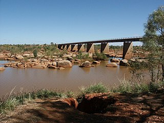
Robe River is a river in the Pilbara region of Western Australia.
The Sherlock River is a river in the Pilbara region of Western Australia. It was named on 11 July 1861 by the surveyor and explorer Frank Gregory while on expedition in the area.
The Yule River is an ephemeral river in the Pilbara region of Western Australia. It was named on 10 August 1861 by the surveyor and explorer Frank Gregory while on expedition in the area, after Thomas Newte Yule, at times farmer of Toodyay, winemaker, Acting Colonial Secretary and Magistrate.

The Turner River is a river in the Pilbara region of Western Australia.
The Shaw River is an ephemeral river in the Pilbara region of Western Australia. It was named by explorer F.T. Gregory on 21 August 1861 after Norton Shaw, Secretary of the Royal Geographical Society.
Mardie Station is a pastoral lease and sheep then cattle station that was established in 1866 in the Pilbara region of Western Australia near the mouth of the Fortescue River. The leasee in 2012 was Fourseasons Corporation; Mardie is operating under the Crown Lease number CL453-1984 and has the Land Act number LA3114/1027.
Yarraloola or Yarraloola Station is a pastoral lease that once operated as a sheep station but is currently operating as a cattle station in Western Australia.
Uaroo Station is a pastoral lease that operates as a cattle station and has previously operated as a sheep station.
Main Roads Western Australia controls the major roads in the state's Pilbara region. There are two main highways in the region: Great Northern Highway, which travels north through the region to Port Hedland and then north-west along the coast, as well as North West Coastal Highway, which heads south-west from Port Hedland. A series of main roads connects towns to the highways, and local roads provide additional links. The majority of these roads service the western half of the region, with few located in the various deserts east of the Oakover River. Roads are often named after the towns or areas they connect.
The Moyle River is a river in the Northern Territory, Australia.
Peedamulla Station, often referred to as Peedamulla, is a pastoral lease that currently operates as a cattle station but once operated as a sheep station.
References
- ↑ "Bonzle Digital Atlas – Map of Cane River". 2009. Retrieved 19 April 2009.
- ↑ "History of river names – C". Western Australian Land Information Authority. Archived from the original on 19 April 2021. Retrieved 3 September 2011.
- ↑ "Surface Hdrology of the Pilbara Region" (PDF). 2007. Archived from the original (PDF) on 29 June 2009. Retrieved 19 April 2009.
- ↑ "Estuary Assessment Framework for Non-Pristine Estuaries - Estuary 661 -Cane River". 2000. Archived from the original on 23 May 2009. Retrieved 19 April 2009.
- ↑ T. Wiley; R Glover; P. Russell; T. Parker; D. Parker; M. Clinch; G. Woolston (2015). "Cattle, carbon, critters and culture – building a new rangelands" (PDF). Retrieved 17 December 2015.
21°32′54″S115°22′45″E / 21.54833°S 115.37917°E
Rivers of Western Australia | |
|---|---|
| Rivers of the Gascoyne region | |
| Rivers of the Goldfields-Esperance region | |
| Rivers of the Great Southern region | |
| Rivers of the Kimberley region |
|
| Rivers of the Mid West region | |
| Rivers of the Peel and Perth regions | |
| Rivers of the Pilbara region | |
| Rivers of the South West region | |
| Rivers of the Wheatbelt region | |