
North West Coastal Highway is a generally north-south Western Australian highway which links the coastal city of Geraldton with the town of Port Hedland. The 1,300-kilometre-long (808 mi) road, constructed as a sealed two-lane single carriageway, travels through remote and largely arid landscapes. Carnarvon is the only large settlement on the highway, and is an oasis within the harsh surrounding environment. The entire highway is allocated National Route 1, part of Australia's Highway 1, and parts of the highway are included in tourist routes Batavia Coast Tourist Way and Cossack Tourist Way. Economically, North West Coastal Highway is an important link to the Mid West, Gascoyne and Pilbara regions, supporting the agricultural, pastoral, fishing, and tourism industries, as well as mining and offshore oil and gas production.

The Serpentine River is a river in the South West region of Western Australia. It is known as Waangaamaap Bilya to the Indigenous Bindjareb people, who met, lived and fished there before British settlement.
North Bannister is a locality in the Wheatbelt region of Western Australia, 94 kilometres (58 mi) south-southeast of the state capital, Perth along Albany Highway between Armadale and Williams.

The Shire of Wandering is a local government area in the Wheatbelt region of Western Australia, and, with a population of 444 as at the 2016 census, is one of the nation's smallest. It covers an area of 1,901 square kilometres (734 sq mi) generally to the east of Albany Highway about 120 kilometres (75 mi) south-east of Perth, the state capital. The Shire's seat of government is the town of Wandering.

The Shire of Boddington is a local government area in the Peel region of Western Australia, about 120 kilometres (75 mi) south-east of the state capital, Perth. The Shire covers an area of 1,901 square kilometres (734 sq mi), and its seat of government is the town of Boddington.

The Hotham River is one of the major tributaries of the Murray River in Western Australia. It is about 160 kilometres (99 mi) long with its upper reaches being the Hotham River North, which begins in the Dutarning Range and joins the Hotham at its crossing of the Great Southern Highway near Popanyinning. A 15 km (9.3 mi) long southern tributary, Hotham River South, begins near Cuballing and flows generally northerly before joining the Hotham near Yornaning.
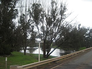
The Williams River is one of the two major tributaries of the Murray River in Western Australia, the other being the Hotham River.

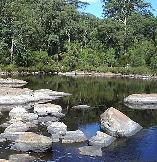
Nornalup Inlet is an estuarine body of water on the south coast of the South West of Australia, approximately 450 km (280 mi) from Perth.
The Frankland River is a river in the Great Southern region of Western Australia. The Frankland River is the largest river by volume in the region and the eighth largest in the state. The traditional owners of the area are the Menang Noongar people, who know the river as Kwakoorillup, meaning "place of quokka".

Balgarup River is a river in Western Australia that has its headwaters south-east of Kojonup just below Byenup Hill.
The Beaufort River is a river in the South West region of Western Australia.
The Walpole River is a river in the Great Southern region of Western Australia. The river was seen by Captain Thomas Bannister in 1831 and named by Governor James Stirling after Captain W. Walpole.
The Bow River is a river in the Great Southern region of Western Australia.

Norman Creek is a tributary of the Brisbane River in the City of Brisbane, Queensland, Australia. The headwaters of the creek are located on the northern slopes of Toohey Mountain and Mount Gravatt in southern Brisbane.

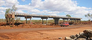
The Fortescue River is an ephemeral river in the Pilbara region of Western Australia. It is the third longest river in the state.
The Impey River is a river in the Mid West region of Western Australia which rises south of Mount Murchison and flows east-north-east until it merges with the Murchison River of which it is a tributary.
The Hardey River is a river in the Pilbara region of Western Australia.
The Maitland River is a river in the Pilbara region of Western Australia.
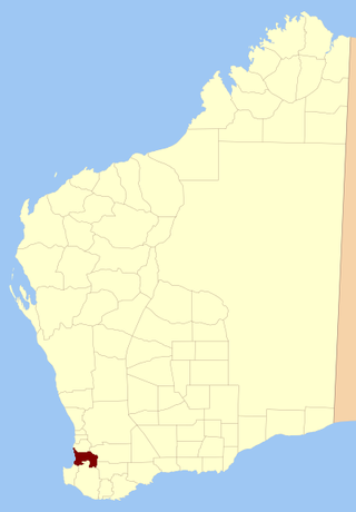
Wellington Land District is a land district of Western Australia, located within the South-West Land Division on the state's west coast. It spans roughly 32°56'S - 33°40'S in latitude and 115°25'E - 116°50'E in longitude.
