Related Research Articles

The House of Hanover, whose members are known as Hanoverians, is a European royal house of German origin that ruled Hanover, Great Britain, and Ireland at various times during the 17th to 20th centuries. The house originated in 1635 as a cadet branch of the House of Brunswick-Lüneburg, growing in prestige until Hanover became an Electorate in 1692. George I became the first Hanoverian monarch of Great Britain and Ireland in 1714. At Queen Victoria's death in 1901, the throne of the United Kingdom passed to her eldest son Edward VII, a member of the House of Saxe-Coburg and Gotha. The last reigning members of the House lost the Duchy of Brunswick in 1918 when Germany became a republic.

Admiral Sir James Stirling was a Scottish naval officer and colonial administrator. His enthusiasm and persistence persuaded the British Government to establish the Swan River Colony and he became the first Governor and Commander-in-Chief of Western Australia. In 1854, when Commander-in-Chief, East Indies and China Station, Stirling on his own initiative signed Britain's first Anglo-Japanese Friendship Treaty. Throughout his career Stirling showed considerable diplomatic skill and was selected for a number of sensitive missions. Paradoxically, this was not reflected in his personal dealings with officialdom and his hopes for preferment received many rebuffs. Stirling also personally led the attack in Western Australia on a group of approximately seventy Bindjareb men, women and children now known as the Pinjarra massacre.

The City of Stirling is a local government area in the northern suburbs of the Western Australian capital city of Perth about 10 kilometres (6 mi) north of Perth's central business district. The City covers an area of 105.2 square kilometres (40.6 sq mi) and has a population of over 223,000, making it the largest local government area by population in Western Australia.

Toodyay, known as Newcastle between 1860 and 1910, is a town on the Avon River in the Wheatbelt region of Western Australia, 85 kilometres (53 mi) north-east of Perth. The first European settlement occurred in the area in 1836. After flooding in the 1850s, the townsite was moved to its current location in the 1860s. It is connected by railway and road to Perth. During the 1860s, it was home to bushranger Moondyne Joe.

Augusta is a town on the south-west coast of Western Australia, where the Blackwood River emerges into Flinders Bay. It is the nearest town to Cape Leeuwin, on the furthest southwest corner of the Australian continent. In the 2001 census it had a population of 1,091; by 2016 the population of the town was 1,109.

Brunswick Junction is a town in the South West of Western Australia, situated along the South Western Highway between Harvey and Bunbury. It had a population of 772 people at the 2016 census, down from 797 at the 2006 census.

The Canning River is a major tributary of the Swan River in the South West Land Division of Western Australia. It is home to much wildlife including dolphins, pelicans, swans and many other bird species.

The Blackwood River is a major river and catchment in the South West of Western Australia.
The following lists events that happened during 1829 in Australia.

The Murray River is a river in the southwest of Western Australia. It played a significant part in the expansion of settlement in the area south of Perth after the arrival of British settlers at the Swan River Colony in 1829.

The Harvey River is a river in Western Australia and is the southernmost of the three major waterways which drain into the Peel-Harvey Estuary, with its delta in the southern extreme of the Harvey Estuary. It is about 90 km in length, rising near Mount Keats. Due to flooding of grazing land the river was diverted to discharge directly into the ocean in 1934.

HMS Success was an Atholl-class 28-gun sixth-rate wooden sailing ship notable for exploring Western Australia and the Swan River in 1827 as well as being one of the first ships to arrive at the fledgling Swan River Colony two years later, at which time she ran aground off Carnac Island.

The Shire of Capel is a local government area in the South West region of Western Australia, taking in the land between the cities of Bunbury and Busselton about 200 kilometres (124 mi) south of the state capital, Perth. The Shire covers an area of 557.6 square kilometres (215.3 sq mi), and its seat of government is the town of Capel.

The Collie River is a river in the South West region of Western Australia.
The Frankland River is a river in the Great Southern region of Western Australia. The Frankland River is the largest river by volume in the region and the eighth largest in the state. The traditional owners of the area are the Noongar people who know the river as Kwakoorillup.

The Arthur River is located in the south-west of Western Australia. The river was named by Governor James Stirling in October 1835 after Arthur Trimmer, who was a member of the exploring expedition led by Stirling.

The Donnelly River is a river in the South West of Western Australia. Its main tributaries are Barlee Brook and Carey Brook. The river runs primarily through state forest reserves, although 25 private landholdings are situated along the length of the river. Clearing of the catchment area is estimated at 20% with the land mostly being used for viticulture, horticulture, dairy, grazing and tourism.
The Warren River is a river in the South West region of Western Australia with a catchment encompassing the towns of Manjimup and Pemberton. The river was named by Governor James Stirling, probably after Admiral Sir John Borlase Warren under whom Stirling served whilst in action in North America in 1813.

Sussex County was one of the 26 counties of Western Australia that were designated in 1829 as cadastral divisions. Lieutenant-Governor James Stirling named the county in honour of Prince Augustus Frederick, Duke of Sussex, the sixth son of George III.
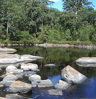
The Lunenburgh River is a perennial river in the South West region of Western Australia.
References
- ↑ "Bonzle Digital Atlas - Map of Brunswick River, WA". 2008. Retrieved 16 December 2008.
- ↑ "History of river names – B". Western Australian Land Information Authority. Retrieved 16 December 2008.
- ↑ Statham-Drew, Pamela (2003). James Stirling: admiral and founding governor of Western Australia. Crawley, Western Australia: University of Western Australia Press. p. 27. ISBN 1876268948.
Coordinates: 33°17′27″S115°43′37″E / 33.29083°S 115.72694°E
Rivers of Western Australia | |
|---|---|
| Rivers of the Gascoyne region | |
| Rivers of the Goldfields-Esperance region | |
| Rivers of the Great Southern region | |
| Rivers of the Kimberley region |
|
| Rivers of the Mid West region | |
| Rivers of the Peel and Perth regions | |
| Rivers of the Pilbara region | |
| Rivers of the South West region | |
| Rivers of the Wheatbelt region | |