Related Research Articles

Millstream Chichester National Park is a national park in the Pilbara region of Western Australia, located 1,190 kilometres (739 mi) north of the state capital, Perth.
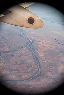
The Pilbara is a large, dry, thinly populated region in the north of Western Australia. It is known for its Aboriginal peoples; its ancient landscapes; the red earth; and its vast mineral deposits, in particular iron ore. It is also a global biodiversity hotspot for subterranean fauna.
The De Grey River is a river located in the Pilbara region of Western Australia. It was named on 16 August 1861 by the explorer and surveyor Francis Gregory after Thomas de Grey, 2nd Earl de Grey who was, at the time, President of the Royal Geographical Society.

The Fortescue River is an ephemeral river in the Pilbara region of Western Australia. It is the third longest river in the state.

Robe River is a river in the Pilbara region of Western Australia.

The Harding River is a river in the Pilbara region of Western Australia. It was named on 31 July 1861 by the surveyor and explorer Francis Gregory while on expedition in the area, after one of the volunteer members of his expedition, John Harding.
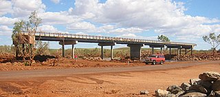
The Maitland River is a river in the Pilbara region of Western Australia.
The Nullagine River is a river in the Pilbara region of Western Australia.
The Oakover River is a river in the Pilbara region of Western Australia.
The Yule River is an ephemeral river in the Pilbara region of Western Australia. It was named on 10 August 1861 by the surveyor and explorer Frank Gregory while on expedition in the area, after Thomas Newte Yule, at times farmer of Toodyay, winemaker, Acting Colonial Secretary and Magistrate.
The Cane River is a river in the Pilbara region of Western Australia.
The Coongan River is an ephemeral river in the Pilbara region of Western Australia.

The Turner River is a river in the Pilbara region of Western Australia.
The Shaw River is an ephemeral river in the Pilbara region of Western Australia. It was named by explorer F.T. Gregory on 21 August 1861 after Norton Shaw, Secretary of the Royal Geographical Society.

The Chichester Range is a range in the Pilbara region of Western Australia. The range rises abruptly from the coastal plain and is composed of rolling hills, escarpments, jagged peaks, gorges and winding tree-lined watercourses.
Balla Balla River is a river in the Pilbara region of Western Australia.
Sherlock Station is a pastoral lease and sheep station located approximately 54 kilometres (34 mi) East of Roebourne in the Pilbara region of Western Australia. Covering an area of 216,700 acres (87,695 ha) pasture, the lease provides good grazing land. In 2015 it was purchased by Bettini Bros, now Bettini Beef, in a package with Mallina and Pyramid Stations. The Bettinis still owned the lease in 2018. Sherlock is operating under the Crown Lease number CL311-1966 and has the Land Act number LA3114/558.
Croydon Station, often spelt as Croyden Station, is a pastoral lease and sheep station.
The George River is a river in the Pilbara region of Western Australia. The river was named on 16 July 1861 by the surveyor and explorer Frank Gregory, who was conducting an expedition in the area. It is not known after whom he named the river.
The Wooramel River is an ephemeral river in the Gascoyne region of Western Australia.
References
- ↑ "Bonzle Digital Atlas – Map of Sherlock River". 2009. Retrieved 16 April 2009.
- ↑ "Surface Hydrology of the Pilbara Region Summary" (PDF). 2000. Archived from the original (PDF) on 29 June 2009. Retrieved 16 April 2009.
- ↑ Gregory, Augustus Charles; Gregory, Francis Thomas (1884). Journals of Australian Explorations. Brisbane: James C. Beal, Government Printer. Retrieved 26 August 2013.
- ↑ "Estuary Assessment Framework for Non-Prisitne Estuaries - Estuary 674 - Sherlock River" (PDF). 2006. Retrieved 17 April 2009.
Rivers of Western Australia | |
|---|---|
| Rivers of the Gascoyne region | |
| Rivers of the Goldfields-Esperance region | |
| Rivers of the Great Southern region | |
| Rivers of the Kimberley region |
|
| Rivers of the Mid West region | |
| Rivers of the Peel and Perth regions | |
| Rivers of the Pilbara region | |
| Rivers of the South West region | |
| Rivers of the Wheatbelt region | |
Coordinates: 20°42′36″S117°33′07″E / 20.71000°S 117.55194°E