Related Research Articles

The Wunaamin Miliwundi Ranges are a range of hills in the western Kimberley region of Western Australia.

Iskar Glacier is a glacier in Livingston Island, South Shetland Islands in Antarctica situated southeast of lower Huron Glacier, west-southwest of Sopot Ice Piedmont, and north of Dobrudzha and Magura Glaciers. It drains the north slopes of the Tangra Mountains between Helmet Peak to the west and Delchev Peak to the east, and flows northward into Bruix Cove between Yana Point and Rila Point.
Moore River (Garban) is a river in the Wheatbelt region of Western Australia.
Hill River is a river in the Wheatbelt region of Western Australia.
Hutt River is a river in the Mid West region of Western Australia.
The Hann River is a river in the Kimberley region of Western Australia.
Durack River is a river in the Kimberley region of Western Australia.

Drysdale River is a river in the Kimberley region of Western Australia.
The Gibb River is a river in the Kimberley region of northern Western Australia.
The Margaret River is a river in the Kimberley region of Western Australia.

The Chamberlain River is a river in the Kimberley region of Western Australia.
Mary River is a river in the Kimberley region of Western Australia.

The King Edward River is a river in the Kimberley region of Western Australia.
The Adcock River is a river in the Kimberley region of Western Australia.

The Carson River is a river in the Kimberley region of Western Australia.
The Bowes River is a river in the Mid West region of Western Australia. It was named on 6 April 1839 by the explorer George Grey while on his second exploration expedition along the Western Australian coast. It was named for Mary Bowes, Dowager Countess of Strathmore, the wife of Sir William Hutt. Hutt was a British Liberal politician who was heavily involved in the colonization of New Zealand and South Australia, and the brother of John Hutt, the second governor of Western Australia. Sir William Hutt was a member of the 1836 select committee on Disposal of Lands in the British Colonies. Grey named the nearby Hutt River after Hutt.
Louisa Downs, also commonly just referred to as "Louisa", is a large cattle station midway between Fitzroy Crossing and Halls Creek in the Kimberley region in Western Australia.
Three Rivers or Three Rivers Station is a pastoral lease and sheep station located in the Mid West region of Western Australia. Three Rivers and the neighbouring Bryah Station occupy an area of 513,000 hectares on the headwater of the Gascoyne River and primarily composed of grasslands.

Drysdale River Station is a pastoral lease that operates as a cattle station in Western Australia.
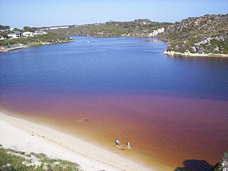
The Berkeley River is a river in the Kimberley region of Western Australia.
References
- ↑ "Bonzle Digital Atlas – Map of Barton River". 2009. Retrieved 30 March 2009.
- ↑ "Ausanthrop - Australian Aboriginal tribal database". 2012. Archived from the original on 29 November 2014. Retrieved 29 April 2012.
- ↑ "History of river names – B". Western Australian Land Information Authority. Archived from the original on 19 April 2021. Retrieved 3 September 2011.
Rivers of Western Australia | |
|---|---|
| Rivers of the Gascoyne region | |
| Rivers of the Goldfields-Esperance region | |
| Rivers of the Great Southern region | |
| Rivers of the Kimberley region |
|
| Rivers of the Mid West region | |
| Rivers of the Peel and Perth regions | |
| Rivers of the Pilbara region | |
| Rivers of the South West region | |
| Rivers of the Wheatbelt region | |
14°11′33″S126°59′20″E / 14.19250°S 126.98889°E