
Tanza, officially the Municipality of Tanza, formerly known as Santa Cruz de Malabon, is a 1st class municipality in the province of Cavite, Philippines. According to the 2020 census, it has a population of 312,116 people. It has a land area of 95.59 square kilometers (36.91 sq mi), making it the third largest municipality by land area in the province.

General Trias, officially the City of General Trias, is a 1st class component city in the province of Cavite, Philippines. According to the 2020 census, it has a population of 450,583 people.

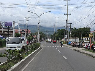
Trece Martires, officially the City of Trece Martires, is a 4th class component city and de facto capital city of the province of Cavite, Philippines. According to the 2020 census, it has a population of 210,503 people.

The Manila–Cavite Expressway, signed as E3 of the Philippine expressway network and R-1 of Metro Manila's arterial road network, is a 14-kilometer-long (8.7 mi) controlled-access toll expressway linking Manila to the southern province of Cavite in the Philippines. At its north end, it feeds into and from Roxas Boulevard in the city of Parañaque in Metro Manila, also part of R-1. At the south end, it splits into two termini, both along the north coast in Kawit, Cavite. The first feeds into the intersection of Tirona Highway and Antero Soriano Highway. The second southern terminus is on the intersection of Tirona Highway, Antero Soriano Highway and Covelandia Road in Kawit, Cavite.

Radial Road 1 (R-1), informally known as the R-1 Road, is a network of roads and bridges that all together form the first arterial road of Metro Manila in the Philippines. Spanning some 42.67 kilometers (26.51 mi), it connects the cities and municipalities of Bacoor, General Trias, Imus, Kawit, Las Piñas, Manila, Naic, Noveleta, Parañaque, Pasay, and Tanza in Cavite and Metro Manila.

The Juanito R. Remulla Sr. Road, formerly and still commonly referred to as Governor's Drive, is a two-to-nine lane, 58.3-kilometer (36.2 mi) network of primary, secondary and tertiary highways and bridges traversing through the central cities and municipalities of the province of Cavite, Philippines. It is the widest among the three major highways located in the province, the others being the Aguinaldo and Antero Soriano Highways.

The Antero Soriano Highway, also partly known as Centennial Road, is a two-to-six lane, 21.6-kilometer (13.4 mi) highway traversing through the western coast of Cavite. It is one of the three major highways located in the province, the others are Aguinaldo Highway and Governor's Drive.

Crisanto Mendoza de los Reyes Avenue, formerly known as the General Trias–Amadeo–Tagaytay Road and also known as Tejero-General Trias-Amadeo-Tagaytay Road, is a two-to-four lane, 36.7-kilometer (22.8 mi), tertiary highway traversing through the central towns and cities of the province of Cavite, Philippines. It connects the city of General Trias to the city of Tagaytay and acts as a secondary road for the Aguinaldo Highway.

The Tanza–Trece Martires Road is a 12.559-kilometer (7.804 mi), two-to-four lane, primary highway in Cavite, Philippines. It connects the municipality of Tanza to the city of Trece Martires.

The Santa Rosa–Tagaytay Road, also known as the Tagaytay–Santa Rosa Road and the Santa Rosa–Ulat–Tagaytay Road, is a 23.245-kilometer (14.444 mi) major thoroughfare in the provinces of Laguna and Cavite, Philippines. Originally an old road linking the Santa Rosa municipal proper to the western edge of the then-municipality at barangay Santo Domingo and narrowly onto barangay Lumil in Silang, the highway was constructed in the late 1990s.

The Trece Martires–Indang Road is a two-to-four lane 12.015-kilometer (7.466 mi) secondary highway in Cavite, Philippines.

National Route 64 (N64) forms part of the Philippine highway network. It runs through northern Cavite.

National Route 402 (N402) forms part of the Philippine highway network. It runs through the rural municipalities of Cavite.
National Route 62 (N62) forms part of the Philippine highway network. It runs south from Metro Manila to northeastern Cavite.
National Route 405 (N405) forms part of the Philippine highway network. It runs through western Cavite. It connects the municipality of Naic to Caylabne Bay.

National Route 65 (N65) forms part of the Philippine highway network. It runs through central Cavite and northern Laguna.
National Route 401 (N401) forms part of the Philippine highway network. It connects the municipalities of Noveleta to the city of General Trias through the municipality of Rosario.

The Ternate–Nasugbu Road, also known as Ternate–Nasugbu Highway or Nasugbu–Ternate Highway, is a two-to-four lane, secondary road in the provinces of Cavite and Batangas, Philippines. It connects the municipality of Ternate in Cavite to the municipality of Nasugbu in Batangas.
The Cebu North Road, also known as the Cebu North Hagnaya Wharf Road, is a 108.558-kilometer (67.455 mi) road, the major thoroughfare that connects the city of Cebu to the Port of Hagnaya in the municipality of San Remigio in Cebu, Philippines.

The Cavite Provincial Board is the Sangguniang Panlalawigan of the Philippine province of Cavite.

