National Register of Historic Places listings in Lake and Peninsula Borough, Alaska

Last updated

Location of the Lake and Peninsula Borough in Alaska Map of Alaska highlighting Lake and Peninsula Borough.svg
Location of the Lake and Peninsula Borough in Alaska

This is a list of the National Register of Historic Places listings in Lake and Peninsula Borough, Alaska, United States.

Contents

This is intended to be a complete list of the properties and districts on the National Register of Historic Places in Lake and Peninsula Borough, Alaska, United States. The locations of National Register properties and districts for which the latitude and longitude coordinates are included below, may be seen in an online map. [1]

There are 25 properties and districts listed on the National Register in the borough, including 2 National Historic Landmarks.


    This National Park Service list is complete through NPS recent listings posted July 28, 2023. [2]

Map all coordinates using: OpenStreetMap

Current listings

[3] Name on the Register [4] ImageDate listed [5] Location City or townDescription
1 Aniakchak Bay Historic Landscape District
Aniakchak Bay Historic Landscape District Alaska Packers Association Bunkhouse.jpg
Aniakchak Bay Historic Landscape District
February 14, 1997
(#97000016)
Surrounding the Aniakchak River from Aniakchak Crater to Aniakchak Bay
56°45′30″N157°31′19″W / 56.75837°N 157.52197°W / 56.75837; -157.52197 (Aniakchak Bay Historic Landscape District)
Aniakchak National Preserve Originally listed as being in Dillingham Census Area.
2 Dr. Elmer Bly House
Dr. Elmer Bly House Bly House Lake Clark.jpg
Dr. Elmer Bly House
April 12, 2006
(#06000240)
Hardenburg Bay
60°12′17″N154°18′25″W / 60.20466°N 154.30683°W / 60.20466; -154.30683 (Dr. Elmer Bly House)
Port Alsworth Now the National Park Service HQ for Lake Clark National Park and Preserve
3 Brooks Camp Boat House
Brooks Camp Boat House BrooksRiverBoatHouse.jpg
Brooks Camp Boat House
March 15, 2010
(#10000071)
Brooks Camp
58°33′24″N155°46′43″W / 58.55667°N 155.77857°W / 58.55667; -155.77857 (Brooks Camp Boat House)
Katmai National Park and Preserve Originally listed as being in Dillingham Census Area.
4 Brooks River Archeological District
Brooks River Archeological District Brooks River Archeological District (Bristol Bay, Alaska).jpg
Brooks River Archeological District
February 14, 1978
(#78000342)
Along the Brooks River near Brooks Camp [6]
58°33′15″N155°47′18″W / 58.554285°N 155.788307°W / 58.554285; -155.788307 (Brooks River Archeological District)
Naknek Originally listed as being in Bristol Bay Borough.
5 Brooks River Historic Ranger Station
Brooks River Historic Ranger Station BrooksRiverRangerStation.jpg
Brooks River Historic Ranger Station
March 15, 2010
(#10000072)
Brooks Camp
58°33′22″N155°46′42″W / 58.55616°N 155.77822°W / 58.55616; -155.77822 (Brooks River Historic Ranger Station)
Katmai National Park and Preserve Now serves as visitor center for Katmai National Park. Originally listed as being in Dillingham Census Area.
6 Chilikadrotna Headwaters Archeological District July 27, 2023
(#100009155)
Address restricted [7]
7 DIL-161 Site
DIL-161 Site Alagnak River Site (DIL-161).jpg
DIL-161 Site
January 22, 2007
(#06001306)
Address restricted [7]
Katmai National Park and Preserve
8 Fure's Cabin
Fure's Cabin Fure's Cabin NPS.jpg
Fure's Cabin
February 7, 1985
(#85000187)
Between Naknek Lake and Lake Grosvenor
58°40′11″N155°25′52″W / 58.66979°N 155.43124°W / 58.66979; -155.43124 (Fure's Cabin)
Katmai National Park and Preserve Originally listed as being in Bristol Bay Borough.
9 Jay and Bella Hammond Homestead July 30, 2018
(#100002107)
N shore of Lake Clark
60°19′26″N154°09′29″W / 60.3239°N 154.1580°W / 60.3239; -154.1580 (Jay and Bella Hammond Homestead)
Port Alsworth A private inholding of Lake Clark National Park and Preserve, once belonging to Alaska Governor Jay Hammond.
10 Kasna Creek Mining District February 17, 2010
(#10000017)
Address restricted [7]
Port Alsworth
11 Kijik Archeological District
Kijik Archeological District Lake Clark in the Kijik Archeological District.jpg
Kijik Archeological District
October 12, 1994
(#94001644)
On the shores of Lake Clark, approximately 50 kilometres (31 mi) northeast of Nondalton [8]
60°17′33″N154°15′01″W / 60.2925°N 154.2503°W / 60.2925; -154.2503 (Kijik Archeological District)
Nondalton Originally listed as being in Bristol Bay Borough.
12 Kijik Historic District
Kijik Historic District Kijik Trade Beads.jpg
Kijik Historic District
January 29, 1979
(#79000410)
On the western shore of Lake Clark near the mouth of the Kijik River [9]
60°17′28″N154°13′00″W / 60.2911°N 154.2167°W / 60.2911; -154.2167 (Kijik Historic District)
Nondalton An Eskimo village site. Originally listed as being in Bristol Bay Borough.
13 LIBBY'S NO. 23 (Bristol Bay double ender)
LIBBY'S NO. 23 (Bristol Bay double ender) Libbys No 23 Bristol Bay double-ender - Port Alsworth Alaska.jpg
LIBBY'S NO. 23 (Bristol Bay double ender)
June 14, 2013
(#13000379)
1 Park Place
60°11′51″N154°19′20″W / 60.19746°N 154.32232°W / 60.19746; -154.32232 (LIBBY'S NO. 23 (Bristol Bay double ender))
Port Alsworth
14 Old Savonoski Site
Old Savonoski Site OldSavonoski.jpg
Old Savonoski Site
June 23, 1978
(#78000344)
On the northern side of the Savonoski River, near its mouth at Naknek Lake [10]
58°32′00″N155°19′00″W / 58.533333°N 155.316667°W / 58.533333; -155.316667 (Old Savonoski Site)
Naknek Site of native village destroyed by 1912 volcanic eruption. Originally listed as being in Bristol Bay Borough.
15 Richard Proenneke Site
Richard Proenneke Site Proenneke Cabin NPS.jpg
Richard Proenneke Site
March 8, 2007
(#06000241)
Southeastern end of upper Twin Lakes
60°38′42″N153°49′15″W / 60.645°N 153.82096°W / 60.645; -153.82096 (Richard Proenneke Site)
Lake Clark National Park and Preserve
16 Qinuyang August 23, 2021
(#100006827)
Address Restricted
Igiugig vicinity
17 St. John the Theologian Church
St. John the Theologian Church Saint John the Theologian Church, Perryville, Alaska.jpg
St. John the Theologian Church
June 6, 1980
(#80000741)
Corner of B Street and 2nd Avenue
55°54′42″N159°08′43″W / 55.91165°N 159.14515°W / 55.91165; -159.14515 (St. John the Theologian Church)
Perryville Originally listed as being in Aleutian West Census Area.
18 St. Nicholas Chapel
St. Nicholas Chapel St. Nicholas Church, Igiugig, Alaska.jpg
St. Nicholas Chapel
June 6, 1980
(#80004579)
Along Main Road
59°19′37″N155°53′42″W / 59.32701°N 155.89508°W / 59.32701; -155.89508 (St. Nicholas Chapel)
Igiugig Originally listed as being in Dillingham Census Area.
19 St. Nicholas Chapel
St. Nicholas Chapel NORTH SIDE AND WEST FRONT, NEW CHURCH (UNDER CONSTRUCTION) TO RIGHT - St. Nicholas Russian Orthodox Church, Nondalton, Lake and Peninsula Borough, AK HABS AK,5-NODA,1-1.tif
St. Nicholas Chapel
June 6, 1980
(#80000751)
Along 2nd Avenue
59°58′24″N154°50′55″W / 59.97323°N 154.84866°W / 59.97323; -154.84866 (St. Nicholas Chapel)
Nondalton Originally listed as being in Bristol Bay Borough.
20 St. Nicholas Chapel
St. Nicholas Chapel Saint Nicholas Chapel, Pedro Bay, Alaska.jpg
St. Nicholas Chapel
June 6, 1980
(#80000753)
In Pedro Bay
59°47′07″N154°06′10″W / 59.78537°N 154.10287°W / 59.78537; -154.10287 (St. Nicholas Chapel)
Pedro Bay Originally listed as being in Bristol Bay Borough.
21 St. Nicholas Church
St. Nicholas Church St. Nicholas Church, Pilot Point.jpg
St. Nicholas Church
June 6, 1980
(#80000754)
Along Church Road
57°33′49″N157°34′48″W / 57.56352°N 157.5801°W / 57.56352; -157.5801 (St. Nicholas Church)
Pilot Point Originally listed as being in Bristol Bay Borough.
22 Savonoski River Archeological District February 14, 1978
(#78000525)
Near the mouth of the Grosvenor River [6]
58°34′10″N155°01′24″W / 58.569327°N 155.023327°W / 58.569327; -155.023327 (Savonoski River Archeological District)
Katmai National Park and Preserve Originally listed as being in Bristol Bay Borough.
23 Snipe Lake Archeological District July 27, 2023
(#100009152)
Address Restricted
Lake Clark National Park and Preserve
24 Two Lakes Archeological District August 12, 2019
(#100004254)
Address Restricted
Port Alsworth vicinity
25 Wassillie Trefon Dena'ina Fish Cache
Wassillie Trefon Dena'ina Fish Cache Trefon Dena'ina Fish Cache - Port Alsworth Alaska.jpg
Wassillie Trefon Dena'ina Fish Cache
June 5, 2013
(#13000348)
1 Park Place
60°11′51″N154°19′24″W / 60.19761°N 154.3232°W / 60.19761; -154.3232 (Wassillie Trefon Dena'ina Fish Cache)
Port Alsworth

See also

Related Research Articles

<span class="mw-page-title-main">National Register of Historic Places listings in Mobile County, Alabama</span>

This is a list of the National Register of Historic Places listings in Mobile County, Alabama.

<span class="mw-page-title-main">National Register of Historic Places listings in Alger County, Michigan</span>

This is a list of the National Register of Historic Places listings in Alger County, Michigan.

<span class="mw-page-title-main">National Register of Historic Places listings in Delta County, Michigan</span>

This is a list of the National Register of Historic Places listings in Delta County, Michigan.

<span class="mw-page-title-main">National Register of Historic Places listings in Lancaster County, Pennsylvania</span>

This is a list of the National Register of Historic Places listings in Lancaster County, Pennsylvania.

<span class="mw-page-title-main">National Register of Historic Places listings in Dauphin County, Pennsylvania</span>

This is a list of the National Register of Historic Places listings in Dauphin County, Pennsylvania.

<span class="mw-page-title-main">National Register of Historic Places listings in Alachua County, Florida</span>

This is a list of the National Register of Historic Places listings in Alachua County, Florida.

<span class="mw-page-title-main">National Register of Historic Places listings in Greene County, Ohio</span>

This is a list of the National Register of Historic Places listings in Greene County, Ohio.

<span class="mw-page-title-main">National Register of Historic Places listings in Converse County, Wyoming</span>

This is a list of the National Register of Historic Places listings in Converse County, Wyoming.

<span class="mw-page-title-main">National Register of Historic Places listings in Nome Census Area, Alaska</span>

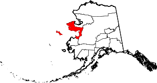
This is a list of the National Register of Historic Places listings in Nome Census Area, Alaska.

<span class="mw-page-title-main">National Register of Historic Places listings in Southeast Fairbanks Census Area, Alaska</span>

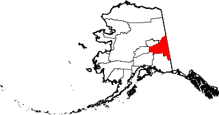
This is a list of the National Register of Historic Places listings in Southeast Fairbanks Census Area, Alaska.

<span class="mw-page-title-main">National Register of Historic Places listings in Kenai Peninsula Borough, Alaska</span>

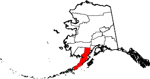
This is a list of the National Register of Historic Places listings in Kenai Peninsula Borough, Alaska.

<span class="mw-page-title-main">National Register of Historic Places listings in North Slope Borough, Alaska</span>

This is a list of the National Register of Historic Places listings in North Slope Borough, Alaska.

<span class="mw-page-title-main">National Register of Historic Places listings in Larimer County, Colorado</span> List of National Register of Historic Places in Larimer County, Colorado, United States

This is a list of the National Register of Historic Places listings in Larimer County, Colorado.

<span class="mw-page-title-main">National Register of Historic Places listings in Sandoval County, New Mexico</span>

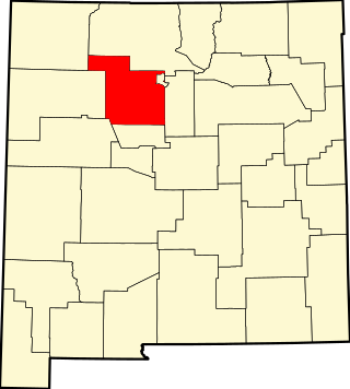
This is a list of the National Register of Historic Places listings in Sandoval County, New Mexico, United States.

<span class="mw-page-title-main">National Register of Historic Places listings in San Juan County, New Mexico</span>

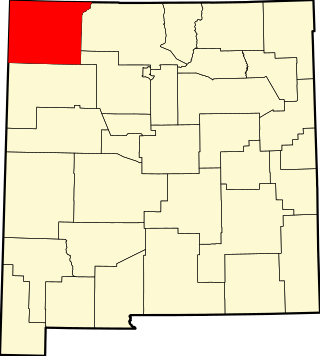
This is a list of the National Register of Historic Places listings in San Juan County, New Mexico.

<span class="mw-page-title-main">National Register of Historic Places listings in Blaine County, Idaho</span>

This is a list of the National Register of Historic Places listings in Blaine County, Idaho.

<span class="mw-page-title-main">National Register of Historic Places listings in Clay County, Mississippi</span>

This is a list of the National Register of Historic Places listings in Clay County, Mississippi.

<span class="mw-page-title-main">National Register of Historic Places listings in Warren County, Mississippi</span>

This is a list of the National Register of Historic Places listings in Warren County, Mississippi.

<span class="mw-page-title-main">National Register of Historic Places listings in Corson County, South Dakota</span>

This is a list of the National Register of Historic Places listings in Corson County, South Dakota.

<span class="mw-page-title-main">National Register of Historic Places listings in Knox County, Indiana</span>

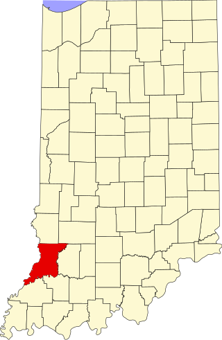
This is a list of the National Register of Historic Places listings in Knox County, Indiana.

References

  1. The latitude and longitude information provided in this table was derived originally from the National Register Information System, which has been found to be fairly accurate for about 99% of listings. Some locations in this table may have been corrected to current GPS standards.
  2. National Park Service, United States Department of the Interior, "National Register of Historic Places: Weekly List Actions", retrieved July 28, 2023.
  3. Numbers represent an alphabetical ordering by significant words. Various colorings, defined here, differentiate National Historic Landmarks and historic districts from other NRHP buildings, structures, sites or objects.
  4. "National Register Information System". National Register of Historic Places . National Park Service. April 24, 2008.
  5. The eight-digit number below each date is the number assigned to each location in the National Register Information System database, which can be viewed by clicking the number.
  6. 1 2 "The Story of a House". National Park Service. Archived from the original on 2014-03-05. Retrieved 2014-02-28.
  7. 1 2 3 Federal and state laws and practices restrict general public access to information regarding the specific location of this resource. In some cases, this is to protect archeological sites from vandalism, while in other cases it is restricted at the request of the owner. See: Knoerl, John; Miller, Diane; Shrimpton, Rebecca H. (1990), Guidelines for Restricting Information about Historic and Prehistoric Resources, National Register Bulletin, National Park Service, U.S. Department of the Interior, OCLC   20706997 .
  8. Location derived from its NHL profile; the NRIS lists the site as "Address Restricted"
  9. Location derived from the GNIS feature record for Kijik; the NRIS lists the site as "Address Restricted"
  10. Location derived from its GNIS feature record; the NRIS lists the site as "Address Restricted"