National Register of Historic Places listings in Matanuska-Susitna Borough, Alaska

Last updated

Location of the Matanuska-Susitna Borough in Alaska Map of Alaska highlighting Matanuska-Susitna Borough.svg
Location of the Matanuska-Susitna Borough in Alaska

This is a list of the National Register of Historic Places listings in Matanuska-Susitna Borough, Alaska.

Contents

This is intended to be a complete list of the properties and districts on the National Register of Historic Places in Matanuska-Susitna Borough, Alaska, United States. The locations of National Register properties and districts for which the latitude and longitude coordinates are included below, may be seen in an online map. [1]

There are 30 properties and districts listed on the National Register in the borough.


    This National Park Service list is complete through NPS recent listings posted October 20, 2023. [2]

Map all coordinates using: OpenStreetMap

Current listings

[3] Name on the Register [4] ImageDate listed [5] Location City or townDescription
1 Bailey Colony Farm
Bailey Colony Farm Bailey Colony Farm.jpg
Bailey Colony Farm
June 21, 1991
(#91000775)
3150 North Glenn Highway
61°36′57″N149°07′10″W / 61.61585°N 149.11931°W / 61.61585; -149.11931 (Bailey Colony Farm)
Palmer
2 Berry House June 21, 1991
(#91000779)
5805 North Farm Loop Road
61°38′42″N149°08′53″W / 61.64509°N 149.14801°W / 61.64509; -149.14801 (Berry House)
Palmer
3 Campbell House
Campbell House The Campbell House.JPG
Campbell House
April 3, 2013
(#13000129)
1540 Inner Springer Loop
61°34′15″N149°07′38″W / 61.57094°N 149.1271°W / 61.57094; -149.1271 (Campbell House)
Palmer
4 Cunningham-Hall PT-6, NC-692W December 29, 1978
(#78000531)
In Alaska Museum of Transportation and Industry, 3800 West Museum Drive
61°34′38″N149°32′39″W / 61.57734°N 149.54426°W / 61.57734; -149.54426 (Cunningham-Hall PT-6, NC-692W)
Wasilla Originally in the Transportation Museum of Alaska, in Palmer.
5 Curry Lookout April 27, 1992
(#92000424)
Atop Curry Ridge, mile 137.2 of the Parks Highway
62°37′22″N150°05′54″W / 62.62264°N 150.09832°W / 62.62264; -150.09832 (Curry Lookout)
Talkeetna
6 Fairview Inn
Fairview Inn Fairview Inn, Talkeetna, AK.jpg
Fairview Inn
May 7, 1982
(#82004905)
Main Street
62°19′24″N150°06′48″W / 62.32328°N 150.11332°W / 62.32328; -150.11332 (Fairview Inn)
Talkeetna Also a contributing property to Talkeetna Historic District
7 Herried House June 21, 1991
(#91000778)
4400 North Palmer-Fishook Road
61°37′41″N149°10′13″W / 61.62793°N 149.17025°W / 61.62793; -149.17025 (Herried House)
Palmer
8 High Ridge August 19, 2021
(#100006829)
9721 East Hilscher Hwy.
61°34′39″N149°10′26″W / 61.5775°N 149.1740°W / 61.5775; -149.1740 (High Ridge)
Palmer Homesite of Fred Machetanz
8 Hyland Hotel
Hyland Hotel Hyland Hotel.jpg
Hyland Hotel
June 21, 1991
(#91000774)
333 Evergreen Avenue
61°35′59″N149°07′11″W / 61.5996°N 149.11974°W / 61.5996; -149.11974 (Hyland Hotel)
Palmer
9 Independence Mines
Independence Mines Tram Remains and Work Camp.JPG
Independence Mines
October 9, 1974
(#74000440)
About 14.2 miles (22.9 km) northwest of Palmer
61°47′25″N149°17′05″W / 61.7903°N 149.28467°W / 61.7903; -149.28467 (Independence Mines)
Palmer
10 Kirsch's Place January 9, 1998
(#97001631)
About 10.5 miles (16.9 km) south of Talkeetna
62°10′01″N150°04′30″W / 62.16704°N 150.07493°W / 62.16704; -150.07493 (Kirsch's Place)
Talkeetna
11 Knik Site
Knik Site Knik town site cabin.jpg
Knik Site
July 24, 1973
(#73000379)
Along South Knik Goose Bay Road, about 13 miles (21 km) southwest of Wasilla
61°27′27″N149°43′52″W / 61.45748°N 149.73108°W / 61.45748; -149.73108 (Knik Site)
Wasilla
12 Matanuska Colony Community Center June 21, 1991
(#91000773)
Roughly bounded by South Colony Way, East Firewood Avenue, South Eklutna Street, East Elmwood Avenue, South Denali Street and a line of properties along East Dahlia Avenue
61°35′56″N149°06′34″W / 61.59881°N 149.10944°W / 61.59881; -149.10944 (Matanuska Colony Community Center)
Palmer
13 Old Willow Community Center October 5, 2017
(#100001695)
W. Willow Community Center Cir.
61°44′40″N150°03′03″W / 61.744534°N 150.050840°W / 61.744534; -150.050840 (Old Willow Community Center)
Willow
14 Palmer Depot
Palmer Depot PalmerAK Depot.jpg
Palmer Depot
January 9, 1978
(#78000530)
Corner of Evergreen Avenue and South Valley Way
61°36′00″N149°06′49″W / 61.59999°N 149.11362°W / 61.59999; -149.11362 (Palmer Depot)
Palmer Also a contributing property to Matanuska Colony Community Center
15 Patten Colony Farm June 21, 1991
(#91000776)
Mile 39.9 of the Glenn Highway, about 1.7 miles (2.7 km) southwest of Palmer
61°34′43″N149°08′29″W / 61.57862°N 149.14138°W / 61.57862; -149.14138 (Patten Colony Farm)
Palmer
16 Puhl House
Puhl House BARN AND HOUSE, WITH VEGETABLE GARDEN IN FOREGROUND - Farm, Glenn Highway and Scott Road, Palmer, Matanuska-Susitna Borough, AK HABS AK,13-PALM.V,5-1.tif
Puhl House
June 21, 1991
(#91000777)
Corner of Scott Road and Glenn Highway
61°36′38″N149°07′09″W / 61.61062°N 149.11908°W / 61.61062; -149.11908 (Puhl House)
Palmer
17 Raymond Rebarchek Colony Farm
Raymond Rebarchek Colony Farm Raymond Rebarchek Colony Farm.jpg
Raymond Rebarchek Colony Farm
October 3, 1978
(#78000532)
Along East Rebarcheck Avenue, about 1.6 miles (2.6 km) southwest of Palmer
61°34′38″N149°07′37″W / 61.57728°N 149.1269°W / 61.57728; -149.1269 (Raymond Rebarchek Colony Farm)
Palmer
18 Susitna River Bridge
Susitna River Bridge Susitna rail bridge 1920.jpeg
Susitna River Bridge
September 15, 1977
(#77000227)
Alaska Railroad Mile 264.1, North of Gold Creek
62°46′05″N149°41′35″W / 62.76793°N 149.69318°W / 62.76793; -149.69318 (Susitna River Bridge)
Gold Creek Railroad bridge
19 Sutton Community Hall August 27, 2013
(#13000617)
Alon Jonesville Road, about 0.25 miles (0.40 km) north of Glenn Highway
61°42′40″N148°53′49″W / 61.71118°N 148.89685°W / 61.71118; -148.89685 (Sutton Community Hall)
Sutton
20 Talkeetna Airstrip
Talkeetna Airstrip Talkeetna Airstrip.jpg
Talkeetna Airstrip
August 2, 2002
(#02000814)
Along D Street, from East First Street to the Susitna River
62°19′12″N150°06′48″W / 62.31997°N 150.11333°W / 62.31997; -150.11333 (Talkeetna Airstrip)
Talkeetna
21 Talkeetna Historic District
Talkeetna Historic District Nagley's Store, Talkeetna, AK.jpg
Talkeetna Historic District
April 26, 1993
(#93000321)
Roughly bounded by C Street, East First Street, D Street, and Front Street
62°19′23″N150°06′52″W / 62.32318°N 150.11437°W / 62.32318; -150.11437 (Talkeetna Historic District)
Talkeetna Includes Fairview Inn
22 Tangle Lakes Archeological District November 12, 1971
(#71001091)
Address restricted [6]
Paxson The archeological district is mostly comprised in Valdez–Cordova Census Area, Alaska. [7]
23 Teeland's Country Store
Teeland's Country Store Teeland right.jpg
Teeland's Country Store
November 14, 1978
(#78000533)
Corner of East Herning Avenue and North Boundary Street
61°34′57″N149°26′24″W / 61.58239°N 149.43991°W / 61.58239; -149.43991 (Teeland's Country Store)
Wasilla
24 Blanche and Oscar Tryck House September 15, 2004
(#04000968)
North Knik Street, between Parks Highway and East Herning Avenue
61°34′53″N149°26′38″W / 61.58133°N 149.44392°W / 61.58133; -149.44392 (Blanche and Oscar Tryck House)
Wasilla
25 United Protestant Church
United Protestant Church United Protestant Church, Palmer.jpg
United Protestant Church
April 10, 1980
(#80000757)
Corner of South Denali Street and East Elmwood Avenue
61°35′55″N149°06′29″W / 61.59848°N 149.10793°W / 61.59848; -149.10793 (United Protestant Church)
Palmer Also a contributing property to Matanuska Colony Community Center
26 Wasilla Community Hall September 8, 1982
(#82002072)
323 Main Street
61°34′58″N149°26′27″W / 61.58265°N 149.44095°W / 61.58265; -149.44095 (Wasilla Community Hall)
Wasilla
27 Wasilla Depot
Wasilla Depot Wd1.jpg
Wasilla Depot
December 16, 1977
(#77000218)
415 East Railroad Avenue
61°34′49″N149°26′26″W / 61.58041°N 149.44054°W / 61.58041; -149.44054 (Wasilla Depot)
Wasilla
28 Wasilla Elementary School
Wasilla Elementary School Wes3.jpg
Wasilla Elementary School
February 5, 1980
(#80000758)
Corner of East Swanson Avenue and North Boundary Street
61°34′58″N149°26′24″W / 61.58288°N 149.4401°W / 61.58288; -149.4401 (Wasilla Elementary School)
Wasilla
29 Whitney Section House October 6, 2004
(#04001106)
In Alaska Museum of Transportation and Industry, 3800 West Museum Drive
61°34′38″N149°32′36″W / 61.57725°N 149.5433°W / 61.57725; -149.5433 (Whitney Section House)
Wasilla Originally located in Anchorage, was moved to Palmer in 1976, and then to Wasilla in 1992. [8]

See also

Related Research Articles

<span class="mw-page-title-main">National Register of Historic Places listings in Aleutians West Census Area, Alaska</span>

This is a list of the National Register of Historic Places listings in Aleutians West Census Area, Alaska.

<span class="mw-page-title-main">National Register of Historic Places listings in Petersburg Borough, Alaska</span>

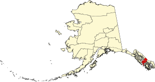
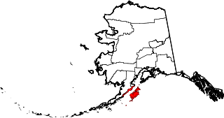
This is a list of the National Register of Historic Places listings in Petersburg, Alaska.

<span class="mw-page-title-main">National Register of Historic Places listings in Nome Census Area, Alaska</span>

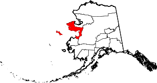
This is a list of the National Register of Historic Places listings in Nome Census Area, Alaska.

<span class="mw-page-title-main">National Register of Historic Places listings in Anchorage, Alaska</span>

This is a list of the National Register of Historic Places listings in Anchorage, Alaska.

<span class="mw-page-title-main">National Register of Historic Places listings in Yakutat, Alaska</span>

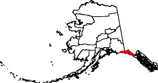
This is a list of the National Register of Historic Places listings in Yakutat, Alaska.

<span class="mw-page-title-main">National Register of Historic Places listings in Wrangell, Alaska</span>

This is a list of the National Register of Historic Places listings in Wrangell, Alaska.

<span class="mw-page-title-main">National Register of Historic Places listings in Aleutians East Borough, Alaska</span>

This is a list of the National Register of Historic Places listings in Aleutians East Borough, Alaska.

<span class="mw-page-title-main">National Register of Historic Places listings in Bristol Bay Borough, Alaska</span>

This is a list of the National Register of Historic Places listings in Bristol Bay Borough, Alaska.

<span class="mw-page-title-main">National Register of Historic Places listings in Haines Borough, Alaska</span>

This is a list of the National Register of Historic Places listings in Haines Borough, Alaska.

<span class="mw-page-title-main">National Register of Historic Places listings in Denali Borough, Alaska</span>

This is a list of the National Register of Historic Places listings in Denali Borough, Alaska.

<span class="mw-page-title-main">National Register of Historic Places listings in Fairbanks North Star Borough, Alaska</span>

This is a list of the National Register of Historic Places listings in Fairbanks North Star Borough, Alaska.

<span class="mw-page-title-main">National Register of Historic Places listings in Kenai Peninsula Borough, Alaska</span>

This is a list of the National Register of Historic Places listings in Kenai Peninsula Borough, Alaska.

<span class="mw-page-title-main">National Register of Historic Places listings in Kodiak Island Borough, Alaska</span>

This is a list of the National Register of Historic Places listings in Kodiak Island Borough, Alaska.

<span class="mw-page-title-main">National Register of Historic Places listings in Ketchikan Gateway Borough, Alaska</span>

This is a list of the National Register of Historic Places listings in Ketchikan Gateway Borough, Alaska.

<span class="mw-page-title-main">National Register of Historic Places listings in Lake and Peninsula Borough, Alaska</span>

This is a list of the National Register of Historic Places listings in Lake and Peninsula Borough, Alaska, United States.

<span class="mw-page-title-main">National Register of Historic Places listings in Northwest Arctic Borough, Alaska</span>

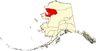
This is a list of the National Register of Historic Places listings in Northwest Arctic Borough, Alaska.

<span class="mw-page-title-main">National Register of Historic Places listings in North Slope Borough, Alaska</span>

This is a list of the National Register of Historic Places listings in North Slope Borough, Alaska.

This is a list of the National Register of Historic Places listings in Lake Clark National Park and Preserve.

This is a list of the National Register of Historic Places listings in Katmai National Park and Preserve.

<span class="mw-page-title-main">National Register of Historic Places listings in Copper River Census Area, Alaska</span>

This is a list of the National Register of Historic Places listings in Copper River Census Area, Alaska.

References

  1. The latitude and longitude information provided in this table was derived originally from the National Register Information System, which has been found to be fairly accurate for about 99% of listings. Some locations in this table may have been corrected to current GPS standards.
  2. National Park Service, United States Department of the Interior, "National Register of Historic Places: Weekly List Actions", retrieved October 20, 2023.
  3. Numbers represent an alphabetical ordering by significant words. Various colorings, defined here, differentiate National Historic Landmarks and historic districts from other NRHP buildings, structures, sites or objects.
  4. "National Register Information System". National Register of Historic Places . National Park Service. April 24, 2008.
  5. The eight-digit number below each date is the number assigned to each location in the National Register Information System database, which can be viewed by clicking the number.
  6. Federal and state laws and practices restrict general public access to information regarding the specific location of this resource. In some cases, this is to protect archeological sites from vandalism, while in other cases it is restricted at the request of the owner. See: Knoerl, John; Miller, Diane; Shrimpton, Rebecca H. (1990), Guidelines for Restricting Information about Historic and Prehistoric Resources, National Register Bulletin, National Park Service, U.S. Department of the Interior, OCLC   20706997 .
  7. US Bureau of Land Management (2016). "Tangle Lakes Archaeological District trail brochure" (PDF). Retrieved May 30, 2017.
  8. National Park Service. "Nomination form for Whitney Section House" . Retrieved May 30, 2017. and accompanying photos