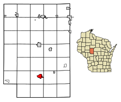
Neillsville, Wisconsin

Last updated

Neillsville, Wisconsin
Neillsville Downtown.jpg
Clark County Wisconsin Incorporated and Unincorporated areas Neillsville Highlighted.svg
Location of Neillsville in Clark County, Wisconsin.
Coordinates: 44°33′40″N90°35′45″W / 44.56111°N 90.59583°W / 44.56111; -90.59583
Country United States
State Wisconsin
County Clark
Area
[1]
  Total2.85 sq mi (7.37 km2)
  Land2.75 sq mi (7.11 km2)
  Water0.10 sq mi (0.26 km2)
Elevation
[2]
1,037 ft (316 m)
Population
 (2020) [3]
  Total2,384
  Density877.60/sq mi (338.89/km2)
Time zone UTC-6 (Central (CST))
  Summer (DST) UTC-5 (CDT)
ZIP Code
54456
Area code(s) 715 & 534
FIPS code 55-55800 [4]
GNIS feature ID1570146 [2]
Website www.neillsville-wi.com

Neillsville is a city and county seat of Clark County, Wisconsin. The population was 2,384 at the 2020 census. [5]

Contents

History

The Ojibwa were the earliest known residents of the Neillsville area. [6]

The first settlers of European descent in the area were James O'Neill and his party, who arrived around 1845, looking for a location to build a sawmill along the Black River. The city was named in honor of O'Neill, as was O'Neill Creek, which runs through the center of the city and drains into the Black River.

In 1854, O’Neill's Mill, as Neillsville was originally called, was selected as the county seat of Clark County. [7]

Neillsville was platted on April 14, 1855, and incorporated in April 1882. [8]

A Winnebago Indian boarding school was operated by the Evangelical and Reformed Church on the west side of Neillsville from 1921 to 1957. [9] [10]

Neillsville is where noted architect William L. Steele died. Poor health had forced Steele to retire from architecture in late 1946, leaving his eldest son William L. Steele Jr. and partner Josiah D. Sandham in charge of the practice. Steele had come to Neillsville to live with one of his daughters, Sallie (Mrs. Thomas S. Noble Jr.), and died at her house on March 4, 1949. [11] [12]

Geography

Neillsville is located at 44°33′40″N90°35′45″W / 44.56111°N 90.59583°W / 44.56111; -90.59583 (44.560996, -90.595746). [13]

According to the United States Census Bureau, the city has a total area of 2.87 square miles (7.43 km2), of which, 2.77 square miles (7.17 km2) is land and 0.10 square miles (0.26 km2) is water. [14]

The city lies on US Highway 10 and State Trunk Highway 73.

Neillsville, Wisconsin aerial.jpg

Climate

Climate data for Neillsville 3ESE, Wisconsin (1991–2020 normals, extremes 1893–present)
MonthJanFebMarAprMayJunJulAugSepOctNovDecYear
Record high °F (°C)57
(14)
62
(17)
83
(28)
91
(33)
105
(41)
104
(40)
106
(41)
103
(39)
98
(37)
92
(33)
81
(27)
64
(18)
106
(41)
Mean daily maximum °F (°C)23.5
(−4.7)
28.7
(−1.8)
41.0
(5.0)
55.4
(13.0)
67.8
(19.9)
76.6
(24.8)
80.4
(26.9)
78.2
(25.7)
70.8
(21.6)
57.7
(14.3)
41.9
(5.5)
28.9
(−1.7)
54.2
(12.3)
Daily mean °F (°C)14.4
(−9.8)
18.4
(−7.6)
30.4
(−0.9)
43.6
(6.4)
55.7
(13.2)
65.2
(18.4)
69.0
(20.6)
66.9
(19.4)
59.1
(15.1)
46.8
(8.2)
33.1
(0.6)
20.8
(−6.2)
43.6
(6.4)
Mean daily minimum °F (°C)5.4
(−14.8)
8.2
(−13.2)
19.8
(−6.8)
31.9
(−0.1)
43.7
(6.5)
53.9
(12.2)
57.6
(14.2)
55.6
(13.1)
47.3
(8.5)
36.0
(2.2)
24.4
(−4.2)
12.7
(−10.7)
33.0
(0.6)
Record low °F (°C)−48
(−44)
−46
(−43)
−39
(−39)
2
(−17)
15
(−9)
22
(−6)
34
(1)
31
(−1)
14
(−10)
4
(−16)
−16
(−27)
−36
(−38)
−48
(−44)
Average precipitation inches (mm)1.11
(28)
1.08
(27)
1.74
(44)
3.26
(83)
4.45
(113)
5.34
(136)
3.85
(98)
4.36
(111)
4.01
(102)
3.08
(78)
1.80
(46)
1.44
(37)
35.52
(902)
Average snowfall inches (cm)9.1
(23)
9.4
(24)
7.7
(20)
2.7
(6.9)
0.0
(0.0)
0.0
(0.0)
0.0
(0.0)
0.0
(0.0)
0.0
(0.0)
0.4
(1.0)
3.4
(8.6)
10.9
(28)
43.6
(111)
Average precipitation days (≥ 0.01 in)7.46.37.810.612.312.510.010.410.19.36.97.9111.5
Average snowy days (≥ 0.1 in)5.85.03.31.50.00.00.00.00.00.32.05.623.5
Source: NOAA [15] [16]

Demographics

Historical population
CensusPop.Note
1880 1,050
1890 1,93684.4%
1900 2,1048.7%
1910 1,957−7.0%
1920 2,16010.4%
1930 2,118−1.9%
1940 2,56221.0%
1950 2,6633.9%
1960 2,7282.4%
1970 2,7500.8%
1980 2,7801.1%
1990 2,680−3.6%
2000 2,7311.9%
2010 2,463−9.8%
2020 2,384−3.2%
U.S. Decennial Census [17]

2010 census

As of the census [3] of 2010, there were 2,463 people, 1,095 households, and 586 families living in the city. The population density was 889.2 inhabitants per square mile (343.3/km2). There were 1,230 housing units at an average density of 444.0 per square mile (171.4/km2). The racial makeup of the city was 96.2% White, 0.4% African American, 0.7% Native American, 1.1% Asian, 0.9% from other races, and 0.7% from two or more races. Hispanic or Latino of any race were 2.3% of the population.

There were 1,095 households, of which 24.7% had children under the age of 18 living with them, 39.1% were married couples living together, 10.5% had a female householder with no husband present, 3.9% had a male householder with no wife present, and 46.5% were non-families. 42.3% of all households were made up of individuals, and 22.8% had someone living alone who was 65 years of age or older. The average household size was 2.13 and the average family size was 2.92.

The median age in the city was 43.6 years. 21.8% of residents were under the age of 18; 8.5% were between the ages of 18 and 24; 21.3% were from 25 to 44; 24.7% were from 45 to 64; and 23.7% were 65 years of age or older. The gender makeup of the city was 46.6% male and 53.4% female.

2000 census

As of the census [4] of 2000, there were 2,731 people, 1,130 households, and 653 families living in the city. The population density was 975.3 people per square mile (376.6/km2). There were 1,200 housing units at an average density of 428.5 per square mile (165.5/km2). The racial makeup of the city was 96.78% White, 0.15% African American, 1.10% Native American, 1.24% Asian, 0.04% Pacific Islander, 0.26% from other races, and 0.44% from two or more races. Hispanic or Latino of any race were 0.95% of the population.

There were 1,130 households, out of which 27.1% had children under the age of 18 living with them, 44.5% were married couples living together, 10.1% had a female householder with no husband present, and 42.2% were non-families. 38.1% of all households were made up of individuals, and 21.3% had someone living alone who was 65 years of age or older. The average household size was 2.24 and the average family size was 2.99.

In the city, the population was spread out, with 25.3% under the age of 18, 7.0% from 18 to 24, 24.2% from 25 to 44, 18.7% from 45 to 64, and 24.8% who were 65 years of age or older. The median age was 40 years. For every 100 females, there were 86.2 males. For every 100 females age 18 and over, there were 79.3 males.

The median income for a household in the city was $29,969, and the median income for a family was $41,076. Males had a median income of $30,523 versus $20,379 for females. The per capita income for the city was $16,298. About 6.3% of families and 10.3% of the population were below the poverty line, including 6.8% of those under age 18 and 8.9% of those age 65 or over.

Transportation

Neillsville airport Neillsville airport.jpg
Neillsville airport

Neillsville is served by the Neillsville Municipal Airport (KVIQ).

Education

Neillsville High School Neillsville High School.jpg
Neillsville High School

Neillsville has a public K-12 school system, consisting of Neillsville Elementary School, Neillsville Middle School, and Neillsville High School, whose mascot is the Neillsville Warriors. Neillsville is also home to St. John's Lutheran School, a private school for grades K-8 of the Wisconsin Evangelical Lutheran Synod, [18] and the former home of St. Mary's School of Neillsville, [19] a Catholic school which closed in 1972. [20]

In addition, the Chippewa Valley Technical College has a regional center in Neillsville, which offers GED, associate's degree, and continuing education classes.

Points of interest

The High Ground is a veterans' memorial park located west of Neillsville. Originally a memorial to Vietnam War veterans, it now includes memorials to World War I, World War II, and Korean War veterans.

The Clark County Jail, now a museum, and the Reed School, now a museum, are on the National Register of Historic Places.

The Wisconsin Pavilion from the 1964 New York World's Fair was moved to Neillsville at the conclusion of the Fair. The building is now home to local radio station WCCN/WCCN-FM and a gift shop. Chatty-Belle is a large cow statue located on the ground of the Wisconsin Pavilion. She has the distinction of being the World's Largest Talking Cow. [21]

See also

Related Research Articles

<span class="mw-page-title-main">Clark County, Wisconsin</span> County in Wisconsin, United States

Clark County is a county in the U.S. state of Wisconsin. As of the 2020 census, the population was 34,659. Its county seat is Neillsville.

<span class="mw-page-title-main">Steele, Missouri</span> City in Missouri, United States

Steele is a city in southern Pemiscot County in the Missouri Bootheel of southeastern Missouri, United States. The population was 1,853 at the 2020 census.

<span class="mw-page-title-main">Dewhurst, Wisconsin</span> Town in Wisconsin, United States

Dewhurst is a town in Clark County in the U.S. state of Wisconsin. The population was 323 at the 2010 census. The ghost town of Trow was located in the town.

<span class="mw-page-title-main">Hixon, Wisconsin</span> Town in Wisconsin, United States

Hixon is a town in Clark County in the U.S. state of Wisconsin. The population was 740 at the 2000 census. Most of the village of Withee, most of the city of Owen, and the ghost town of Clark are located in Hixon.

<span class="mw-page-title-main">Weston, Clark County, Wisconsin</span> Town in Wisconsin, United States

Weston is a town in Clark County in the U.S. state of Wisconsin. The population was 638 at the 2000 census. The unincorporated communities of Christie and Globe are located in the town.

<span class="mw-page-title-main">Horicon, Wisconsin</span> City in Wisconsin, United States

Horicon is a city in Dodge County, Wisconsin, United States. The population was 3,655 at the 2010 census.

<span class="mw-page-title-main">Markesan, Wisconsin</span> City in Wisconsin, United States

Markesan is a city in Green Lake County, Wisconsin, United States. The population was 1,476 at the 2010 census. The center of population of Wisconsin is located in Markesan.

<span class="mw-page-title-main">Mauston, Wisconsin</span> City in Wisconsin, United States

Mauston is a city in and the county seat of Juneau County, Wisconsin, United States. The population was 4,347 as of the 2020 census. It is approximately 70 miles northwest from the state capital, Madison.

<span class="mw-page-title-main">Marathon City, Wisconsin</span> Village in Wisconsin, United States

Marathon City is a village in Marathon County, Wisconsin, United States. It is part of the Wausau, Wisconsin Metropolitan Statistical Area. The population was 1,524 at the 2010 census. The village was incorporated from a part of the original area of the town of Marathon. The village dates back to 1856. The name of the village commemorates the Battle of Marathon.

<span class="mw-page-title-main">Kimberly, Wisconsin</span> Village in Wisconsin, United States

Kimberly is a village in Outagamie County, Wisconsin, United States. The population was 7,320 at the 2020 census. The village is east of Appleton.

<span class="mw-page-title-main">Wild Rose, Wisconsin</span> Village in Wisconsin, United States

Wild Rose is a village in Waushara County, Wisconsin, United States. The population was 725 at the 2010 census.

<span class="mw-page-title-main">Marshfield, Wisconsin</span> City in Wisconsin, United States

Marshfield is in Wood and Marathon counties in the state of Wisconsin. It is located at the intersection of U.S. Highway 10, Highway 13 and Highway 97. The largest city in Wood County, its population was 18,929 at the 2020 census. Of this, 18,119 were in Wood County, and 810 were in Marathon County. The city is part of the United States Census Bureau's Marshfield-Wisconsin Rapids Micropolitan Statistical Area, which includes all of Wood County. The portion of the city in Marathon County is part of the Wausau Metropolitan Statistical Area.

<span class="mw-page-title-main">Abbotsford, Wisconsin</span> City in Wisconsin, United States

Abbotsford is a city in Clark (mostly) and Marathon counties in the U.S. state of Wisconsin. The population was 2,275 at the 2020 census. Of this, 1,665 were in Clark County, and 610 were in Marathon County. Abbotsford is nicknamed "Wisconsin's First City" due to its alphabetical place on a list of Wisconsin cities.

<span class="mw-page-title-main">Brillion, Wisconsin</span> City in Wisconsin, United States

Brillion is a city in Calumet County in the U.S. state of Wisconsin. The population was 3,538 as of 2024. The city is located within the Town of Brillion, though it is politically independent.

<span class="mw-page-title-main">Stockbridge, Wisconsin</span> Village in Wisconsin, United States

Stockbridge is a village in Calumet County, Wisconsin, United States. The population was 686 at the 2020 census. The village lies within the Town of Stockbridge.

<span class="mw-page-title-main">Colby, Wisconsin</span> City in Wisconsin, United States

Colby is a city in Clark and Marathon counties in the U.S. state of Wisconsin. It is part of the Wausau, Wisconsin Metropolitan Statistical Area. The population was 1,852 at the 2010 census. Of this, 1,354 were in Clark County, and 498 were in Marathon County. The city is bordered by the Town of Colby, the Town of Hull, and the City of Abbotsford. Colby cheese was first created in Colby.

<span class="mw-page-title-main">Thorp, Wisconsin</span> City in Wisconsin, United States

Thorp is a city in Clark County in the U.S. state of Wisconsin. The population was 1,621 at the 2010 census. The city is located partially within the Town of Thorp and partially within the Town of Withee.

<span class="mw-page-title-main">Randolph, Wisconsin</span> Village in Wisconsin, United States

Randolph is a village in Columbia and Dodge Counties in the U.S. state of Wisconsin. The population was 1,811 at the 2010 census. Of this, 1,339 were in Dodge County, and 472 were in Columbia County. The village is located at the southeast corner of the Town of Randolph in Columbia County, although only a tiny portion of the village lies within the town. Most of the village lies within the Town of Westford in Dodge County. Small portions also lie within the Town of Fox Lake to the north and the Town of Courtland in Columbia County.

<span class="mw-page-title-main">Ripon, Wisconsin</span> City in Wisconsin, United States

Ripon is a city in Fond du Lac County, Wisconsin, United States. The population was 7,863 at the 2020 census. The city is surrounded by the Town of Ripon.

<span class="mw-page-title-main">Bloomer, Wisconsin</span> City in Wisconsin, United States

Bloomer is a city in Chippewa County, Wisconsin, United States. As of the 2010 census, the population of the city of Bloomer was 3,539.

References

  1. "2019 U.S. Gazetteer Files". United States Census Bureau. Retrieved August 7, 2020.
  2. 1 2 "US Board on Geographic Names". United States Geological Survey. October 25, 2007. Retrieved January 31, 2008.
  3. 1 2 "U.S. Census website". United States Census Bureau . Retrieved November 18, 2012.
  4. 1 2 "U.S. Census website". United States Census Bureau . Retrieved January 31, 2008.
  5. "Find a County". National Association of Counties. Retrieved June 7, 2011.
  6. Author unknown. "The Heart of Wisconsin Archived 2007-07-27 at the Wayback Machine ", 1900 (estimated).
  7. MacBridge, R. J. "The History of Clark County". Thorp Courier, June 17, 1909.
  8. Clark County, WI Internet Library Project. "Pine Valley Township, Clark County, Wisconsin Archived 2008-01-05 at the Wayback Machine ". Retrieved on 2007-10-25.
  9. "Winnebago Indian Mission School". Wisconsin Historical Society. Retrieved September 1, 2023.
  10. "Interactive Digital Map of Indian Boarding Schools". The National Native American Boarding School Healing Coalition. Retrieved September 1, 2023.
  11. "Obit: Steele, William LaBarthe (1875 - 1949)". Clark County Press. Neillsville, Wisconsin. March 10, 1949.
  12. Withey, Henry F; Withey, Elsie Rathburn (1956). Biographical Dictionary of American Architects (Deceased) . Los Angeles: New Age Publishing Co. p.  569.
  13. "US Gazetteer files: 2010, 2000, and 1990". United States Census Bureau. February 12, 2011. Retrieved April 23, 2011.
  14. "US Gazetteer files 2010". United States Census Bureau. Archived from the original on January 25, 2012. Retrieved November 18, 2012.
  15. "NOWData - NOAA Online Weather Data". National Oceanic and Atmospheric Administration. Retrieved March 31, 2024.
  16. "Summary of Monthly Normals 1991-2020". National Oceanic and Atmospheric Administration. Retrieved March 31, 2024.
  17. "Census of Population and Housing". Census.gov. Retrieved June 4, 2015.
  18. "St. John's Neillsville".
  19. "Many Attend Music Festival Held at Loyal" . The Marshfield News-Herald . Vol. 41, no. 14. Marshfield, Wisconsin. March 22, 1961. p. 10. Retrieved January 2, 2024 via Newspapers.com.
  20. "School: Neillsville St. Mary's (Closing 1972)". usgennet.org. Retrieved January 2, 2024.
  21. "Neillsville Area Chamber of Commerce -- Neillsville, Wisconsin". www.neillsville.org. Archived from the original on July 27, 2011.