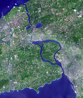
The Niagara River is a river that flows north from Lake Erie to Lake Ontario. It forms part of the border between the province of Ontario in Canada and the state of New York in the United States. There are differing theories as to the origin of the river's name. According to Iroquoian scholar Bruce Trigger, Niagara is derived from the name given to a branch of the locally residing native Neutral Confederacy, who are described as being called the Niagagarega people on several late-17th-century French maps of the area. According to George R. Stewart, it comes from the name of an Iroquois town called Ongniaahra, meaning "point of land cut in two".
Welland is a city in the Regional Municipality of Niagara in Southern Ontario, Canada. In 2016, it had a population of 52,293.
Thorold is a city in Ontario, Canada, located on the Niagara Escarpment. It is also the seat of the Regional Municipality of Niagara.
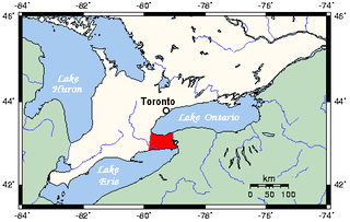
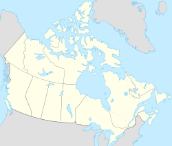
The Niagara Peninsula is the portion of Golden Horseshoe, Southern Ontario, Canada, lying between the southwestern shore of Lake Ontario and the northeastern shore of Lake Erie. Technically an isthmus rather than a peninsula, it stretches from the Niagara River in the east to Hamilton, Ontario, in the west. The population of the peninsula is roughly 1,000,000 people. The region directly across the Niagara River and Lake Erie in New York State is known as the Niagara Frontier. The broader Buffalo Niagara Region includes the Niagara Peninsula, the Niagara Frontier, and the city of Buffalo, New York.
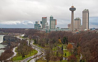
Chippawa is a community located within the city of Niagara Falls, Ontario.
Monck was a federal electoral district in the Canadian province of Ontario, which was represented in the House of Commons of Canada from 1867 to 1892. It is sometimes also considered one of Ontario's historic counties, as it was listed in some post-Confederation census records as a county of residence.
The Welland River is a river in the cities of Welland and Niagara Falls of southern Ontario which flows from its headwaters south of Hamilton, Ontario to empty into the Niagara River near the city of Niagara Falls, Ontario. It drains an area of 880 square kilometres (340 sq mi).

The Niagara College of Applied Arts and Technology is a public College of Applied Arts and Technology within the Niagara Region of Southern Ontario, Canada.

Niagara Falls is a federal electoral district in Ontario, Canada, that has been represented in the House of Commons of Canada since 1953.
Welland—St. Catharines—Thorold was a federal electoral district represented in the House of Commons of Canada from 1988 to 1997. It was located in the province of Ontario. This riding was created in 1987 from Welland riding.
Cooks Mills is a small community in the easternmost part of the city of Welland in Ontario, Canada. It was established, and is still centred, on a Welland River tributary called Lyons Creek. It is almost entirely a bedroom community, as there are few employers located in the area.
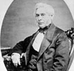
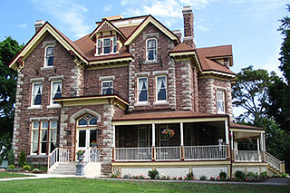
William Hamilton Merritt was an influential figure in the Niagara Peninsula of Upper Canada in early 19th century and one of the fathers of the Welland Canal.

Commisso's Food Markets was a Canadian supermarket chain based in Beamsville, Ontario. Operating under Commisso's Grocery Distributors Limited, the chain was part of one of the largest independently owned grocery and food distribution chains in southern Ontario. At its peak, Commisso's operated a wholesale business and distribution centre, six cash and carry outlets, and 16 supermarkets across the Niagara and Hamilton areas, where its commitment to "quality products, friendly people and low prices" proved very popular.
King's Highway 58A, commonly referred to as Highway 58A, is a provincially maintained highway in the Canadian province of Ontario. The short route serves to connect Highway 58 with Highway 140 and passes beneath the Welland Canal through the Townline Tunnel. The entire route is located within the city of Welland in the Regional Municipality of Niagara.
George Bukator was an Ontario political figure. He represented Niagara Falls in the Legislative Assembly of Ontario from 1958 to 1971 as a Liberal member.
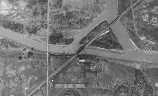
The Montrose Swing Bridge is located on the Welland River at the junction with the Queenston Power Canal in the southeast portion of the City of Niagara Falls, Ontario, Canada. It was built ca. 1910 to carry the Canada Southern Railway over the river. It is a two-track bridge, although only one track remains in use today. It crosses the river at roughly a 45-degree angle.

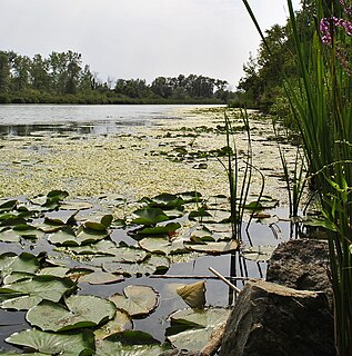
Twelve Mile Creek is a waterway located on the Niagara Peninsula in the Regional Municipality of Niagara in Southern Ontario, Canada. Its headwaters are located in the town of Pelham, encompassing some of the most unspoiled and natural areas of Niagara area. The creek's lower reaches flow through urban areas of Thorold and St. Catharines, and have been heavily altered by human activity for almost two centuries.

Niagara Centre is a provincial electoral district in Ontario, Canada, represented from 1867 until 1977 and again since 2007 in the Legislative Assembly of Ontario. Its population in 2006 was 112,875.