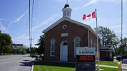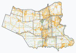
Northumberland County is an upper-tier municipality situated on the north shore of Lake Ontario, east of Toronto in Central Ontario. The Northumberland County headquarters are located in Cobourg.

The Regional Municipality of Niagara, also colloquially known as the Niagara Region or Region of Niagara, is a regional municipality comprising twelve municipalities of Southern Ontario, Canada. The regional seat is in Thorold. It is the southern end of the Golden Horseshoe, the largest megalopolis in Canada.

Whitchurch-Stouffville is a town in the Greater Toronto Area of Ontario, Canada, approximately 50 km (31 mi) north of downtown Toronto, and 55 km (34 mi) north-east of Toronto Pearson International Airport. It is 206.22 km2 (79.62 sq mi) in area, and located in the mid-eastern area of the Regional Municipality of York on the ecologically-sensitive Oak Ridges Moraine. Its motto since 1993 is "country close to the city".

Georgina is a town in south-central Ontario. The northernmost municipality in the Regional Municipality of York, the town is bounded to the north by Lake Simcoe. Although incorporated as a town, it operates as a township in which dispersed communities share a common administrative council. The largest communities are Keswick, Sutton, and Jackson's Point. Smaller communities include Pefferlaw, Port Bolster, Roches Point, Udora, and Willow Beach. The town was formed by the merger of the Village of Sutton, the Township of Georgina, and the Township of North Gwillimbury in 1971 and incorporated in 1986. North Gwillimbury had been part of Georgina but became its own township in 1826. It took its name from the family of Elizabeth Simcoe, née Gwillim.

Brock is a township in the Regional Municipality of Durham, Ontario, Canada. Brock Township is also a former municipality and geographic township prior to the amalgamation that formed the current municipality.

Cavan Monaghan is a township in Peterborough County in central-eastern Ontario, Canada, 20 kilometres (12 mi) southwest of the city of Peterborough.
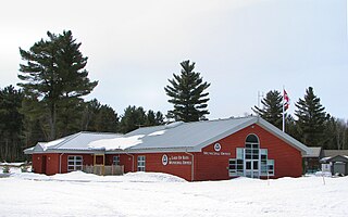
Lake of Bays is a township municipality within the District Municipality of Muskoka, Ontario, Canada. The township, situated 193 kilometres (120 mi) north of Toronto, is named after the Lake of Bays. During the 2016 census, the township had a population of 3,167 and encompassed 677.91 square kilometres (261.74 sq mi) of land.
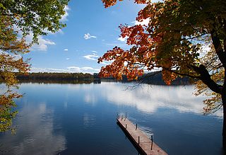
The Township of Muskoka Lakes is a municipality of the District Municipality of Muskoka, Ontario, Canada. It has a year-round population of 7,652.

Addington Highlands is a township in central eastern Ontario, Canada, in the County of Lennox and Addington. Bon Echo Provincial Park is located primarily in Addington Highlands.

McGarry is an incorporated township in Timiskaming District in Northeastern Ontario, Canada. It includes the communities of Virginiatown, North Virginiatown, and Kearns. The township borders with Quebec to the east, along Highway 66 between Kirkland Lake and Rouyn-Noranda. The northern border of the township forms part of the border between Timiskaming District and Cochrane District. Highway 66 was rerouted in 2017 because of concerns that aging mine shafts under the road could cause it to collapse.

Lanark County is a county located in the Canadian province of Ontario. Its county seat is Perth, which was first settled in 1816 and was known as a social and political capital before being over shadowed by what we now know as Ottawa.
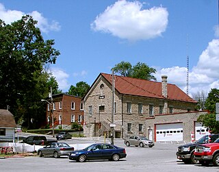
Marmora and Lake is a municipality along the banks of Crowe River and Beaver Creek, about midway between Toronto and Ottawa on provincial Highway 7 in Hastings County in Central Ontario, Canada. It is home to over 4,000 full time and seasonal residents, many of whom enjoy outdoor recreation and relaxation on Crowe Lake.

Severn is a township in south-central Ontario, Canada, located between Lake Couchiching, and the Severn River in Simcoe County.

Lambton County is a county in Southwestern Ontario, Canada. It is bordered on the north by Lake Huron, which is drained by the St. Clair River, the county's western border and part of the Canada-United States border. To the south is Lake Saint Clair and Chatham-Kent. Lambton County's northeastern border follows the Ausable River and Parkhill Creek north until it reaches Lake Huron at the beach community of Grand Bend. The county seat is in the Town of Plympton-Wyoming.
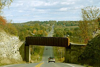
South Frontenac is a township in Frontenac County in eastern Ontario, Canada. It was amalgamated in 1998 from the former townships of Bedford, Loughborough, Portland, and Storrington.

Clearview is a rural incorporated township in Simcoe County in Central Ontario, Canada, west of Barrie and south of Collingwood and Wasaga Beach in Simcoe County.
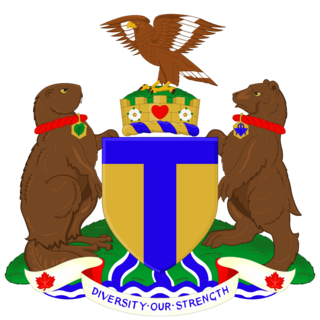
The coat of arms of Toronto is a heraldic symbol used to represent the city Toronto. Designed by Robert Watt, the Chief Herald of Canada at the time, for the City of Toronto after its amalgamation in 1998. The arms were granted by the Canadian Heraldic Authority on 11 January 1999.

Candiac is a suburb of Montreal, in the Canadian province of Quebec; it is located on the South Shore of the Saint Lawrence River opposite Montreal near La Prairie. The population as of the Canada 2021 Census was 22,997.
Robert Cooper was an Ontario farmer and political figure. He represented Welland in the Legislative Assembly of Ontario as a Liberal member from 1919 to 1923.
The Niagara Peninsula Conservation Authority is one of 36 conservation authorities in the Canadian province of Ontario. It was established via the Conservation Authorities Act, and is a member authority of Conservation Ontario.
