The geography of Ukraine varies greatly from one region of the country to another, with the majority of the country lying within the East European Plain. Ukraine is the second-largest European country, after Russia. Its various regions have diverse geographic features ranging from highlands to lowlands, as well as climatic range and a wide variety in hydrography.

Lihue or Līhuʻe is an unincorporated community, census-designated place (CDP) and the county seat of Kauai County, Hawaii, United States. Lihue is the second-largest town on the Hawaiian island of Kauaʻi after Kapaʻa. As of the 2010 census, the CDP had a population of 6,455, up from 5,694 at the 2000 census.

The Greater Toronto Area, commonly referred to as the GTA, includes the City of Toronto and the regional municipalities of Durham, Halton, Peel, and York. In total, the region contains 25 urban, suburban, and rural municipalities. The Greater Toronto Area begins in Burlington in Halton Region, and extends along Lake Ontario past downtown Toronto eastward to Clarington in Durham Region.

Alberta is one of the thirteen provinces and territories of Canada. Located in Western Canada, the province has an area of 661,190 km2 (255,290 sq mi) and is bounded to the south by the United States state of Montana along 49° north for 298 km (185 mi); to the east at 110° west by the province of Saskatchewan for 1,223 km (760 mi); and at 60° north the Northwest Territories for 644 km (400 mi). The southern half of the province borders British Columbia along the Continental Divide of the Americas on the peaks of the Rocky Mountains, while the northern half borders British Columbia along the 120th meridian west. Along with Saskatchewan it is one of only two landlocked provinces or territories.

Corner Brook is a city located on the west coast of the island of Newfoundland in the province of Newfoundland and Labrador, Canada. Corner Brook is the fifth largest settlement in Newfoundland and Labrador.
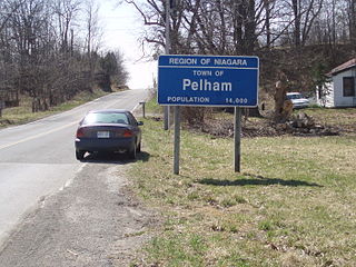
The Town of Pelham is located in the centre of Niagara Region in Ontario, Canada.
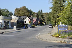
Fonthill is a community in the town of Pelham, Ontario, Canada. It has a few small industries, but is primarily a residential suburb known for its fruit orchards, nature trails, and neighbourly attitude. As a bedroom community, most residents commute to Welland, St. Catharines and some as far as Buffalo, Hamilton and Toronto daily for work.

Sterling, Virginia, refers most specifically to a census-designated place (CDP) in Loudoun County, Virginia, United States. The population of the CDP as of the 2010 United States Census was 27,822. The CDP boundaries are confined to a relatively small area between Virginia State Route 28 on the west and Virginia State Route 7 on the northeast, excluding areas near SR 606 and the Dulles Town Center.

Marathon is a town in the Canadian province of Ontario, located in Thunder Bay District, on the north shore of Lake Superior north of Pukaskwa National Park, in the heart of the Canadian Shield.

Val Marie is a village in the Canadian province of Saskatchewan within the Rural Municipality of Val Marie No. 17 and Census Division 4. It is about 30 kilometres from the Canada-United States border.
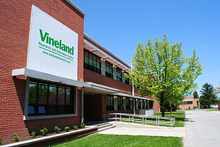
Vineland is an unincorporated community within the Town of Lincoln in Niagara Region. Located in the Canadian province of Ontario, it is bordered by the Twenty Mile Creek and Jordan to the east, Lake Ontario to the north, Beamsville to the west, and Pelham to the south. Vineland is primarily an agricultural community and is home to many tender fruit farms and wineries. As the second-largest community in the Town of Lincoln, Vineland's small commercial centre along King Street serves the surrounding communities of Campden and Jordan. The post office was established in 1894.
The Halifax Regional Municipality (HRM) in Nova Scotia, Canada has a widely varied geography.
Kedgwick is a Canadian incorporated rural community in northern New Brunswick, Canada. On 1 January 2023, Kedgwick annexed a large area including the local service districts of St. Jean Baptiste – Menneval and White's Brook, with parts of two others; revised census figures have not been released.

The geography of Toronto, Ontario, covers an area of 630 km2 (240 sq mi) and is bounded by Lake Ontario to the south; Etobicoke Creek, Eglinton Avenue, and Highway 427 to the west; Steeles Avenue to the north; and the Rouge River and the Scarborough–Pickering Townline to the east. In addition to Etobicoke Creek and the Rouge River, the city is trisected by two minor rivers and their tributaries, the Humber River in the west end and the Don River east of downtown. Both flow southward to Lake Ontario at Humber Bay and Toronto Harbour respectively, which are part of the longer Waterfront, as well as Etobicoke Creek and the Rouge River.
Warfield is a village at the bottom of the Rossland hill, immediately west of Trail, in the West Kootenay region of southern British Columbia.

The climate of California varies widely from hot desert to alpine tundra, depending on latitude, elevation, and proximity to the Pacific Coast. California's coastal regions, the Sierra Nevada foothills, and much of the Central Valley have a Mediterranean climate, with warmer, drier weather in summer and cooler, wetter weather in winter. The influence of the ocean generally moderates temperature extremes, creating warmer winters and substantially cooler summers in coastal areas.

Washington is the northwesternmost state of the contiguous United States. It borders Idaho to the east, bounded mostly by the meridian running north from the confluence of the Snake River and Clearwater River, except for the southernmost section where the border follows the Snake River. Oregon is to the south, with the Columbia River forming the western part and the 46th parallel forming the eastern part of the Oregon–Washington border. During Washington's partition from Oregon, the original plan for the border followed the Columbia River east until the confluence with the Snake, and then would have followed the Snake River east; this was changed to keep Walla Walla's fertile farmland in Washington.

In March 2012, one of the greatest heat waves was observed in many regions of North America. Very warm air pushed northward west of the Great Lakes region, and subsequently spread eastward. The intense poleward air mass movement was propelled by an unusually intense low level southerly jet that stretched from Louisiana to western Wisconsin. Once this warm surge inundated the area, a remarkably prolonged period of record setting temperatures ensued.