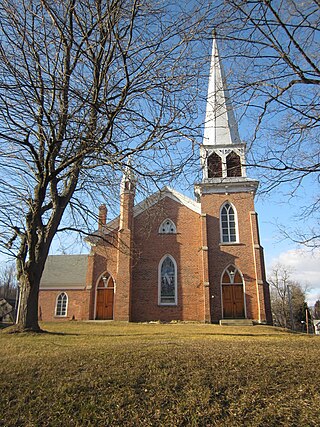
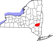
Delmar is a hamlet in the Town of Bethlehem, in Albany County, New York, United States. It is a suburb of the neighboring city of Albany. The community is bisected by NY Route 443, a major thoroughfare, main street, and route to Albany.
Jefferson Heights is a hamlet and census-designated place (CDP) in Greene County, New York, United States. The population was 1,122 at the 2020 census.

New Baltimore is a town in the northeastern part of Greene County, New York, United States. The population was 3,226 at the 2020 United States census, down from 3,370 in the 2010 census.

Schodack is a town in Rensselaer County, New York, United States. The population was 12,965 at the 2020 census. The town name is derived from the Mahican word, Escotak. The town is in the southwestern part of the county. Schodack is southeast of Albany, New York.
Coeymans is a hamlet in Albany County, New York, United States. It is located on Route 144 in the southeastern part of the Town of Coeymans. The population was 835 at the 2000 census, which listed the community as a census-designated place (CDP), but it was not included as a CDP in the 2010 census.

Coeymans is a town in Albany County, New York, United States. The population was 7,256 in the 2020 census, a decline from 7,418 at the 2010 census. The town is named after an early settler, who was the patent-holder for the area. The town is in the southeastern part of the county, south of Albany.

Catskill is a town in the southeastern section of Greene County, New York, United States. The population was 11,298 at the 2020 census, the largest town in the county. The western part of the town is in the Catskill Park. The town contains a village, also called Catskill. The village of Catskill has a well-defined Main Street. There is a public boat launch on the Hudson River called Dutchman's Landing.

Coxsackie is a town in Greene County, New York, United States. The population in the 2020 census was 8,382, a decrease from the 2010 census. The name of the town is said to be derived from a Native American term, but it has various translations.

New York State Route 144 (NY 144) is a state highway in the Capital District of New York in the United States. The highway runs for 14.74 miles (23.72 km) as a two-lane road from an intersection with U.S. Route 9W (US 9W) in the Greene County town of New Baltimore to a junction with NY 32 in the town of Bethlehem just south of the Albany city limits. NY 144 closely parallels the New York State Thruway and the west bank of the Hudson River as it heads across Albany County. The Thruway and NY 144 connect at exit 22 about 6 miles (9.7 km) south of Albany in Bethlehem.

New York State Route 143 (NY 143) is a 18.82-mile-long (30.29 km) state highway in Albany County, New York, in the United States. The highway runs from an intersection with NY 85 in the town of Westerlo to a junction with NY 144 in the hamlet of Coeymans. The entire route is two lanes wide. NY 143 follows the path of the Coeymans and Westerlo Plank Road, a plank road that operated from 1850 to the early 20th century. The road became a state highway by 1915 and was designated NY 143 as part of the 1930 renumbering of state highways in New York.

New York State Route 396 (NY 396) is a 6.58-mile-long (10.59 km) east–west state highway in Albany County, New York, in the United States. The route is functionally a spur route as it connects to another signed state highway at only one end. The western terminus of NY 396 is at an intersection with County Route 103 (CR 103) in Callanans Corners, a small hamlet situated just south of the Bethlehem–Coeymans town line in the town of Coeymans. Its eastern terminus is at a junction with NY 144 in Bethlehem east of the hamlet of Selkirk. West of Callanans Corners, the road continues northwestward to NY 443 in New Scotland as CR 301. NY 396 was assigned as part of the 1930 renumbering of state highways in New York.
East Worcester is a hamlet and census-designated place (CDP) in the town of Worcester in Otsego County, New York, United States. It was first listed as a CDP prior to the 2020 census.

Alcove is a hamlet in the town of Coeymans, Albany County, New York, United States. It is a prime example of a 19th-century mill town located at a rural intersection, and as such it is listed on the National Register of Historic Places in the Albany area as the Alcove Historic District. The city of Albany's Alcove Reservoir lies to the west of the hamlet.

Plattekill is a town in Ulster County, New York, United States. The population was 10,424 in 2020, a slight decrease from 10,499 at the 2010 census. The name is derived from a stream, the Platte Kill.

Hyde Park is a hamlet and census-designated place (CDP) in the town of Hyde Park, Dutchess County, New York, United States. Its population was 1,908 as of the 2010 census.

Sunset Bay is a hamlet and census-designated place (CDP) in the town of Hanover in Chautauqua County, New York, United States. The population was 660 at the 2010 census.
Prattsville is a hamlet and census-designated place (CDP) in the town of Prattsville, Greene County, New York, United States. The population of the CDP was 355 at the 2010 census, out of a total population of 700 in the town.
Groveland Station is a census-designated place (CDP) in Livingston County, New York, United States. The CDP consists of the hamlet of Groveland and nearby residential areas. The CDP population was 281 as of the 2010 census. New York State Route 63 passes through the community.
Marcy is an unincorporated community and census-designated place (CDP) in the town of Marcy, Oneida County, New York, United States. It was first listed as a CDP prior to the 2020 census.
Cementon is a hamlet and census-designated place (CDP) in the town of Catskill in Greene County, New York, United States. It was first listed as a CDP prior to the 2020 census.


