New Boston, New Hampshire

Last updated

New Boston, New Hampshire
Town
Church in New Boston, New Hampshire.jpg
Town Hall
New Boston Town Seal.png
Nickname: 
Gravity Center of the World
Hillsborough-New-Boston-NH.png
Coordinates: 42°58′33″N71°41′30″W / 42.97583°N 71.69167°W / 42.97583; -71.69167
Country United States
State New Hampshire
County Hillsborough
Incorporated 1763
Government
   Select Board
  • William McFadden, Chair
  • Kary Jencks
  • Joe Constance
Area
[1]
  Total43.2 sq mi (111.9 km2)
  Land42.8 sq mi (110.9 km2)
  Water0.4 sq mi (1.0 km2)  0.92%
Elevation
420 ft (130 m)
Population
 (2020) [2]
  Total6,108
  Density143/sq mi (55.1/km2)
Time zone UTC-5 (Eastern)
  Summer (DST) UTC-4 (Eastern)
ZIP code
03070
Area code 603
FIPS code 33-50740
GNIS feature ID0873674
Website www.newbostonnh.gov

New Boston is a town in Hillsborough County, New Hampshire, United States. The population was 6,108 at the 2020 census, [2] up from 5,321 at the 2010 census. [3] New Boston is home to the annual Hillsborough County Agricultural Fair and the Molly Stark Cannon. The 1743 cannon, which appears on the town seal, was given by General John Stark to the New Boston Artillery Company after the Battle of Bennington. [4]

Contents

The town's central village is listed as the New Boston census-designated place, with a population in 2020 of 326.

History

The town was first granted in 1736 by colonial governor Jonathan Belcher of Massachusetts and New Hampshire. At the time, lands to the west of the Merrimack River, disputed between the two provinces, were treated by Belcher as part of Massachusetts, and he granted the town to several Boston families. It was to have been called "Lanestown" or "Piscataquog Township", but by 1751 they called it "New Boston" after their hometown. Not all the grantees took up their claims, and the land was regranted 10 years later to settlers from Londonderry, New Hampshire. When the town was incorporated in 1763, Governor Benning Wentworth formally recognized the long-used name of "New Boston". [5]

In 1820, the town had 25 sawmills, six grain mills, two clothing mills, two carding mills, two tanneries and a bark mill. It also had 14 schoolhouses and a tavern. The Great Village Fire of 1887, which started when a spark from a cooper's shop set a barn on fire, destroyed nearly 40 buildings in the lower village. In 1893, the railroad came to New Boston, and farm produce was sent by rail to city markets. [6] Passenger service was discontinued in 1931, and the tracks were removed in 1935. Today the former grade is the multi-use New Boston Rail Trail.

The town is home to the 2,800-acre (1,100 ha) New Boston Space Force Station, which started as an Army Air Corps bombing range in 1942. By 1960, it had become a U.S. Air Force base for tracking military satellites. In July 2021, the facility was given its current name and began operating as part of the United States Space Force. New Boston was also home to the Gravity Research Foundation from the late 1940s through the mid-1960s. Founder Roger Babson placed it in New Boston because he believed it safe from nuclear fallout should New York or Boston be attacked.

Dodge's Store, in the center of town, was established in 1872 and was owned and operated by five generations of the Dodge family until 1994. Clarence H. Dodge started the family business, and ownership remained in the Dodge family until Malcom J. Dodge sold the business in 1994 due to a downturn in the economy. The store closed on August 29, 2011, due to the owner's financial problems, but has since been reopened under new ownership. [7]

Geography

According to the United States Census Bureau, the town has a total area of 43.2 square miles (111.9 km2), of which 42.8 square miles (110.9 km2) are land and 0.39 square miles (1.0 km2) are water, comprising 0.92% of the town. [1] New Boston is drained by the South Branch and Middle Branch of the Piscataquog River, except for the town's southeastern corner, which is drained by Joe English Brook, a tributary of Baboosic Brook. The entire town is part of the Merrimack River watershed. Joe English Hill, elevation 1,285 feet (392 m) above sea level and the highest point in the town, is in the south.

The town is crossed by state routes 13, 77, and 136. The three state highways meet in the center of the town at New Boston village. Klondike Corner is a low-density residential area in the southeastern part of the town.

Adjacent municipalities

Demographics

Historical population
CensusPop.Note
1790 1,202
1800 1,49124.0%
1810 1,6198.6%
1820 1,6864.1%
1830 1,680−0.4%
1840 1,570−6.5%
1850 1,477−5.9%
1860 1,369−7.3%
1870 1,241−9.3%
1880 1,144−7.8%
1890 1,067−6.7%
1900 1,002−6.1%
1910 982−2.0%
1920 768−21.8%
1930 693−9.8%
1940 77311.5%
1950 86511.9%
1960 9256.9%
1970 1,39050.3%
1980 1,92838.7%
1990 3,21466.7%
2000 4,13828.7%
2010 5,32128.6%
2020 6,10814.8%
U.S. Decennial Census [1] [8]

As of the census [9] of 2000, there were 4,138 people, 1,434 households, and 1,162 families residing in the town. The population density was 96.6 inhabitants per square mile (37.3/km2). There were 1,462 housing units at an average density of 34.1 per square mile (13.2/km2). The racial makeup of the town was 98.02% White, 0.36% African American, 0.10% Native American, 0.36% Asian, 0.31% from other races, and 0.85% from two or more races. Hispanic or Latino of any race were 0.63% of the population.

There were 1,434 households, out of which 44.4% had children under the age of 18 living with them, 70.3% were married couples living together, 7.5% had a female householder with no husband present, and 18.9% were non-families. 12.4% of all households were made up of individuals, and 2.6% had someone living alone who was 65 years of age or older. The average household size was 2.88 and the average family size was 3.15.

In the town, the population was spread out, with 30.4% under the age of 18, 4.7% from 18 to 24, 33.5% from 25 to 44, 26.4% from 45 to 64, and 5.0% who were 65 years of age or older. The median age was 36 years. For every 100 females, there were 100.2 males. For every 100 females age 18 and over, there were 99.6 males.

The median income for a household in the town was $66,020, and the median income for a family was $69,458. Males had a median income of $47,173 versus $32,417 for females. The per capita income for the town was $26,488. About 3.1% of families and 4.3% of the population were below the poverty line, including 5.7% of those under age 18 and none of those age 65 or over.

Education

New Boston is part of School Administrative Unit 19, along with Goffstown. New Boston Central School provides public elementary school through grade six for town residents. Students subsequently attend Mountain View Middle School in Goffstown through eighth grade, followed by Goffstown High School.

Politics

New Boston is part of New Hampshire's 2nd congressional district, [10] represented by Democrat Ann McLane Kuster.

New Boston is served by New Hampshire's 9th State Senate District.

Culture

New Boston's fairgrounds are host to several events each year, including the Hillsborough County Fair, which usually takes place in September. The fair helps to preserve the agricultural roots of the area, and families can enjoy rides, exhibits, and the famous tractor pull. [11]

The Fourth of July celebration is one of the larger productions in the area, starting with a parade featuring an assortment of floats created by locals, marching bands, and emergency vehicles, winding through the center of town and ending at the fairgrounds. The annual firing of the Molly Stark cannon also takes place.

Notable people

Related Research Articles

<span class="mw-page-title-main">Hillsborough County, New Hampshire</span> County in New Hampshire, United States

Hillsborough County is the most populous county in the U.S. state of New Hampshire. As of the 2020 census, the population was 422,937, almost one-third the population of the entire state. Its county seats are Manchester and Nashua, the state's two biggest cities. Hillsborough is northern New England's most populous county as well as its most densely populated.

<span class="mw-page-title-main">Jefferson, New Hampshire</span> Town in New Hampshire, United States

Jefferson is a town in Coos County, New Hampshire, United States. The population was 1,043 at the 2020 census. It is home to parts of the White Mountain National Forest in the south and northeast and to Santa's Village, a Christmas-themed amusement park. There are also several private campgrounds, motels and inns.

<span class="mw-page-title-main">Bennington, New Hampshire</span> Town in New Hampshire, United States

Bennington is a town in Hillsborough County, New Hampshire, United States. The population was 1,501 at the 2020 census.

<span class="mw-page-title-main">Deering, New Hampshire</span> Town in New Hampshire, United States

Deering is a town in Hillsborough County, New Hampshire, United States. The population was 1,904 at the 2020 census.

<span class="mw-page-title-main">Francestown, New Hampshire</span> Town in New Hampshire, United States

Francestown is a town in Hillsborough County, New Hampshire, United States. The population was 1,610 at the 2020 census. The village of Francestown, population 201 in 2020, is in the center of the town.

<span class="mw-page-title-main">Goffstown, New Hampshire</span> Town in New Hampshire, United States

Goffstown is a town in Hillsborough County, New Hampshire, United States. The population was 18,577 at the 2020 census. The compact center of town, where 3,366 people resided at the 2020 census, is defined by the U.S. Census Bureau as the Goffstown census-designated place and is located at the junctions of New Hampshire routes 114 and 13. Goffstown also includes the villages of Grasmere and Pinardville. The town is home to Saint Anselm College, the Goffstown Giant Pumpkin Regatta, and was the location of the New Hampshire State Prison for Women, prior to the prison's relocation to Concord in 2018.

<span class="mw-page-title-main">Greenfield, New Hampshire</span> Town in New Hampshire, United States

Greenfield is a town in Hillsborough County, New Hampshire, United States. The population was 1,716 at the 2020 census. Greenfield is home to the Crotched Mountain Rehabilitation Center, to Greenfield State Park, and to part of the Wapack Trail.

<span class="mw-page-title-main">Lyndeborough, New Hampshire</span> Town in New Hampshire, United States

Lyndeborough is a town in Hillsborough County, New Hampshire, United States. The population was 1,702 at the 2020 census.

<span class="mw-page-title-main">Pinardville, New Hampshire</span> Census-designated place in New Hampshire, United States

Pinardville is a census-designated place (CDP) in the town of Goffstown, Hillsborough County, New Hampshire, United States. It is a suburban neighborhood adjacent to the city of Manchester. The population was 5,034 at the 2020 census. Pinardville has existed since 1906.

<span class="mw-page-title-main">Sharon, New Hampshire</span> Town in New Hampshire, United States

Sharon is a town in Hillsborough County, New Hampshire, United States. The population was 359 at the 2020 census. It was the long-time home to the Sharon Arts Center, a nonprofit which has ceased operations.

<span class="mw-page-title-main">Temple, New Hampshire</span> Town in New Hampshire, United States

Temple is a town in Hillsborough County, New Hampshire, United States. The population was 1,382 at the 2020 census. It is home to Temple Mountain State Reservation, formerly the Temple Mountain Ski Area.

<span class="mw-page-title-main">Weare, New Hampshire</span> Town in New Hampshire, United States

Weare is a town in Hillsborough County, New Hampshire, United States. The population was 9,092 at the 2020 census. It is close to two important New Hampshire cities, Manchester and Concord.

<span class="mw-page-title-main">Dunbarton, New Hampshire</span> Town in New Hampshire, United States

Dunbarton is a town in Merrimack County, New Hampshire, United States. The population was 3,005 at the 2020 census, up from 2,758 at the 2010 census.

<span class="mw-page-title-main">Wentworth, New Hampshire</span> Town in New Hampshire, United States

Wentworth is a town in Grafton County, New Hampshire, United States. The population was 845 at the 2020 census, down from 911 at the 2010 census. The town is home to Plummer's Ledge Natural Area, and part of the White Mountain National Forest is in the northeast. The town has a picturesque common, presided over by a Federal-style church and bordered by antique homes.

<span class="mw-page-title-main">Milford (CDP), New Hampshire</span> Census-designated place in New Hampshire, United States

Milford is a census-designated place (CDP) and the main village in the town of Milford, Hillsborough County, New Hampshire, United States. The population of the CDP was 9,212 at the 2020 census, out of 16,131 in the entire town.

<span class="mw-page-title-main">Henniker, New Hampshire</span> Town in New Hampshire, United States

Henniker is a town in Merrimack County, New Hampshire, United States. As of the 2020 census, the reported total population of the town was 6,185, although the figure, 27.9% greater than the 2010 population, has been questioned by local officials. Henniker is home to New England College and Pats Peak Ski Area. Henniker is a college town and resort area, featuring both skiing and white-water kayaking.

<span class="mw-page-title-main">Hillsborough, New Hampshire</span> Town in New Hampshire, United States

Hillsborough, frequently spelled Hillsboro, is a town in Hillsborough County, New Hampshire, United States. The population was 5,939 at the 2020 census. The town is home to Fox State Forest and part of Low State Forest.

<span class="mw-page-title-main">Goffstown (CDP), New Hampshire</span> Census-designated place in New Hampshire, United States

Goffstown is a census-designated place (CDP) and the main village in the town of Goffstown in Hillsborough County, New Hampshire, United States. The population of the CDP was 3,366 at the 2020 census, out of 18,577 in the entire town.

<span class="mw-page-title-main">New Boston (CDP), New Hampshire</span> Census-designated place in New Hampshire, United States

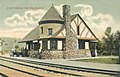
New Boston is a census-designated place (CDP) comprising the main village in the town of New Boston, Hillsborough County, New Hampshire, United States. As of the 2020 census, the population of the CDP was 326, out of 6,108 in the entire town.

<span class="mw-page-title-main">Klondike Corner, New Hampshire</span> Census-designated place in New Hampshire, United States

Klondike Corner is a census-designated place (CDP) in the town of New Boston in Hillsborough County, New Hampshire, United States. As of the 2020 census the population was 652.

References

  1. 1 2 3 "2021 U.S. Gazetteer Files – New Hampshire". United States Census Bureau. Retrieved December 9, 2021.
  2. 1 2 "New Boston town, Hillsborough County, New Hampshire: 2020 DEC Redistricting Data (PL 94-171)". U.S. Census Bureau. Retrieved December 9, 2021.
  3. United States Census Bureau, U.S. Census website, 2010 Census figures. Retrieved March 23, 2011.
  4. New Boston Historical Society "The Molly Stark Cannon"
  5. Cogswell, Elliott Colby (1864). History of New Boston, New Hampshire. Boston: Press of G. C. Rand & Avery.
  6. Coolidge, Austin J.; John B. Mansfield (1859). A History and Description of New England. Boston, Massachusetts: A.J. Coolidge. pp.  593.
  7. Cabinet.com "Town tradition comes to an end"
  8. "Census of Population and Housing". Census.gov. Retrieved June 4, 2016.
  9. "U.S. Census website". United States Census Bureau . Retrieved January 31, 2008.
  10. "New Hampshire's Representatives - Congressional District Maps (NH)". GovTrack.us. February 22, 1999. Retrieved April 16, 2011.
  11. "Hillsborough County Agricultural Fair | September 11–13, 2015". hcafair.com. Retrieved October 14, 2015.
  12. Dodge, Prentiss Cutler (1912). Encyclopedia Vermont Biography. Burlington, VT: Ullery Publishing Company. p. 157 via HathiTrust.
  13. Watson, Charles S. (2003). Horton Foote: A Literary Biography. Austin, TX: University of Texas Press. p. 155. ISBN   978-0-2927-9160-2.
  14. Reid, Nick (2015). "While others kept their feet on the ground, N.H.-born, world-class climber always pushed the envelope".
  15. About the farm: an illustrated description of the New Boston Dairy and other industries at Valley View, Muzzey, and Hutchinson farms, which are a part of the supply department of Young's Hotel, Parker House, and Hotel Touraine. Boston: Printed for J. R. Whipple Company, 1910