New Cordell, Oklahoma

Last updated
New Cordell, Oklahoma
New Cordell Courthouse Square Historic District.JPG
OKMap-doton-NewCordell.PNG
Location of New Cordell, Oklahoma
Coordinates: 35°17′48″N98°59′02″W / 35.29667°N 98.98389°W / 35.29667; -98.98389
CountryUnited States
State Oklahoma
County Washita
EstablishedApril 20, 1892
Government
   Mayor Bob Plummer [ citation needed ]
Area
[1]
  Total2.25 sq mi (5.82 km2)
  Land2.25 sq mi (5.82 km2)
  Water0.00 sq mi (0.00 km2)
Elevation
[2]
1,555 ft (474 m)
Population
 (2020)
  Total2,775
  Density1,233.88/sq mi (476.47/km2)
Time zone UTC−6 (Central (CST))
  Summer (DST) UTC−5 (CDT)
ZIP code
73632
Area code 580
FIPS code 40-51250 [3]
GNIS feature ID2411230 [2]
Website City website

New Cordell is a city in, and county seat of, Washita County, Oklahoma, United States. It lies along U.S. Route 183. The population was 2,915 at the 2010 census. The community was previously established a few miles from the current site, but was moved about 1900. It was named for a U.S. Postal Service employee in Washington D. C., Wayne W. Cordell. The official name is New Cordell, though it is now commonly called Cordell. [4]

Contents

History

Cordell began when H. D. Young opened a general store about 1.5 miles east of the present town, shortly after the Cheyenne and Arapaho lands were opened for non-Indian settlement in 1892. A post office named Cordell was established in the same year in Young's store. In 1897, A. J. Johnson and J. C. Harrell convinced Young to move his store to the present site, where water was more plentiful and of better quality than in Old Cordell. The new location became known as New Cordell. In 1900, Washita County residents voted to move the county seat from the town of Cloud Chief to New Cordell. The move was challenged in the court as illegal, because only the territorial legislature could authorize such an action. In 1904, the Oklahoma Territorial Supreme Court ruled that the county seat must return to Cloud Chief. A Cordell attorney, Sam Massengale, traveled to Washington, where he lobbied for a bill to make Cordell the official county seat. The bill passed the U. S. Congress in 1906. [4]

The county courthouse was destroyed by a fire in 1909. It was rebuilt by 1911 by the same architect who designed the Oklahoma State Capitol. Governor George Nigh called it, "...godfather of all courthouses in the state of Oklahoma." The Washita County Courthouse is listed on the National Register of Historic Places. [4] In 1911, the Carnegie Foundation approved a grant to construct what became known as the Cordell Carnegie Community Library.

Geography

According to the United States Census Bureau, the city has a total area of 2.5 square miles (6.5 km2), all land. The city is located approximately in the center of the county.

Climate

Like most of Oklahoma, New Cordell has a humid subtropical climate (Köppen Cfa), although it is nearly dry enough to qualify as a cool semi-arid climate (BSk). Summers are hot to sweltering, and typically dry, whilst winters average cool by afternoon and freezing by morning but show extreme variation from very warm due to descending chinook winds to frigid periods dominated by Arctic air masses. The heaviest precipitation occurs in the spring from thunderstorms, although occasionally remnant rain depressions in summer and fall provide very heavy rain.

Climate data for New Cordell, Oklahoma
MonthJanFebMarAprMayJunJulAugSepOctNovDecYear
Record high °F (°C)84
(29)
85
(29)
95
(35)
99
(37)
106
(41)
114
(46)
113
(45)
115
(46)
109
(43)
100
(38)
89
(32)
90
(32)
115
(46)
Average high °F (°C)51
(11)
56
(13)
64
(18)
74
(23)
82
(28)
91
(33)
96
(36)
97
(36)
89
(32)
77
(25)
63
(17)
54
(12)
75
(24)
Average low °F (°C)26
(−3)
30
(−1)
36
(2)
47
(8)
57
(14)
67
(19)
70
(21)
70
(21)
61
(16)
50
(10)
36
(2)
30
(−1)
48
(9)
Record low °F (°C)−12
(−24)
−2
(−19)
22
(−6)
32
(0)
45
(7)
55
(13)
52
(11)
36
(2)
26
(−3)
10
(−12)
−12
(−24)
Average precipitation inches (mm)1.0
(25)
1.0
(25)
1.5
(38)
2.8
(71)
4.5
(110)
3.7
(94)
2.5
(64)
1.6
(41)
2.0
(51)
2.5
(64)
0.9
(23)
1.1
(28)
25.1
(634)
Average precipitation days2.72.73.85.97.06.45.03.63.64.42.13.050.2
Source 1: weather.com
Source 2: Weatherbase.com [5]

Demographics

Historical population
CensusPop.Note
1910 1,950
1920 1,855−4.9%
1930 2,93658.3%
1940 2,776−5.4%
1950 2,9205.2%
1960 3,58922.9%
1970 3,261−9.1%
1980 3,3011.2%
1990 2,903−12.1%
2000 2,867−1.2%
2010 2,9151.7%
2020 2,775−4.8%
U.S. Decennial Census [6]

As of the census [3] of 2000, there were 2,867 people, 1,192 households, and 816 families residing in the city. The population density was 1,132.3 inhabitants per square mile (437.2/km2). There were 1,427 housing units at an average density of 563.6 per square mile (217.6/km2). The racial makeup of the city was 95.33% White, 0.21% African American, 2.09% Native American, 0.17% Asian, 0.94% from other races, and 1.26% from two or more races. Hispanic or Latino of any race were 2.62% of the population.

There were 1,192 households, out of which 32.3% had children under the age of 18 living with them, 55.2% were married couples living together, 10.1% had a female householder with no husband present, and 31.5% were non-families. 28.4% of all households were made up of individuals, and 14.6% had someone living alone who was 65 years of age or older. The average household size was 2.39 and the average family size was 2.92.

In the city, the population was spread out, with 25.9% under the age of 18, 7.5% from 18 to 24, 26.1% from 25 to 44, 22.1% from 45 to 64, and 18.4% who were 65 years of age or older. The median age was 39 years. For every 100 females, there were 90.9 males. For every 100 females age 18 and over, there were 86.4 males.

The median income for a household in the city was $28,053, and the median income for a family was $34,519. Males had a median income of $24,531 versus $18,173 for females. The per capita income for the city was $15,509. About 15.4% of families and 17.3% of the population were below the poverty line, including 25.9% of those under age 18 and 9.2% of those age 65 or over.

Education

Notable people

Related Research Articles

<span class="mw-page-title-main">Washita County, Oklahoma</span> County in Oklahoma, United States

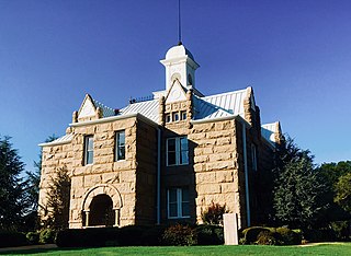
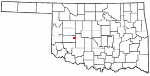
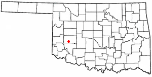
Washita County is a county located in the U.S. state of Oklahoma. As of the 2020 census, the population was 10,924. Its county seat is New Cordell. The county seat was formerly located in Cloud Chief. The county was created in 1891.

<span class="mw-page-title-main">Stephens County, Oklahoma</span> County in Oklahoma, United States

Stephens County is a county located in the U.S. state of Oklahoma. As of the 2020 census, its population was 42,848. Its county seat is Duncan. The county was created at statehood, partly from the Chickasaw Nation in Indian Territory and partly from Comanche County in Oklahoma Territory. It was named for Texas politician John Hall Stephens.

<span class="mw-page-title-main">Roger Mills County, Oklahoma</span> County in Oklahoma, United States

Roger Mills County is a county located in the western part of the U.S. state of Oklahoma. As of the 2020 census, the population was 3,442, making it the fourth-least populous county in Oklahoma. Its county seat is Cheyenne. The county was created in 1891.

<span class="mw-page-title-main">Kiowa County, Oklahoma</span> County in Oklahoma, United States

Kiowa County is a county located in the southwestern part of the U.S. state of Oklahoma. As of the 2020 census, the population was 8,509. Its county seat is Hobart. The county was created in 1901 as part of Oklahoma Territory. It was named for the Kiowa people.

<span class="mw-page-title-main">Grady County, Oklahoma</span> County in Oklahoma, United States

Grady County is a county located in the U.S. state of Oklahoma. As of the 2020 census, the population was 54,795. Its county seat is Chickasha. It was named for Henry W. Grady, an editor of the Atlanta Constitution and southern orator.

<span class="mw-page-title-main">Garvin County, Oklahoma</span> County in Oklahoma, United States

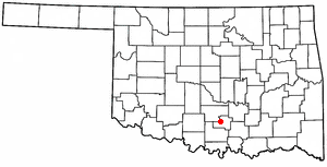
Garvin County is a county in south-central Oklahoma, United States. As of the 2020 census, the population was 25,656. Its county seat is Pauls Valley. In 1906, delegates to Constitution Convention formed Garvin County from part of the Chickasaw Nation, Indian Territory. The county was named for Samuel J. Garvin, a local Chickasaw rancher, merchant and banker. Its economy is largely based on farming, ranching and oil production.

<span class="mw-page-title-main">Caddo County, Oklahoma</span> County in Oklahoma, United States

Caddo County is a county located in the U.S. state of Oklahoma. As of the 2020 census, the population was 26,945. Its county seat is Anadarko. Created in 1901 as part of Oklahoma Territory, the county is named for the Caddo tribe who were settled here on a reservation in the 1870s. Caddo County is immediately west of the seven-county Greater Oklahoma City metro area, and although is not officially in the metro area, it has many economic ties in this region.

<span class="mw-page-title-main">Binger, Oklahoma</span> Town in Oklahoma, United States

Binger is a town in Caddo County, Oklahoma, United States. The population was 672 at the 2010 census. It is the headquarters of the Caddo Nation of Oklahoma, who were settled in the area during the 1870s.

<span class="mw-page-title-main">Maysville, Oklahoma</span> Town in Oklahoma, United States

Maysville is a town in Garvin and McClain counties, Oklahoma, United States. The population was 1,232 at the 2010 census, down from 1,313 in 2000.

<span class="mw-page-title-main">Tishomingo, Oklahoma</span> City in Oklahoma

Tishomingo is the largest city in, and the county seat of, Johnston County, Oklahoma, United States. The population was 3,034 at the 2010 census, a decline of 4.1 percent from the figure of 3,162 in 2000. It was the first capital of the Chickasaw Nation, from 1856 until Oklahoma statehood in 1907. The city is home to Murray State College, a community college with an annual enrollment of 3,015 students. Tishomingo is part of the Texoma region.

<span class="mw-page-title-main">Cheyenne, Oklahoma</span> Town in Oklahoma, United States

Cheyenne is a town in Roger Mills County, Oklahoma, United States. The population was 801 at the 2010 census. It is the county seat of Roger Mills County.

<span class="mw-page-title-main">Strong City, Oklahoma</span> Town in Oklahoma, United States

Strong City is a town in Roger Mills County, Oklahoma, United States. The population was 47 at the 2010 census.

<span class="mw-page-title-main">Bessie, Oklahoma</span> Town in Oklahoma, United States

Bessie is a town in Washita County, Oklahoma, United States. The population was 181 at the 2010 census, a 4.7 percent decline from 190 in 2000.

<span class="mw-page-title-main">Colony, Oklahoma</span> Town in Oklahoma, United States

Colony is a town in northeastern Washita County, Oklahoma, United States. The population was 136 at the 2010 U.S. census, a decrease of 7.5 percent from 147 in 2000. It was named for the Seger Colony, founded in 1886, which taught modern agricultural techniques to the Arapaho and Cheyenne tribes that would be resettled in the vicinity. Colony is 16 miles (26 km) east and 4 miles (6.4 km) north of Cordell.

<span class="mw-page-title-main">Corn, Oklahoma</span> Town in Oklahoma, United States

Corn is a town in Washita County, Oklahoma, United States. The population was 503 at the 2010 census.

<span class="mw-page-title-main">Dill City, Oklahoma</span> Town in Oklahoma, United States

Dill City is a town in Washita County, Oklahoma, United States. The population was 562 at the 2010 census.

<span class="mw-page-title-main">Rocky, Oklahoma</span> Town in Oklahoma, United States

Rocky is a town in Washita County, Oklahoma, United States. The population was 162 at the 2010 United States Census, a 6.9 percent decline from the figure of 174 in 2000. The town lies along U.S. Route 183.

<span class="mw-page-title-main">Sentinel, Oklahoma</span> Town in Oklahoma, United States

Sentinel is a town in Washita County, in the U.S. state of Oklahoma. The population was 901 in the 2010 census, an increase of 4.9 percent from the figure of 859 residents in 2000. Towns near Sentinel are Rocky, Cordell, Canute, and Burnsflat.

<span class="mw-page-title-main">Wellington, Texas</span> City in Texas, United States

Wellington is a city and county seat of Collingsworth County, Texas, United States. The population was 2,189 at the 2010 census.

<span class="mw-page-title-main">Davis, Oklahoma</span> City in Oklahoma, United States

Davis is a city in Garvin and Murray counties in the U.S. state of Oklahoma. The population is 2,823 as of the 2020 census.

References

  1. "ArcGIS REST Services Directory". United States Census Bureau. Retrieved September 20, 2022.
  2. 1 2 U.S. Geological Survey Geographic Names Information System: New Cordell, Oklahoma
  3. 1 2 "U.S. Census website". United States Census Bureau . Retrieved 2008-01-31.
  4. 1 2 3 Boothe, Wayne. Encyclopedia of Oklahoma History and Culture. "Cordell." Accessed August 29, 2012
  5. "Historical Weather for Cordell, Oklahoma, United States".
  6. "Census of Population and Housing". Census.gov. Retrieved June 4, 2015.