Arnett, Oklahoma

Last updated

Arnett, Oklahoma
Ellis County, Oklahoma courthouse from SW 1.JPG
Ellis County courthouse
OKMap-doton-Arnett.PNG
Location of Arnett within Oklahoma
Coordinates: 36°08′04″N99°46′22″W / 36.13444°N 99.77278°W / 36.13444; -99.77278
Country United States
State Oklahoma
County Ellis
Founded1900
Incorporated 1909
Area
[1]
  Total0.52 sq mi (1.34 km2)
  Land0.52 sq mi (1.34 km2)
  Water0.00 sq mi (0.00 km2)
Elevation
[2]
2,451 ft (747 m)
Population
 (2020)
  Total495
  Density959.30/sq mi (370.23/km2)
Time zone UTC-6 (Central (CST))
  Summer (DST) UTC-5 (CDT)
ZIP code
73832
Area code 580
FIPS code 40-02800 [3]
GNIS feature ID2411646 [2]

Arnett is a town in and the county seat of Ellis County, Oklahoma, United States. [4] The population was 495 at the time of the 2020 census. [5]

Contents

History

The townsite came about at the junction of local trading routes. A post office was established at the townsite in 1902, with William G. Brown as the postmaster. Brown is said to have named the post office Arnett after A. S. Arnett, Brown's minister from Fayetteville, West Virginia. [6] [7] [8]

After statehood in 1907, several county boundaries changed, and the southern part of old Day County was added to the southwestern part of Woodward County to become Ellis County. An election to locate the county seat was held in June 1908, and resulted in a runoff between Arnett and Shattuck, Oklahoma. Arnett won and remains the county seat today. [9] Shortly thereafter, development continued with the founding of two weekly newspapers the Ellis County Capital and the Arnett Leader [10] as well as lawyer offices, banks, real estate/loan shops, grocery stores, blacksmiths, and more operating there in the pre-World War I years. [11]

Geography

Arnett lies approximately 9 miles (14 km) north-northeast of the Canadian River in the rolling Red Plains region of the Great Plains. Located in northwestern Oklahoma at the junction of U.S. Route 60 and U.S. Route 283, Arnett is 131 mi (211 km) west-northwest of Oklahoma City, 135 mi (217 km) northeast of Amarillo, and 172 mi (277 km) southwest of Wichita. [12]

According to the United States Census Bureau, the town has a total area of 0.4 square miles (1.0 km2), all land.

Climate

Arnett has a humid subtropical climate (Köppen Cfa) with hot, humid summers and cold, dry winters. The average temperature in Arnett is 57 °F or 13.9 °C, [13] and the average yearly precipitation is 25.4 inches or 645.2 millimetres. On average, January is the coolest month, July is the warmest month, and May is the wettest month. The hottest temperature recorded in Arnett was 110 °F or 43.3 °C in 1951; the coldest temperature recorded was −12 °F or −24.4 °C in 1959. [14]

Climate data for Arnett, Oklahoma, United States
MonthJanFebMarAprMayJunJulAugSepOctNovDecYear
Record high °F (°C)85
(29)
88
(31)
93
(34)
98
(37)
102
(39)
110
(43)
109
(43)
110
(43)
105
(41)
99
(37)
88
(31)
87
(31)
110
(43)
Mean daily maximum °F (°C)45
(7)
51
(11)
59
(15)
69
(21)
77
(25)
86
(30)
91
(33)
90
(32)
82
(28)
71
(22)
57
(14)
47
(8)
69
(21)
Daily mean °F (°C)33
(1)
37
(3)
46
(8)
57
(14)
66
(19)
75
(24)
80
(27)
79
(26)
70
(21)
59
(15)
46
(8)
35
(2)
57
(14)
Mean daily minimum °F (°C)20
(−7)
25
(−4)
33
(1)
42
(6)
52
(11)
62
(17)
66
(19)
65
(18)
57
(14)
45
(7)
32
(0)
23
(−5)
44
(6)
Record low °F (°C)−12
(−24)
−9
(−23)
−6
(−21)
18
(−8)
28
(−2)
43
(6)
52
(11)
49
(9)
30
(−1)
14
(−10)
5
(−15)
−11
(−24)
−12
(−24)
Average precipitation inches (mm)0.63
(16)
0.95
(24)
1.95
(50)
2.23
(57)
4.54
(115)
3.50
(89)
2.08
(53)
2.41
(61)
2.47
(63)
2.15
(55)
1.44
(37)
1.01
(26)
25.36
(644)
Source: The Weather Channel; [14] Weatherbase [13]

Demographics

Historical population
CensusPop.Note
1910 511
1920 404−20.9%
1930 4265.4%
1940 52924.2%
1950 69030.4%
1960 547−20.7%
1970 71130.0%
1980 7140.4%
1990 547−23.4%
2000 520−4.9%
2010 5240.8%
2020 495−5.5%
U.S. Decennial Census [15]

As of the census of 2010, there were 524 people living in the town. [16] The population density was 1,300 inhabitants per square mile (500/km2). There were 281 housing units at an average density of 666.4 units per square mile (257.3 units/km2). The racial makeup of the town was 96.35% White, 0.38% African American, 0.96% Native American, 1.15% from other races, and 1.15% from two or more races. Hispanic or Latino of any race were 1.35% of the population.

There were 238 households, out of which 23.1% had children under the age of 18 living with them, 51.3% were married couples living together, 5.9% had a female householder with no husband present, and 40.8% were non-families. 39.1% of all households were made up of individuals, and 19.3% had someone living alone who was 65 years of age or older. The average household size was 2.13 and the average family size was 2.81.

In the town, the population was spread out, with 21.3% under the age of 18, 6.3% from 18 to 24, 23.3% from 25 to 44, 25.8% from 45 to 64, and 23.3% who were 65 years of age or older. The median age was 44 years. For every 100 females, there were 97.0 males. For every 100 females age 18 and over, there were 94.8 males.

The median income for a household in the town was $26,618, and the median income for a family was $29,861. Males had a median income of $24,250 versus $13,438 for females. The per capita income for the town was $14,512. About 12.8% of families and 18.9% of the population were below the poverty line, including 27.4% of those under age 18 and 20.0% of those age 65 or over.

Education

Arnett Public Schools operates one school in the town, Arnett School (Grades Pre-K-12). [17]

Transportation

U.S. Route 60 and SH-51 run concurrently east–west through Arnett. U.S. Route 283, a north–south highway which meets U.S. 60 and SH-51 roughly one-half mile east of town, runs concurrently east–west with U.S. 60 and SH-51 through town. Arnett is also the southern terminus of SH-46 which runs north–south.

Media

Arnett has a weekly newspaper, The Ellis County Capital. [18]

Historical Sites

The Ellis County Courthouse, built in 1912, is in the center of the Courthouse Square in Arnett. [19] The Courthouse is on the National Register of Historic Places listings in Ellis County, Oklahoma. [9]

A log cabin sits just south of the Ellis County Courthouse on the Courthouse lawn, [20] variously known as the Historic Log Cabin of Arnett [21] or the Ellis County Log Cabin. [22] It was built in 1893 of huge cedar logs, some as much as 2-1/2 feet across. [20] It was used as a residence until 1939, and soon thereafter disassembled and put back together in Arnett for preservation. [20]

The remains of Grand, Oklahoma, included on the National Register of Historic Places listings in Ellis County, Oklahoma as Grand Town Site, is 14 miles south of Arnett. This town was voted the seat of old Day County in 1893; however, Day County was eliminated at Oklahoma statehood. [23] The post office closed September 30, 1943, and only building footings remain today. [24]

Recreation

Fort Supply Reservoir and Cooper Wildlife Management Area are to the northwest. [25]

Lake Lloyd Vincent and the Ellis County Wildlife Management Area are to the southwest. [26]

Paddlesack Wildlife Management Area is to the south, [27] while the Black Kettle National Grassland is further south. [28]

Notable people

Notable individuals who were born in and/or have lived in Arnett include:

Related Research Articles

<span class="mw-page-title-main">Marion County, Texas</span> County in Texas, United States

Marion County is a county located in the U.S. state of Texas. As of the 2020 census, its population was 9,725. Its county seat is Jefferson. Marion County is in East Texas and is named for Francis Marion, the Revolutionary War general from South Carolina who was nicknamed the "Swamp Fox".

<span class="mw-page-title-main">Woodward County, Oklahoma</span> County in Oklahoma, United States

Woodward County is a county located in the U.S. state of Oklahoma. As of the 2020 census, the population was 20,470. Its county seat is Woodward.

<span class="mw-page-title-main">Sequoyah County, Oklahoma</span> County in Oklahoma, United States

Sequoyah County is a county located in the U.S. state of Oklahoma. As of the 2020 census, the population was 39,281. The county seat is Sallisaw. Sequoyah County was created in 1907 when Oklahoma became a state. It was named after Sequoyah, who created the Cherokee syllabary and its written language.

<span class="mw-page-title-main">Okmulgee County, Oklahoma</span> County in Oklahoma, United States

Okmulgee County is a county in the U.S. state of Oklahoma. As of the 2020 census, the population was 36,706. The county seat is Okmulgee. Located within the Muscogee Nation Reservation, the county was created at statehood in 1907. The name Okmulgee is derived from the Hitchita word okimulgi, meaning "boiling waters".

<span class="mw-page-title-main">Oklahoma County, Oklahoma</span> County in Oklahoma, United States

Oklahoma County is located in the central part of the U.S. state of Oklahoma. As of the 2020 census, the population was 796,292, making it the most populous county in Oklahoma. The county seat is Oklahoma City, the state capital and largest city. Oklahoma County is at the heart of the Oklahoma City metropolitan statistical area.

<span class="mw-page-title-main">Ellis County, Oklahoma</span> County in Oklahoma, United States

Ellis County is a county located on the western border of the U.S. state of Oklahoma. As of the 2020 census, the population was 3,749, making it the fifth-least populous county in Oklahoma. Its county seat is Arnett.

<span class="mw-page-title-main">Rooks County, Kansas</span> County in Kansas, United States

Rooks County is a county located in the U.S. state of Kansas. Its county seat is Stockton, and its largest city is Plainville. As of the 2020 census, the county population was 4,919. The county was named for John Rooks, a private in Company I of the 11th Kansas Cavalry Regiment, who died at the Battle of Prairie Grove during the American Civil War.

<span class="mw-page-title-main">Iowa County, Iowa</span> County in Iowa, United States

Iowa County is a county located in the U.S. state of Iowa. As of the 2020 census, the population was 16,662. The county seat is Marengo.

<span class="mw-page-title-main">Hancock County, Illinois</span> County in Illinois, United States

Hancock County is a county in the U.S. state of Illinois. According to the 2020 census, it has a population of 17,620. Its county seat is Carthage, and its largest city is Hamilton. The county is composed of rural towns with many farmers.

<span class="mw-page-title-main">Benton County, Arkansas</span> County in Arkansas, United States

Benton County is a county within the Northwest Arkansas region with a culture, economy, and history that have transitioned from rural and agricultural to suburban and white collar since the growth of Walmart, which is headquartered in Benton County. Created as Arkansas's 35th county on September 30, 1836, Benton County contains thirteen incorporated municipalities, including Bentonville, the county seat, and Rogers, the most populous city. The county was named after Thomas Hart Benton, a U.S. Senator from Missouri influential in Arkansas statehood.

<span class="mw-page-title-main">Knoxville, Illinois</span> City in Illinois, United States

Knoxville is a city in Knox County, Illinois, United States. The population was 2,911 at the 2010 census. It is part of the Galesburg Micropolitan Statistical Area.

<span class="mw-page-title-main">Gage, Oklahoma</span> Town in Oklahoma, United States

Gage is a town in Ellis County, Oklahoma, United States. The population was 433 at the time of the 2020 census.

<span class="mw-page-title-main">Shattuck, Oklahoma</span> Town in Oklahoma, United States

Shattuck is a town in Ellis County, Oklahoma, United States. The population was 1,249 at the time of the 2020 census, a change from the 1,356 reported in the 2010 census.

<span class="mw-page-title-main">Newkirk, Oklahoma</span> City in Oklahoma, United States

Newkirk is a city and county seat of Kay County, Oklahoma, United States. The population was 2,172 at the 2020 census.

<span class="mw-page-title-main">Hobart, Oklahoma</span> City in Oklahoma, United States

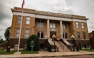
Hobart is a city in, and the county seat of, Kiowa County, Oklahoma, United States. It is west-southwest of Oklahoma City, and northwest of Lawton. It was named for Garret Hobart, the 24th Vice President of the United States. The population was 3,413 at the 2020 Census. It is served by Hobart Regional Airport. It also has two museums: the General Tommy Franks Museum and the Kiowa County Museum.

<span class="mw-page-title-main">Chandler, Oklahoma</span> City in Oklahoma, United States

Chandler is a city in, and the county seat of, Lincoln County, Oklahoma, United States. and is part of the Oklahoma City Metropolitan Area. The population was 2,858 at the time of the 2020 census. Chandler is located northeast of Oklahoma City on SH-66 and I-44, and north of Shawnee on SH-18.

<span class="mw-page-title-main">Muldrow, Oklahoma</span> Town in Oklahoma, United States

Muldrow, officially the Town of Muldrow, is a town in Sequoyah County, Oklahoma, United States. It is part of the Fort Smith, Arkansas–Oklahoma Metropolitan Statistical Area. The population was 3,466 at the 2010 census, an increase of 11.7 percent over the figure of 3,104 recorded in 2000.

<span class="mw-page-title-main">Wagoner, Oklahoma</span> City in Oklahoma, United States

Wagoner is a city in Wagoner County, Oklahoma, United States. The population was 8,323 at the 2010 census, compared to the figure of 7,669 recorded in 2000. It is the county seat of Wagoner County. Wagoner became the first city incorporated in Indian Territory on January 4, 1896.

<span class="mw-page-title-main">Columbus, Texas</span> City in Texas, United States

Columbus is a city in and the county seat of Colorado County in southeastern Texas, United States. The population was 3,699 as of the 2020 census. It is located on the Colorado River. The Colorado County Courthouse is listed on the National Register of Historic Places.

<span class="mw-page-title-main">Anderson, Texas</span> City in Texas, United States

Anderson is a city and county seat of Grimes County, Texas, United States. The population was 193 as of the 2020 census. The town and its surroundings are listed on the National Register of Historic Places as the Anderson Historic District.

References

  1. "ArcGIS REST Services Directory". United States Census Bureau. Retrieved September 20, 2022.
  2. 1 2 U.S. Geological Survey Geographic Names Information System: Arnett, Oklahoma
  3. "U.S. Census website". United States Census Bureau . Retrieved January 31, 2008.
  4. "Find a County". National Association of Counties. Archived from the original on May 31, 2011. Retrieved June 7, 2011.
  5. "Arnett (town), Oklahoma". United States Census Bureau. Retrieved August 29, 2023.
  6. "Ellis County" Towns. - USGenNet
  7. Arnett Archived October 15, 2008, at the Wayback Machine . - Encyclopedia of Oklahoma History and Culture. - Oklahoma Historical Society
  8. Shirk, George H., (1987). - Oklahoma Place Names. - Norman: University of Oklahoma Press. - p.12. - ISBN   978-0-8061-2028-7
  9. 1 2 "Ellis County". Dianna Everett, Oklahoma Historical Society. Retrieved July 16, 2020.
  10. "Arnett | The Encyclopedia of Oklahoma History and Culture". Oklahoma Historical Society | OHS. Retrieved November 14, 2023.
  11. "Arnett | The Encyclopedia of Oklahoma History and Culture". Oklahoma Historical Society | OHS. Retrieved November 14, 2023.
  12. "City Distance Tool". Geobytes. Archived from the original on October 5, 2010. Retrieved August 29, 2010.
  13. 1 2 "Historical Weather for Arnett, Oklahoma, United States of America". Weatherbase. Retrieved August 29, 2010.
  14. 1 2 "Average weather for Arnett, OK". The Weather Channel . Retrieved August 29, 2010.
  15. "Census of Population and Housing". Census.gov. Retrieved June 4, 2015.
  16. "2010 City Population and Housing Occupancy Status". U.S. Census Bureau. Retrieved October 18, 2013.[ dead link ]
  17. "Arnett Wildcats". Arnett Public Schools. Archived from the original on August 24, 2010. Retrieved September 7, 2010.
  18. "About this Newspaper: Ellis County capital". Chronicling America. Library of Congress . Retrieved August 29, 2010.
  19. "Ellis County Courthouse". OklahomaTravel.net. Retrieved July 16, 2020.
  20. 1 2 3 "Log Cabin". OklahomaTravel.net. Retrieved July 16, 2020.
  21. "About Us". Town of Arnett. Retrieved July 16, 2020.
  22. "History of Ellis County Log Cabin" (PDF). Town of Arnett. Retrieved July 16, 2020.
  23. "Day County". Dianna Everett, Oklahoma Historical Society. Retrieved July 16, 2020.
  24. Shirk, George H. Oklahoma Place Names. Norman: University of Oklahoma Press, 1987. ISBN   0-8061-2028-2 Accessed March 1, 2020.
  25. "Arnett, Oklahoma". Google Maps. Retrieved July 16, 2020.
  26. "Ellis County Wildlife Management Area". Google Maps. Retrieved July 16, 2020.
  27. "Packsaddle Wildlife Management Area". Google Maps. Retrieved July 16, 2020.
  28. "Black Kettle National Grasslands". Google Maps. Retrieved July 16, 2020.
  29. "Donald Joseph Gott". Hall of Valor. Military Times. Retrieved June 16, 2016.