Gage, Oklahoma

Last updated

Gage, Oklahoma
Gage, Oklahoma, Artesian Beach Park.jpg
Artesian Beach Park in Gage
OKMap-doton-Gage.PNG
Location of Gage, Oklahoma
Coordinates: 36°19′05″N99°45′27″W / 36.31806°N 99.75750°W / 36.31806; -99.75750
Country United States
State Oklahoma
County Ellis
Area
[1]
  Total0.43 sq mi (1.11 km2)
  Land0.43 sq mi (1.11 km2)
  Water0.00 sq mi (0.00 km2)
Elevation
[2]
2,142 ft (653 m)
Population
 (2020)
  Total433
  Density1,014.05/sq mi (391.56/km2)
Time zone UTC-6 (Central (CST))
  Summer (DST) UTC-5 (CDT)
ZIP code
73843
Area code 580
FIPS code 40-28250 [3]
GNIS feature ID2412665 [2]

Gage is a town in Ellis County, Oklahoma, United States. The population was 433 at the time of the 2020 census. [4]

Contents

History

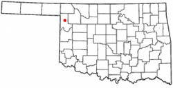
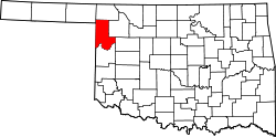
Located in the central part of Ellis County on SH-46, thirteen miles north of the county seat, Arnett, and on SH-15, twenty-one miles southwest of Woodward, Gage developed primarily because of transportation access. The military road from Fort Supply to Fort Elliott/Mobeetie, Texas, passed near the future town, and two miles to the northwest a stage stop existed at the confluence of Little Wolf Creek and Wolf Creek. In 1887 the Southern Kansas Railway (later part of the Atchison, Topeka and Santa Fe Railway) had constructed a line across northwestern Oklahoma from Kansas to the Texas Panhandle. A station called Gage, named for Chicago railroad financier Lyman J. Gage, was established in July near Wolf Creek. Once the domain of various Plains Indian groups, by that time this region had become part of the Cherokee Outlet, opened to settlement by a land run in September 1893.

After that, Woodward County included the site of future Gage. A year after the run several settlers, including John Barr and Frederick D. Webster, took up land near the railroad stop. A post office was designated in February 1895, with Webster as postmaster. By 1898 the community was big enough to support a half dozen stores, a hotel, and a sawmill. In 1901 activity surrounding the opening of the Kiowa-Comanche-Apache lands, to the south, attracted new people to the town and farmers to purchase land nearby. The town's residents voted to incorporate a six-block area in May 1904. Eighteen months later, anti-liquor campaigner and Guthrie resident Carrie Nation, on one of her lecture tours through Oklahoma Territory, made a brief visit to Gage's saloons and met a cold reception. In 1907, when Ellis County was created, taking in this part of Woodward County, Gage's 1907 population stood at 755 and in 1910 at 924, the all-time peak.

The growing community served as a cattle and grain shipping point for the surrounding area. Prosperity in the first decade after incorporation attracted two banks, five lumberyards, and more than two dozen retail establishments. Two cotton gins, a roller mill, and three elevators served farmers. The Brennecke Metal Manufacturing Company made water and stock tanks. A theater and the Wolf Valley Cornet Band provided entertainment. Travelers patronized three hotels and five restaurants. Residents could attend any one of three churches, and children attended a large school building.

Like most rural centers, Gage suffered a decline in the World War I years, but the ideally located railroad town remained viable, as it was some distance from towns of any size. Newspapers serving the residents have included the Ellis County Advocate, the Ellis County Republican, the Gage Banner, and the Gage Record, with the latter continuing in existence at the end of the twentieth century. In 1920 the town had 804 inhabitants

Because of the flat terrain and good weather, the U.S. Army maintained a 720-acre bomber-pilot training field outside Gage during World War II. In the 1940s and 1950s Gage supported two dozen retail stores, gasoline stations, and other commercial establishments. The 1940 census recorded 684 inhabitants, and the 1960 census, 482.

After paved highways allowed commuting to jobs in Woodward and Shattuck, Gage's population rose to 536 and 667 in 1970 and 1980, respectively. Folk artist Jim Powers, whose "junk yard art" was created in welded metal, made Gage his base of operations. Powers' created several "Jimmy Bird" statues, which are still in high demand today. Charlie's Bar and Grill, ( 36°19′14″N99°45′25″W / 36.32044°N 99.75704°W / 36.32044; -99.75704 ) located downtown Main Street, has the distinction of having the longest continuous operating bar and grill in Ellis County, as well as throughout much of the western strip of Oklahoma. The Bank of Gage, a turn-of-the-century two-story brick building on Main Street, is on the National Register of Historic Places in Ellis County, Oklahoma. [5] Ranching and farming are still the community's economic mainstay. Gage Airport is still operating, based around the former military runways. In 1904 the National Weather Service established a regional climate station at Gage, and the station served the Civil Aviation Authority/FAA at Gage Airport from 1939. The FAA portion of the facility moved to McAlester in the 1990s, but the weather service maintained an unmanned station at the Gage location, which by 2004 had been gathering weather data for a century. After declining to 473 in 1990, Gage finished the twentieth century with a population of 429. Gage Public Schools consolidated with Fargo Public Schools in the summer of 2016. [6] The issue was hotly debated, with many parents still opting to take their children to the town of Shattuck due to the closer distance and more educational offerings. The local rivalry between "Tiger" and "Bearcat" residents still exists today.

Geography

Gage is located on the southern bank of Wolf Creek, an intermittent spring-fed tributary of the Beaver River (also known as the North Canadian River). Wolf Creek extends 40 miles (64 km) through Ochiltree and Lipscomb counties of the Texas Panhandle and 52 miles (84 km) through Ellis and Woodward counties in Oklahoma. The stream generally runs from the southwest to the northeast and thereby defines the primary orientation of the BNSF Railway and Oklahoma State Highway 15, both of which run through Gage and stretch from Shattuck to Woodward.

Artesian Beach Park

Gage is home to Artesian Beach Park (locally known as Gage Beach) ( 36°19′17″N99°44′31″W / 36.32139°N 99.74194°W / 36.32139; -99.74194 ). This park contains a clear, spring-fed or artesian lake approximately the size of five football fields and it hosts what is claimed to be Oklahoma's largest outdoor swimming pool. The natural swimming area has cement sides like a pool and a sandy, lake-like bottom. [7] The water depth ranges from 3 to 14 feet (0.91 to 4.27 m) and the natural pool is home to a few fish. [7] The artesian lake is said to have formed in 1917 when petroleum exploration first came to the area. [8] When an oil well drilled on the C. J. Minton farm produced only artesian water, the landowner created a swimming and boating area for the public. [9] The city acquired Gage Beach in 1939 and constructed a bathhouse and boat dock and considerable work was done in 2012 to rebuild the banks of Gage Beach. There was once a motel on the springs and travelers came from afar to relax and swim in the spring waters. The water is not drinkable nor is it suitable for irrigation due to high mineral content. [8] Early advertisements touted the water as good for kidney ailments, rheumatism, eczema, and stomach problems and people traveled from Kansas, Texas, and from various parts of Oklahoma to try the pool so full of minerals one can easily float. [8] Originally the artesian spring discharged 1,700 US gallons per minute (110 L/s). Measurements in 2009 suggest that the spring discharge had reduced to only 400 US gallons per minute (25 L/s). [10] More recently, the output of the spring has possibly increased and currently the spring-fed lake is fuller than it has been in recent years.

Climate

According to the Köppen Climate Classification system, has a humid subtropical climate, abbreviated "Cfa" on climate maps. The hottest temperature recorded in Gage was 114 °F (45.6 °C) on July 19, 2022, while the coldest temperature recorded was −20 °F (−28.9 °C) on January 15, 1905. [11]

Climate data for Gage, Oklahoma (Gage Airport), 1991–2020 normals, extremes 1904–present
MonthJanFebMarAprMayJunJulAugSepOctNovDecYear
Record high °F (°C)86
(30)
94
(34)
102
(39)
101
(38)
105
(41)
113
(45)
114
(46)
113
(45)
108
(42)
102
(39)
93
(34)
91
(33)
114
(46)
Mean maximum °F (°C)74.4
(23.6)
79.2
(26.2)
87.3
(30.7)
92.5
(33.6)
95.8
(35.4)
100.2
(37.9)
104.4
(40.2)
103.4
(39.7)
98.6
(37.0)
92.3
(33.5)
81.3
(27.4)
73.2
(22.9)
106.0
(41.1)
Mean daily maximum °F (°C)50.7
(10.4)
54.5
(12.5)
64.5
(18.1)
72.9
(22.7)
81.6
(27.6)
90.1
(32.3)
95.1
(35.1)
93.9
(34.4)
86.1
(30.1)
74.3
(23.5)
61.7
(16.5)
51.0
(10.6)
73.0
(22.8)
Daily mean °F (°C)36.6
(2.6)
40.0
(4.4)
49.7
(9.8)
58.3
(14.6)
68.0
(20.0)
77.5
(25.3)
82.0
(27.8)
80.6
(27.0)
72.4
(22.4)
59.8
(15.4)
47.2
(8.4)
37.4
(3.0)
59.1
(15.1)
Mean daily minimum °F (°C)22.4
(−5.3)
25.5
(−3.6)
34.8
(1.6)
43.7
(6.5)
54.5
(12.5)
64.8
(18.2)
68.9
(20.5)
67.2
(19.6)
58.8
(14.9)
45.3
(7.4)
32.7
(0.4)
23.8
(−4.6)
45.2
(7.3)
Mean minimum °F (°C)4.2
(−15.4)
7.1
(−13.8)
14.2
(−9.9)
24.9
(−3.9)
35.5
(1.9)
50.1
(10.1)
56.7
(13.7)
55.0
(12.8)
40.5
(4.7)
24.7
(−4.1)
12.6
(−10.8)
5.9
(−14.5)
−0.8
(−18.2)
Record low °F (°C)−20
(−29)
−19
(−28)
−7
(−22)
14
(−10)
25
(−4)
40
(4)
47
(8)
43
(6)
29
(−2)
10
(−12)
−5
(−21)
−13
(−25)
−20
(−29)
Average precipitation inches (mm)0.56
(14)
0.68
(17)
1.52
(39)
2.02
(51)
3.05
(77)
3.48
(88)
2.05
(52)
2.50
(64)
1.52
(39)
2.34
(59)
0.78
(20)
0.91
(23)
21.41
(543)
Average snowfall inches (cm)3.2
(8.1)
3.0
(7.6)
2.7
(6.9)
0.3
(0.76)
0.0
(0.0)
0.0
(0.0)
0.0
(0.0)
0.0
(0.0)
0.0
(0.0)
0.3
(0.76)
1.5
(3.8)
3.6
(9.1)
14.6
(37.02)
Average extreme snow depth inches (cm)0.6
(1.5)
0.5
(1.3)
0.8
(2.0)
0.0
(0.0)
0.0
(0.0)
0.0
(0.0)
0.0
(0.0)
0.0
(0.0)
0.0
(0.0)
0.1
(0.25)
0.7
(1.8)
1.1
(2.8)
1.9
(4.8)
Average precipitation days (≥ 0.01 in)3.13.45.56.17.77.76.47.55.25.04.03.364.9
Average snowy days (≥ 0.1 in)2.11.51.20.40.00.00.00.00.00.30.81.78.0
Source 1: NOAA (average snow/snow days 1981–2010) [12] [13]
Source 2: National Weather Service [11]

Demographics

Historical population
CensusPop.Note
1910 924
1920 804−13.0%
1930 8566.5%
1940 684−20.1%
1950 648−5.3%
1960 482−25.6%
1970 53611.2%
1980 66724.4%
1990 473−29.1%
2000 429−9.3%
2010 4423.0%
2020 433−2.0%
U.S. Decennial Census [14]

As of the census [3] of 2000, there were 429 people, 197 households, and 121 families residing in the town. The population density was 1,032.8 inhabitants per square mile (398.8/km2). There were 223 housing units at an average density of 536.9 per square mile (207.3/km2). The racial makeup of the town was 96.97% White, 1.40% Native American, 0.93% Asian, and 0.70% from two or more races. Hispanic or Latino of any race were 2.56% of the population.

There were 197 households, out of which 24.4% had children under the age of 18 living with them, 47.7% were married couples living together, 11.7% had a female householder with no husband present, and 38.1% were non-families. 36.5% of all households were made up of individuals, and 19.3% had someone living alone who was 65 years of age or older. The average household size was 2.18 and the average family size was 2.86.

In the town, the population was spread out, with 23.3% under the age of 18, 7.0% from 18 to 24, 22.6% from 25 to 44, 28.0% from 45 to 64, and 19.1% who were 65 years of age or older. The median age was 43 years. For every 100 females, there were 95.9 males. For every 100 females age 18 and over, there were 91.3 males.

The median income for a household in the town was $25,795, and the median income for a family was $32,750. Males had a median income of $22,788 versus $13,929 for females. The per capita income for the town was $15,706. About 15.4% of families and 20.6% of the population were below the poverty line, including 37.8% of those under age 18 and 8.0% of those age 65 or over.

See also

Notable people

Related Research Articles

<span class="mw-page-title-main">Woodward County, Oklahoma</span> County in Oklahoma, United States

Woodward County is a county located in the U.S. state of Oklahoma. As of the 2020 census, the population was 20,470. Its county seat is Woodward.

<span class="mw-page-title-main">Woods County, Oklahoma</span> County in Oklahoma, United States

Woods County is a county located in the northwestern part of the U.S. state of Oklahoma. As of the 2020 census, the population was 8,624. Its county seat is Alva. The county is named after Samuel Newitt Wood, a renowned Kansas populist.

<span class="mw-page-title-main">Harper County, Oklahoma</span> County in Oklahoma, United States

Harper County is a county located in the U.S. state of Oklahoma. As of the 2020 census, the population was 3,272, making it the third-least populous county in Oklahoma. The county seat is Buffalo. It was created in 1907 from the northwestern part of Woodward County, and named for Oscar Green Harper, who was clerk of the Oklahoma Constitutional Convention.

<span class="mw-page-title-main">Ellis County, Oklahoma</span> County in Oklahoma, United States

Ellis County is a county located on the western border of the U.S. state of Oklahoma. As of the 2020 census, the population was 3,749, making it the fifth-least populous county in Oklahoma. Its county seat is Arnett.

<span class="mw-page-title-main">Beaver County, Oklahoma</span> County in Oklahoma, United States

Beaver County is a county located in the U.S. state of Oklahoma. As of the 2020 census, the population was 5,049. The county seat is Beaver. The name was given because of the presence of many beaver dams on the Beaver River, which runs through the area. It is located in the Oklahoma Panhandle.

<span class="mw-page-title-main">Melbourne Beach, Florida</span> Town in the state of Florida, United States

Melbourne Beach is a town in Brevard County, Florida, United States. It is part of the Palm Bay–Melbourne–Titusville Metropolitan Statistical Area. The population had 3,231 residents at the 2020 United States Census.

<span class="mw-page-title-main">Jackson, Missouri</span> City in Missouri, United States

Jackson is a city in and the county seat of Cape Girardeau County, Missouri, United States. It is a principal city of the Cape Girardeau–Jackson, MO-IL Metropolitan Statistical Area. The population of Jackson was 15,481 at the 2020 census.

<span class="mw-page-title-main">Soper, Oklahoma</span> Town in Oklahoma, United States

Soper is a town in Choctaw County, Oklahoma, United States. The population was 261 at the 2010 census. The town was named for Pliny L. Soper, who was an attorney for the Arkansas and Choctaw Railway.

<span class="mw-page-title-main">Boise City, Oklahoma</span> City in Oklahoma, United States

Boise City is a city in and the county seat of Cimarron County, in the Panhandle of Oklahoma, United States. The population was 1,166 at the 2020 census, a decline of 7.9 percent from 1,266 in 2010.

<span class="mw-page-title-main">Arnett, Oklahoma</span> Town in Oklahoma, United States

Arnett is a town in and the county seat of Ellis County, Oklahoma, United States. The population was 495 at the time of the 2020 census.

<span class="mw-page-title-main">Fargo, Oklahoma</span> Town in Oklahoma, United States

Fargo is a town in Ellis County, Oklahoma, United States. The population was 312 at the time of the 2020 census. Fargo, like many towns in the region, has never fully recovered from the Dust Bowl years.

<span class="mw-page-title-main">Shattuck, Oklahoma</span> Town in Oklahoma, United States

Shattuck is a town in Ellis County, Oklahoma, United States. The population was 1,249 at the time of the 2020 census, a change from the 1,356 reported in the 2010 census.

<span class="mw-page-title-main">Tishomingo, Oklahoma</span> City in Oklahoma

Tishomingo is the largest city in, and the county seat of, Johnston County, Oklahoma, United States. The population was 3,034 at the 2010 census, a decline of 4.1 percent from the figure of 3,162 in 2000. It was the first capital of the Chickasaw Nation, from 1856 until Oklahoma statehood in 1907. The city is home to Murray State College, a community college with an annual enrollment of 3,015 students. Tishomingo is part of the Texoma region.

<span class="mw-page-title-main">Goodwell, Oklahoma</span> Town in Oklahoma, United States

Goodwell is a town in Texas County, Oklahoma, United States. As of the 2020 census, the town's population was 951. Goodwell is home to Oklahoma Panhandle State University.

<span class="mw-page-title-main">Woodward, Oklahoma</span> City in Oklahoma, United States

Woodward is a city in and the county seat of Woodward County, Oklahoma, United States. It is the largest city in a nine-county area. The population was 12,133 at the time of the 2020 census.

<span class="mw-page-title-main">Carrizo Springs, Texas</span> City in Texas, United States

Carrizo Springs is the largest city in and the county seat of Dimmit County, Texas, United States. The population was 5,368 at the 2010 census..

<span class="mw-page-title-main">Anson, Texas</span> City in Texas, United States

Anson is a city in and the county seat of Jones County, Texas, United States. The population was 2,294 at the 2020 census. It is part of the Abilene, Texas metropolitan area. Originally named "Jones City", the town was renamed "Anson" in 1882 in honor of Anson Jones, the last president of the Republic of Texas.

<span class="mw-page-title-main">Lipscomb, Texas</span> Census-designated place in Texas, United States

Lipscomb is an unincorporated community and census-designated place (CDP) in Lipscomb County, Texas, United States. It is the Lipscomb county seat. The population was 37 at the 2010 census.

<span class="mw-page-title-main">South Boston, Virginia</span> Town in Virginia, United States

South Boston, formerly Boyd's Ferry, is a town in Halifax County, Virginia, United States. The population was 8,142 at the 2010 census, down from 8,491 at the 2000 census. It is the most populous town in Halifax County.

<span class="mw-page-title-main">Stony Creek, Virginia</span> Town in Virginia, United States

Stony Creek is a town in Sussex County, Virginia, United States. The population was 198 at the 2010 census.

References

  1. "ArcGIS REST Services Directory". United States Census Bureau. Retrieved September 20, 2022.
  2. 1 2 U.S. Geological Survey Geographic Names Information System: Gage, Oklahoma
  3. 1 2 "U.S. Census website". United States Census Bureau . Retrieved January 31, 2008.
  4. "Gage (town), Oklahoma". United States Census Bureau. Retrieved August 29, 2023.
  5. "National Register of Historic Places Inventory—Nomination Form". National Park Service. Retrieved October 22, 2021.
  6. Board of Education. "Gage Patrons" (PDF). Gage Public Schools. Gage Public Schools. Retrieved April 29, 2016.
  7. 1 2 Oklahoma Tourism & Recreation Department. "Gage Artesian Beach". Explore Oklahoma. Retrieved May 5, 2013.
  8. 1 2 3 Jolie Lipson. "Gage's Artesian Beach Haven for Mineral Bathers". The Oklahoman. Retrieved October 30, 2016.
  9. Journal of the Washington Academy of Sciences By Washington Academy of Sciences (Washington, D.C.), Washington Academy of Sciences, Washington Academy of Sciences Published by Washington Academy of Sciences, 1922 Item notes: v.12 (1922) Original from Harvard University
  10. City of Gage employee
  11. 1 2 "NOAA Online Weather Data – NWS Norman". National Weather Service. Retrieved November 1, 2022.
  12. "U.S. Climate Normals Quick Access – Station: Gage Airport, OK (1991–2020)". National Oceanic and Atmospheric Administration. Retrieved on November 1, 2022.
  13. "U.S. Climate Normals Quick Access – Station: Gage Airport, OK (1981–2010)". National Oceanic and Atmospheric Administration. Retrieved November 1, 2022.
  14. "Census of Population and Housing". Census.gov. Retrieved June 4, 2015.