Arapaho, Oklahoma

Last updated

Arapaho, Oklahoma
OKMap-doton-Arapaho.PNG
Location of Arapaho, Oklahoma
Coordinates: 35°34′40″N98°57′34″W / 35.57778°N 98.95944°W / 35.57778; -98.95944
Country United States
State Oklahoma
County Custer
Area
[1]
  Total0.70 sq mi (1.81 km2)
  Land0.70 sq mi (1.81 km2)
  Water0.00 sq mi (0.00 km2)
Elevation
[2]
1,660 ft (510 m)
Population
 (2020)
  Total668
  Density955.65/sq mi (369.03/km2)
Time zone UTC-6 (Central (CST))
  Summer (DST) UTC-5 (CDT)
ZIP code
73620
Area code 580
FIPS code 40-02500 [3]
GNIS feature ID2412374 [2]

Arapaho is a town in, and the county seat of, Custer County, Oklahoma, United States. [4] The population was 796 at the 2010 census, a 6.4 percent increase from the figure of 748 in 2000. [5] The town lies long U.S. Route 183 and is named for the Arapaho Native American tribe.

Contents

History

The area containing present Arapaho was surveyed by federally-contracted surveyors in 1891, prior to the Cheyenne-Arapaho land opening on April 19, 1892. A US post office was set up for the proposed community on March 23, 1892.

On April 19, 1892, the expected inrush of settlers did materialize; by sundown some 400 claims had been posted. The first town newspaper was issued 10 days later, titled The Arapahoe Arrow (by the end of the year its name had changed to The Arapahoe Bee).

Several Protestant church groups had been organized during the first few years. By 1894 the county courthouse and a school had been built. A lending library was in operation by May 1904.

The Oklahoma Territorial Legislature approved the incorporation on March 2, 1905 (Council Bill #80). The county courthouse had been lost in an 1896 fire, and was not replaced until 1935, built with Public Works Administration funds. It was enlarged in 1985. [6]

Geography

Arapaho is located along U.S. Route 183, north of Clinton. [7]

According to the United States Census Bureau, the town has a total area of 0.7 square miles (1.8 km2), all land.

Climate

Climate data for Arapaho, Oklahoma
MonthJanFebMarAprMayJunJulAugSepOctNovDecYear
Average high °F (°C)49.1
(9.5)
54.4
(12.4)
64.5
(18.1)
74.6
(23.7)
82.4
(28.0)
91
(33)
97.1
(36.2)
95.7
(35.4)
86.5
(30.3)
75.7
(24.3)
61.7
(16.5)
51.2
(10.7)
73.7
(23.2)
Average low °F (°C)24.0
(−4.4)
28.5
(−1.9)
37.0
(2.8)
47.3
(8.5)
56.6
(13.7)
65.7
(18.7)
70.4
(21.3)
69.0
(20.6)
61.2
(16.2)
49.2
(9.6)
37.3
(2.9)
27.4
(−2.6)
47.8
(8.8)
Average precipitation inches (mm)0.9
(23)
1.2
(30)
2.0
(51)
2.3
(58)
4.9
(120)
4.2
(110)
2.1
(53)
3.2
(81)
3.7
(94)
2.8
(71)
1.8
(46)
1.0
(25)
30.2
(770)
Source: Weatherbase.com [8]

Public education

The public education system of the town is combined with that of nearby Butler. The Arapaho-Butler Public School System operates an elementary school (pre K-6th grade) and a high school (7th-12th grade). Both schools are located in Arapaho, adjacent to each other on north 12th Avenue. [9] The two schools had a combined enrollment of 280 in 2000. [6]

Demographics

Historical population
CensusPop.Note
1900 253
1910 713181.8%
1920 326−54.3%
1930 41427.0%
1940 401−3.1%
1950 311−22.4%
1960 35112.9%
1970 53151.3%
1980 85160.3%
1990 802−5.8%
2000 748−6.7%
2010 7966.4%
2020 668−16.1%
U.S. Decennial Census [10]

As of the 2010 census, there were 796 people living in the town. [11] The population density was 1,067.4 inhabitants per square mile (412.1/km2). There were 289 housing units at an average density of 426 per square mile (164/km2). The racial makeup of the town was 87.03% White, 1.20% African American, 5.88% Native American, 1.07% Asian, 2.41% from other races, and 2.41% from two or more races. Hispanic or Latino of any race were 5.61% of the population.

There were 265 households, out of which 41.9% had children under the age of 18 living with them, 60.0% were married couples living together, 12.1% had a female householder with no husband present, and 22.3% were non-families. 21.1% of all households were made up of individuals, and 11.7% had someone living alone who was 65 years of age or older. The average household size was 2.66 and the average family size was 3.07.

In the town, the population was spread out, with 29.1% under the age of 18, 7.9% from 18 to 24, 28.6% from 25 to 44, 23.5% from 45 to 64, and 10.8% who were 65 years of age or older. The median age was 35 years. For every 100 females, there were 97.9 males. For every 100 females age 18 and over, there were 97.8 males.

The median income for a household in the town was $34,271, and the median income for a family was $36,339. Males had a median income of $26,375 versus $20,972 for females. The per capita income for the town was $14,645. About 13.7% of families and 16.1% of the population were below the poverty line, including 24.3% of those under age 18 and 3.1% of those age 65 or over.

Related Research Articles

<span class="mw-page-title-main">Washita County, Oklahoma</span> County in Oklahoma, United States

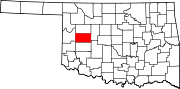
Washita County is a county located in the U.S. state of Oklahoma. As of the 2020 census, the population was 10,924. Its county seat is New Cordell. The county seat was formerly located in Cloud Chief. The county was created in 1891.

<span class="mw-page-title-main">Custer County, Oklahoma</span> County in Oklahoma, United States

Custer County is a county located in the U.S. state of Oklahoma. As of the 2020 census, the population was 28,513. Its county seat is Arapaho. The county was named in honor of General George Armstrong Custer.

<span class="mw-page-title-main">Blaine County, Oklahoma</span> County in Oklahoma, United States

Blaine County is a county located in the U.S. state of Oklahoma. As of the 2020 census, the population was 8,735. Its county seat is Watonga. Part of the Cheyenne-Arapaho land opening in 1892, the county had gained rail lines by the early 1900s and highways by the 1930s. The county was named for James G. Blaine, an American politician who was the Republican presidential candidate in 1884 and Secretary of State under President Benjamin Harrison.

<span class="mw-page-title-main">Arapahoe, Nebraska</span> City in Furnas County, Nebraska, United States

Arapahoe is a city in Furnas County, in the southern part of the state of Nebraska in the Midwestern United States. The population of the rural town was 1,026 at the 2010 census.

<span class="mw-page-title-main">Longdale, Oklahoma</span> Town in Oklahoma, United States

Longdale is a town in northwestern Blaine County, Oklahoma, United States. The population was 262 at the 2010 census, down 18.3 percent from the figure of 310 in 2000.

<span class="mw-page-title-main">Calumet, Oklahoma</span> Town in Oklahoma, United States

Calumet is a town in Canadian County, Oklahoma, United States. It is part of the Oklahoma City Metropolitan Area. The population was 507 at the 2010 census, a 5.23 percent decrease since 2000.

<span class="mw-page-title-main">Butler, Oklahoma</span> Town in Oklahoma, United States

Butler is a town in Custer County, Oklahoma, United States. The population was 287 at the 2010 census.

<span class="mw-page-title-main">Camargo, Oklahoma</span> City in Oklahoma, United States

Camargo is a town in Dewey County, Oklahoma, United States. The population was 178 at the 2010 census, an increase of 54.8 percent from the figure of 115 in 2000.

<span class="mw-page-title-main">Seiling, Oklahoma</span> City in Oklahoma, United States

Seiling is a city in Dewey County, Oklahoma, United States. The population was 850 at the 2020 census. The town was named in 1899 for Louis Seiling, a local store owner who had acquired a homestead in the Cheyenne-Arapaho land run of April 1892. The Hobson Town and Improvement Company established a town called Hobson, but the name was changed to Seiling in January 1899. It incorporated in 1909. Seiling is now the largest city in Dewey County. Their girls basketball team has also won the Oklahoma State Championship four times in a row (2016-2019).

<span class="mw-page-title-main">North Enid, Oklahoma</span> Town in Oklahoma, United States

North Enid is a town in Garfield County, Oklahoma, United States. The population was 860 at the 2010 census. The town is served by the Chisholm school district. North Enid was the original railroad town site in the Enid–Pond Creek Railroad War.

<span class="mw-page-title-main">Ninnekah, Oklahoma</span> Town in Oklahoma, United States

Ninnekah is a town in Grady County, Oklahoma, United States. The population was 775 at the 2020 census, a 22.7% decrease from 2010.

<span class="mw-page-title-main">Hennessey, Oklahoma</span> Town in Oklahoma, United States

Hennessey is a town in Kingfisher County, Oklahoma, United States. The population was 2,131 at the 2010 census, up from 2,058 in 2000.

<span class="mw-page-title-main">Colony, Oklahoma</span> Town in Oklahoma, United States

Colony is a town in northeastern Washita County, Oklahoma, United States. The population was 136 at the 2010 U.S. census, a decrease of 7.5 percent from 147 in 2000. It was named for the Seger Colony, founded in 1886, which taught modern agricultural techniques to the Arapaho and Cheyenne tribes that would be resettled in the vicinity. Colony is 16 miles (26 km) east and 4 miles (6.4 km) north of Cordell.

<span class="mw-page-title-main">Corn, Oklahoma</span> Town in Oklahoma, United States

Corn is a town in Washita County, Oklahoma, United States. The population was 503 at the 2010 census.

<span class="mw-page-title-main">New Cordell, Oklahoma</span> City in Oklahoma, United States

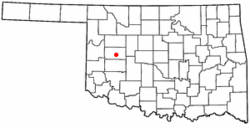
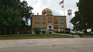
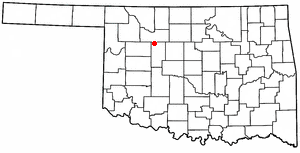
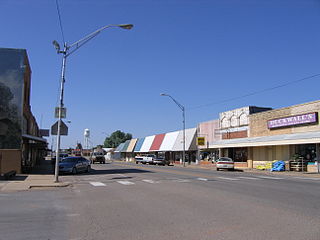
New Cordell is a city in, and county seat of, Washita County, Oklahoma, United States. It lies along U.S. Route 183. The population was 2,915 at the 2010 census. The community was previously established a few miles from the current site, but was moved about 1900. It was named for a U.S. Postal Service employee in Washington D. C., Wayne W. Cordell. The official name is New Cordell, though it is now commonly called Cordell.

<span class="mw-page-title-main">Sentinel, Oklahoma</span> Town in Oklahoma, United States

Sentinel is a town in Washita County, in the U.S. state of Oklahoma. The population was 901 in the 2010 census, an increase of 4.9 percent from the figure of 859 residents in 2000. Towns near Sentinel are Rocky, Cordell, Canute, and Burnsflat.

<span class="mw-page-title-main">Arapahoe, Wyoming</span> Census-designated place in Wyoming, United States

Arapahoe is a census-designated place (CDP) in Fremont County, Wyoming, United States. The population was 1,656 at the 2010 census. A Catholic mission was founded here in 1884. St Stephen's Mission Church, located near Arapahoe, is part of the Catholic mission.

<span class="mw-page-title-main">Geary, Oklahoma</span> City in Oklahoma, United States

Geary is a city in Blaine and Canadian counties in the U.S. state of Oklahoma. The population was 994 at the 2020 census. The town was named for Edmund Guerrier, a scout and an interpreter for the U.S. Army.

<span class="mw-page-title-main">Okarche, Oklahoma</span> Town in Oklahoma, United States

Okarche is a town in Canadian and Kingfisher counties in Oklahoma, United States, that is part of the Oklahoma City Metropolitan Area. The population was 1,215 at the 2010 census, a 9.5 percent increase from 1,110 at the 2000 census.

<span class="mw-page-title-main">Hammon, Oklahoma</span> Town in Oklahoma, United States

Hammon is a town in the U.S. state of Oklahoma, the majority of which is in Roger Mills County, but some of which extends into Custer County. It is located at the junction of Oklahoma State Highways 33 and 34.

References

  1. "ArcGIS REST Services Directory". United States Census Bureau. Retrieved September 20, 2022.
  2. 1 2 U.S. Geological Survey Geographic Names Information System: Arapaho, Oklahoma
  3. "U.S. Census website". United States Census Bureau . Retrieved January 31, 2008.
  4. "Find a County". National Association of Counties. Archived from the original on May 31, 2011. Retrieved June 7, 2011.
  5. CensusViewer:Arapaho, Oklahoma Population. Archived June 15, 2013, at the Wayback Machine Retrieved January 4, 2014.
  6. 1 2 Wilson, Linda D. ARAPAHO, Oklahoma Historical Society
  7. "Arapaho, Oklahoma". Google Maps. Retrieved April 2, 2020.
  8. "Historical Weather for Arapaho, Oklahoma, United States".
  9. "Arapaho-Butler Public Schools". Archived from the original on December 22, 2019. Retrieved April 27, 2017.
  10. "Census of Population and Housing". Census.gov. Retrieved June 4, 2015.
  11. "2010 City Population and Housing Occupancy Status". U.S. Census Bureau. Retrieved October 18, 2013.[ dead link ]