Carmarthenshire is a county in the south-west of Wales. The three largest towns are Llanelli, Carmarthen and Ammanford. Carmarthen is the county town and administrative centre. The county is known as the "Garden of Wales" and is also home to the National Botanic Garden of Wales.

Ceredigion, historically Cardiganshire, is a county in the west of Wales. It borders Gwynedd across the Dyfi estuary to the north, Powys to the east, Carmarthenshire and Pembrokeshire to the south, and the Irish Sea to the west. Aberystwyth is the largest settlement, and together with Aberaeron is an administrative centre of Ceredigion County Council.
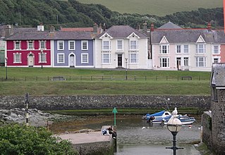
Aberaeron, previously anglicised as Aberayron, is a town, community and electoral ward in Ceredigion, Wales. Located on the coast between Aberystwyth and Cardigan, its resident population was 1,274 in the 2021 census.

Ammanford is a town and community in Carmarthenshire, Wales, with a population of 5,411 at the 2011 census. It is a former coal mining town. The built-up area had a population of 7,945 with the wider urban area even bigger.

Lampeter is a town, community and electoral ward in Ceredigion, Wales, at the confluence of the Afon Dulas with the River Teifi. It is the third largest urban area in Ceredigion, after Aberystwyth and Cardigan, and has a campus of the University of Wales Trinity Saint David. At the 2011 Census, the population was 2,970. Lampeter is the smallest university town in the United Kingdom. The university adds approximately 1,000 people to the town's population during term time.

Scarborough Village is a neighbourhood in Toronto, Ontario, Canada, located in the Scarborough district. It was one of the earliest settlements in the former township of Scarborough with the distinction of being the site of the township's first post office. Today, the neighbourhood is composed of private and public housing, apartment complexes, schools, a few condominiums, and strip mall plazas. The neighbourhood lies along the Scarborough Bluffs escarpment.

New Inn - - is a village and community directly south east of Pontypool, within the County Borough of Torfaen in Wales, within the historic boundaries of Monmouthshire. It had a population of 5,986 at the 2011 Census.

Maentwrog is a village and community in the Welsh county of Merionethshire, lying in the Vale of Ffestiniog just below Blaenau Ffestiniog, within the Snowdonia National Park. The River Dwyryd runs alongside the village. Its population of 585 in 2001 increased to 631 at the 2011 Census. The Community of Maentwrog includes the village of Gellilydan.

Bwlchgwyn is a village in Wrexham County Borough, Wales, on the A525 road, 5 miles (8 km) west of the city of Wrexham and 10 miles (16 km) south-east of the town of Ruthin. Bwlchgwyn is part of the community of Brymbo. In the 2011 Census the population of the village was 855.

Pencader is a small village in Carmarthenshire, Wales, in the community of Llanfihangel-ar-Arth. It is located around 3 miles (5 km) south-east of Llandysul and 6.5 miles (10 km) south-west of Llanybydder, in the valley of the Gwen brook, shortly before the confluence with the River Talog, to form the River Tyweli.
Llanfihangel-ar-Arth is a village and community in the county of Carmarthenshire, Wales.
The Carmarthen–Aberystwyth line was originally a standard-gauge branch line of the Great Western Railway (GWR) in Wales, connecting Carmarthen and Aberystwyth.

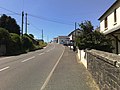
The A475 road in Wales links Newcastle Emlyn in Carmarthenshire with Lampeter in Ceredigion; a distance of 19 miles (31 km).

Llanpumsaint is a village and community in Carmarthenshire, Wales. In the 2001 UK Census, Llanpumsaint community had a population of 595. It is not to be confused with Pumsaint, a small village some distance away on the River Cothi. The population increased in 2011 to 734, and thus the percentage of Welsh speakers declined.
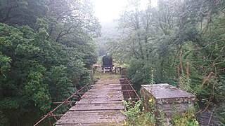
The Manchester and Milford Railway was a Welsh railway company, intended to connect Manchester and the industrial areas of Northwest England with a deep-water port on Milford Haven, giving an alternative to the Port of Liverpool.

Boncath is a village, community and postal district in north Pembrokeshire, Wales, about 5 miles (8.0 km) west of Newcastle Emlyn.

Pencarreg is a village and community located in Carmarthenshire, Wales, 4 miles (6.4 km) to the south-west of Lampeter.

The University of Wales Trinity Saint David is a multi-campus university with three main campuses in South West Wales, in Carmarthen, Lampeter and Swansea, a fourth campus in London, England, and learning centres in Cardiff, Wales, and Birmingham, England.

Gwyddgrug is a small village in Carmarthenshire, West Wales. It is located on the main A485 road south of New Inn.
Tavernspite is a small village about 6 miles (9.7 km) southeast of Narberth in Pembrokeshire, southwest Wales. It lies on the B4314 Pendine to Templeton road, close to the border with Carmarthenshire and is in Lampeter Velfrey community and parish. It is a historical meeting point of several roads. The population at the 2011 census was 349.