Related Research Articles

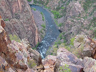
The Gunnison River is a tributary of the Colorado River, 180 miles (290 km) long, in the Southwestern state of Colorado. It is the largest tributary of the Colorado River in Colorado, with a mean flow of 2,570 cu ft/s (73 m3/s).

Roaring Fork River is a tributary of the Colorado River, approximately 70 miles (110 km) long, in west central Colorado in the United States. The river drains a populated and economically vital area of the Colorado Western Slope called the Roaring Fork Valley or Roaring Fork Watershed, which includes the resort city of Aspen and the resorts of Aspen/Snowmass.

White River is a river, approximately 195 miles (314 km) long, in the U.S. states of Colorado and Utah and is a tributary of the Green River.
Beaver Creek may refer to:

The Little Cacapon River is a 25.1-mile-long (40.4 km) free-flowing tributary of the Potomac River in the center of Hampshire County, West Virginia. Via the Potomac River, its waters are part of the Chesapeake Bay watershed, leading to the Atlantic Ocean. The Little Cacapon enters the Potomac at an elevation of 499 feet (152 m) near the community of Little Cacapon. For the majority of its course the Little Cacapon is a shallow non-navigable stream. It has been historically referred to as both Little Cacapehon and Little Capecaphon. The name is pronounced kə-KAY-pən or KAY-pən.
Piney River is a 28.2-mile-long (45.4 km) tributary of the Colorado River in Eagle County, Colorado. The river flows northwest from Upper Piney Lake in the Eagles Nest Wilderness to a confluence with the Colorado River.

The Williams Fork is a tributary of the Colorado River, approximately 33.8 miles (54.4 km) long, in north central Colorado in the United States. It flows through Grand County between the valleys of the Fraser River and the Blue River. It rises at the juncture of McQueary and Bobtail creeks just west of the Continental Divide 8 miles (13 km) west of Berthoud Pass and 7 miles (11 km) north of the Eisenhower Tunnel in the Arapaho National Forest. It flows north-northwest to the Williams Fork Reservoir, then turns northeast and joins the Colorado at Parshall.

The New Fork River is the uppermost major tributary of the Green River in Wyoming, flowing about 70 miles (110 km) entirely within Sublette County. It drains an arid farming region of southwestern Wyoming south of the Wind River Range.
South Fork Piney River is a tributary of the Piney River in Eagle County, Colorado. The river flows north from a source near Red and White Mountain in the White River National Forest to a confluence with the Piney River.
First Fork South Fork Piney River is a tributary of the South Fork Piney River in Eagle County, Colorado. The river flows northeast from a source in the White River National Forest to a confluence with the South Fork Piney River.
References
- ↑ "North Fork Piney River". Geographic Names Information System . United States Geological Survey . Retrieved 2013-06-08.
| This article related to a river in Colorado is a stub. You can help Wikipedia by expanding it. |