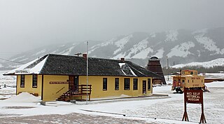
Old Roach is a ghost town in northwestern Larimer County, Colorado, United States. Once a company logging town, occupied roughly between 1923 and 1938, it lies in northern Colorado near the Wyoming border.
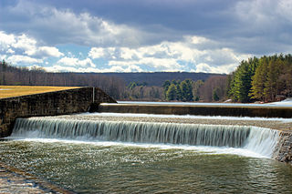
Old Roach was built by the Otto Lumber Company for the purpose of railroad logging, or tie hacking. Railroad ties were needed to build and maintain the growing railroad network in the American west, and tie hacks were the loggers who cut the timber and shaped it into railroad ties. Old Roach was an extensive company town which had homes as well as a post office, a store, and a school. It was inhabited from the early 1920s to the 1930s when it was dismantled from the National Forest lands where it was located. All that remains today in this ghost town are a few foundations, and the remains of a wooden flume and splash dam located along nearby Stuck Creek. The splash dam and flume were used to regulate water flows needed to float the new railroad ties down to the Big Laramie River during the annual spring tie drive. The ties were collected in Laramie, Wyoming where the Union Pacific Railroad was located.
Old Roach is located on the Roosevelt National Forest. Archaeological exploration of Old Roach were conducted by the U.S. Forest Service through the Passport in Time (PIT) program. The town site was examined and surveyed by Forest Service archaeologists and PIT volunteers in the summer of 2006. The splash dam and Stuck Creek flume were also surveyed and artifacts noted. In 2007, archaeologists expanded the survey to include the search for the remains of Forrester Camp, a satellite logging camp operated by the Otto Lumber Company. This camp was found located about 5 miles southeast of Old Roach. The 2008 field survey resulted in the finding of another satellite logging camp known as "Camp 3" located about 3 miles west of Old Roach. Another satellite camp known as East Beaver Creek was located and recorded during the 2009 field survey. East Beaver Camp is about five miles northwest of Old Roach. Several other satellite camps of the Otto Lumber company remain in the forest and hope to be located and recorded in future years.
The history of Tie Hacking in northern Colorado and southern Wyoming is described in Logging the Rockies: The Langendorf-Olson Story by Patricia Langendorf, Spruce Gulch Press (1992), ISBN 0-9625714-9-0.

Lumberjacks are mostly North American workers in the logging industry who perform the initial harvesting and transport of trees for ultimate processing into forest products. The term usually refers to loggers in the era when trees were felled using hand tools and dragged by oxen to rivers.

Larimer County is a county located in the U.S. state of Colorado. As of the 2020 census, the population was 359,066. The county seat and most populous city is Fort Collins. The county was named for William Larimer, Jr., the founder of Denver.

Franktown is an unincorporated town, a post office, and a census-designated place (CDP) located in and governed by Douglas County, Colorado, United States. The CDP is a part of the Denver–Aurora–Lakewood, CO Metropolitan Statistical Area. The Franktown post office has the ZIP Code 80116. At the United States Census 2020, the population of the Franktown CDP was 409.

Red Feather Lakes is an unincorporated town, a post office, and a census-designated place (CDP) located in and governed by Larimer County, Colorado, United States. The CDP is a part of the Fort Collins, CO Metropolitan Statistical Area. The Red Feather Lakes post office has the ZIP Code 80545. At the United States Census 2020, the population of the Red Feather Lakes CDP was 426.

Centennial is a small mountain-town in Albany County, Wyoming, United States. It serves a fairly large surrounding landscape, along with a few ranches, located along a gently sloping hillside traversed by a highway. Because it has been, since 1980 or later, included in a census-designated place (CDP), bearing the town's name, specific demographics characterizing the town itself are not available.

Laramie is a city in and the county seat of Albany County, Wyoming, United States. The population was estimated 32,711 in 2019, making it the third-most populous city in Wyoming after Cheyenne and Casper. Located on the Laramie River in southeastern Wyoming, the city is north west of Cheyenne, at the junction of Interstate 80 and U.S. Route 287.

Dubois is a town in Fremont County, Wyoming, United States. The population was 971 at the 2010 census, but dropped to 911 in the 2020 census. The population nearly doubles in the summer with many part-time residents.

A log flume is a watertight flume constructed to transport lumber and logs down mountainous terrain using flowing water. Flumes replaced horse- or oxen-drawn carriages on dangerous mountain trails in the late 19th century. Logging operations preferred flumes whenever a reliable source of water was available. Flumes were cheaper to build and operate than logging railroads. They could span long distances across chasms with more lightweight trestles.

The North Platte River is a major tributary of the Platte River and is approximately 716 miles (1,152 km) long, counting its many curves. In a straight line, it travels about 550 miles (890 km), along its course through the U.S. states of Colorado, Wyoming, and Nebraska.

Hume Lake is a reservoir in the Sierra Nevada, within Sequoia National Forest and Fresno County, central California.

The Medicine Bow Mountains are a mountain range in the Rocky Mountains that extend 100 miles (160 km) from northern Colorado into southern Wyoming. The northern extent of this range is the sub-range the Snowy Range. From the northern end of Colorado's Never Summer Mountains, the Medicine Bow mountains extend north from Cameron Pass along the border between Larimer and Jackson counties in Colorado and northward into south central Wyoming. In Wyoming, the range sits west of Laramie, in Albany and Carbon counties to the route of the Union Pacific Railroad and U.S. Interstate 80. The mountains often serve as a symbol for the city of Laramie. The range is home to Snowy Range Ski Area.

Shaver Lake is an artificial lake on Stevenson Creek, in the Sierra National Forest of Fresno County, California. At elevation 5,500 ft (1,700 m), several smaller streams also flow into the lake, and it receives water from the tunnels of Southern California Edison's Big Creek Hydroelectric Project. The town Shaver Lake is located on its south-west shore.

Parker Dam State Park is a 968-acre (392 ha) Pennsylvania state park in Huston Township, Clearfield County, Pennsylvania in the United States. The park is surrounded by Moshannon State Forest. Parker Dam State park is 17 miles (27 km) north of Clearfield on Pennsylvania Route 153 just off exit 111 of Interstate 80. The park was constructed during the Great Depression by the Civilian Conservation Corps; they built many of the facilities that are in use today at Parker Dam State Park.

Tremont is a region in the northwestern Great Smoky Mountains National Park, located in the southeastern United States. Formerly home to a pioneer Appalachian community and logging town, Tremont is now the location of the Great Smoky Mountains Institute at Tremont.

There is evidence of prehistoric human habitation in the region known today as the U.S. state of Wyoming stretching back roughly 13,000 years. Stone projectile points associated with the Clovis, Folsom and Plano cultures have been discovered throughout Wyoming. Evidence from what is now Yellowstone National Park indicates the presence of vast continental trading networks since around 1,000 years ago.
The Laramie, North Park and Western Railroad was a railroad in the U.S. states of Wyoming and Colorado between Laramie, Wyoming and Coalmont, Colorado. It operated under several different names between 1901 and 1951 prior to absorption by the Union Pacific Railroad.
The Overland Trail was a stagecoach and wagon trail in the American West during the 19th century. While portions of the route had been used by explorers and trappers since the 1820s, the Overland Trail was most heavily used in the 1860s as a route alternative to the Oregon, California, and Mormon trails through central Wyoming. The Overland Trail was famously used by the Overland Stage Company owned by Ben Holladay to run mail and passengers to Salt Lake City, Utah, via stagecoaches in the early 1860s. Starting from Atchison, Kansas, the trail descended into Colorado before looping back up to southern Wyoming and rejoining the Oregon Trail at Fort Bridger. The stage line operated until 1869 when the completion of the First transcontinental railroad eliminated the need for mail service via stagecoach.

The Hume-Bennett Lumber Company was a logging operation in the Sequoia National Forest in the late 19th and early 20th centuries. The company and its predecessors were known for building the world's longest log flume and the first multiple-arch hydroelectric dam. However, the company also engaged in destructive clearcutting logging practices, cutting down 8,000 giant sequoias in Converse Basin in a decade-long event that has been described as "the greatest orgy of destructive lumbering in the history of the world."

The Madera Sugar Pine Company was a lumber company that operated in the Sierra Nevada region of California during the late 19th and early 20th centuries. It was known for its use of innovative technologies, such as the first log flume and logging railroad in the southern Sierra, and the adoption of the Steam Donkey engine in commercial logging. The company had a significant impact on the region, leading to the founding of several towns, including Madera, Fish Camp, and Sugar Pine, as well as the growth of Fresno Flats and the formation of Madera County. In addition, the company contributed to the agriculture in California in California through its production of wooden shipping boxes and was involved in a U.S. Supreme Court case related to employer obligations.

Millwood was a lumber boomtown located in present-day Sequoia National Forest near Converse Basin Grove in California. It was established in 1891 by the Kings River Lumber Company and was connected to the Sequoia Railroad, which brought logs to the town to be turned into rough lumber. The lumber was then transported by log flume to Sanger, a journey of 54 miles. At its peak, Millwood had a population of over 2,000 people and featured two hotels, a summer school, and a post office. However, today there are no remaining structures or buildings at the Millwood site.