Related Research Articles

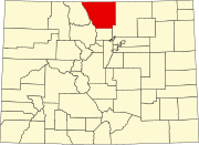
Larimer County is a county located in the U.S. state of Colorado. As of the 2020 census, the population was 359,066. The county seat and most populous city is Fort Collins. The county was named for William Larimer, Jr., the founder of Denver.

Windsor is a home rule municipality in Larimer and Weld counties in the U.S. state of Colorado. According to the 2020 census, the population of the town was 32,716. Windsor is located in the Northern Colorado region. Someone who lives in the municipality is known as a "Winsord."

The Big Thompson River is a tributary of the South Platte River, approximately 78 miles (126 km) long, in the U.S. state of Colorado. Originating in Forest Canyon in Rocky Mountain National Park, the river flows into Lake Estes in the town of Estes Park and then through Big Thompson Canyon. It includes four crossings/bridges which are listed on the U.S. National Register of Historic Places.

Buckeye is a farming and ranching unincorporated community in north central Larimer County, Colorado, United States. Bounded on the west by the 16,500-acre (67 km2) Roberts Ranch, the area includes Red Mountain Open Space to the north, Rawhide flats to the east, and extends south to Owl Canyon.

The Poudre Canyon is a narrow verdant canyon, approximately 40 miles (64 km) long, on the upper Cache la Poudre River in Larimer County, Colorado in the United States. The canyon is a glacier-formed valley through the foothills of the Front Range of the Rocky Mountains northwest of Fort Collins.

Lawn Lake Dam was an earthen dam in Rocky Mountain National Park, United States that failed on July 15, 1982, at about 6 a.m., in an event known as the flood of 1982. The sudden release of 30 million cubic feet (850,000 m3) of water resulted in a flash flood that killed three people camping in the park and caused $31 million in damage to the town of Estes Park, Colorado and other downstream areas.

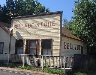
Bellvue is an unincorporated community and U.S. Post Office in Larimer County, Colorado. It is a small agricultural community located in Pleasant Valley, a narrow valley just northwest of Fort Collins near the mouth of the Poudre Canyon between the Dakota Hogback ridge and the foothills of the Rocky Mountains. The ZIP Code of the Bellvue Post Office is 80512.

Manhattan is a ghost town located 4 miles (6.4 km) north of Rustic in Larimer County, Colorado, United States at an elevation of 8,474 feet (2,583 m). It became a mining town after discovery of gold in the area in September 1886. The area was difficult to mine and produced small quantities of gold, and the population dropped off by the turn of the century. The land was acquired by the United States Forest Service and by 1933, the remaining structures were dismantled because they were considered a fire hazard, but a cemetery remains.

Horsetooth Reservoir is a large reservoir in southern Larimer County, Colorado, in the foothills just west of the city of Fort Collins, Colorado. The reservoir runs north-south for approximately 6.5 miles (10 km) and is approximately one-half mile (1 km) wide. Its shape and orientation are the result of the fact that the main body of the reservoir is contained between several homoclinal ridges. A ridge composed of Dakota sandstone runs along the east side where gaps in the ridge are plugged by dams. On the west (uphill) side there are two prominent ridges topped by erosion-resistant sandstones of the Lyons and Ingleside formations. Gaps in these ridges have created a handful of bays and coves the largest of which is Inlet Bay, home to a marina and campgrounds.
Camp Collins was a 19th-century outpost of the United States Army in the Colorado Territory. The fort was commissioned in the summer of 1862 to protect the Overland Trail from attacks by Native Americans in a conflict that later became known as the Colorado War. Located along the Cache la Poudre River in Larimer County, it was relocated from its initial location near Laporte after a devastating flood. Its second location downstream on the Poudre was used until 1866 and became the nucleus around which the City of Fort Collins was founded.

Kinikinik is a small unincorporated community in western Larimer County, Colorado, in the United States. It is located along State Highway 14 in the upper Poudre Canyon west of Fort Collins on the east side of Cameron Pass. The community consists of a general store and neighboring summer mountain resorts and vacation homes. The activities include fishing in the Cache la Poudre River and hiking in the nearby mountains in the Roosevelt National Forest. The community was named for the kinnikinick plant by early settlers.
Picacho is an unincorporated community in Imperial County, California. It is located on the Colorado River 29 miles (47 km) south-southeast of Palo Verde, at an elevation of 203 feet.

The Switzerland Trail is the site of a historic 3 ft narrow gauge railroad line that was operated at different times by the Greeley, Salt Lake and Pacific Railway, the Colorado and Northwestern Railroad, and the Denver, Boulder, and Western Railroad around the turn of the 20th century in the Colorado front range mining area near Nederland, Gold Hill, and Ward. The west end of the trail is listed on the National Register of Historic Places as the "Denver, Boulder and Western Railway Historic District".

The High Park fire was a wildfire in the mountains west of Fort Collins in Larimer County, Colorado, United States. It was caused by a lightning strike and was first detected on the morning of June 9, 2012. It was declared 100 percent contained on June 30, 2012, and all associated evacuation orders were lifted. Disambiguation. In 2022 there was another fire called "High Park Fire." That fire started on 05/12/2022 6 miles west of Cripple Creek Colorado. The size at 89% containment was 1,572 acres. Since wildland fire names are typically assigned by personnel on the fire and often based on local knowledge, it is not unusual to have more than one fire with the same name.

El Dorado Canyon is a canyon in southern Clark County, Nevada famed for its rich silver and gold mines. The canyon was named in 1857 by steamboat entrepreneur Captain George Alonzo Johnson when gold and silver was discovered here. It drains into the Colorado River at the former site of Nelson's Landing.
Roubaix, formerly known as Perry or Lewisville, is an unincorporated community in Lawrence County, South Dakota, United States. It is not monitored by the U.S. Census Bureau.

Poudre Park is an unincorporated community in Larimer County, Colorado. It is located near Poudre Canyon and is west of Fort Collins. Its elevation is 5,676 feet.
Ted's Place is a gas station in Larimer County, Colorado, United States. Ted's Place is located near the mouth of the Poudre Canyon, approximately 5 miles (8.0 km) northwest of Fort Collins.

Chambers Lake is a reservoir in Larimer County, Colorado. Located within the Roosevelt National Forest, the reservoir supplies water for irrigation and municipal water supply.
References
- ↑ James La Force (2012). Glen Echo, Rustic, and Manhattan. Lulu.com. pp. 20–. ISBN 978-1-257-94155-1.
- ↑ E/MJ, Engineering and Mining Journal. McGraw-Hill. 1890. pp. 1–.
- ↑ Stanley R. Case (1995). The Poudre, A Photo History. pp. 39–43.
- ↑ Stanley R. Case (1995). The Poudre, A Photo History. p. 43.
