
Alexandra is a town in the Central Otago district of the South Island of New Zealand. It is located on the banks of the Clutha River, on State Highway 8, 188 kilometres (117 mi) by road from Dunedin and 33 kilometres (21 mi) south of Cromwell. The town is home to 5,790 people as of June 2020.

Cromwell is a town in Central Otago in the Otago region of New Zealand.
Milton, formerly known as Tokomairiro or Tokomairaro, is a town of 2,000 people, located on State Highway 1, 50 kilometres to the south of Dunedin in Otago, New Zealand. It lies on the floodplain of the Tokomairaro River, one branch of which loops past the north and south ends of the town. This river gives its name to many local features, notably the town's main school, Tokomairiro High School.

Clyde, formerly Dunstan, is a small town in Central Otago, New Zealand with a population of 1023 in 2018. It is located on the Clutha River, between Cromwell and Alexandra.

Ranfurly is a town in the Central Otago District of Otago, New Zealand. Located 110 kilometres north of Dunedin, it lies in the dry rough plain of Maniototo at a moderately high altitude close to a small tributary of the Taieri River. It operates as a service town for the local farming community. The town was formerly known as Eweburn, one of the "farmyard" names bestowed by former Otago Chief Surveyor John Turnbull Thomson on many small streams and locations in the district. The modern name honours the Fifth Earl of Ranfurly, who served as Governor of New Zealand (1897–1904) at the time of the extension of the Otago Central Railway to the area. Ranfurly is well known for its Art Deco buildings, such as its hotel and the milk bar.
Roxburgh is a small New Zealand town of about 600 people in Central Otago. It is in Teviot Valley on the banks of the Clutha River, 40 kilometres (25 mi) south of Alexandra in the South Island. State Highway 8, which links Central Otago with Dunedin city, passes through the town. Roxburgh is well known for its Roxdale fruit and "Jimmy's Pies."
Millers Flat is a small town in inland Otago, in the South Island of New Zealand. It is located on the Clutha River, 17 kilometres south of Roxburgh. Fruit growing is the main industry in the area. Most of the town lies on the north bank of the Clutha; the main road, State Highway 8, passes close by on the river's other bank. The Roxburgh Branch railway used to pass through the town; it was opened to Millers Flat in 1925 and was the terminus for approximately two and a half years, until the section to Roxburgh was opened. The line was closed in 1968, though the town's station platform and some of the railway formation still exist.
Frankton is a suburb of the town of Queenstown in the South Island of New Zealand, formerly a separate settlement.
The township of Oturehua is in the Ida Valley of the Maniototo, in Central Otago, in the South Island of New Zealand.
Heriot is a small settlement in West Otago, in the South Island of New Zealand. It is located 20 kilometres southwest of Raes Junction and 15 kilometres north of Tapanui.
Stirling is a settlement in New Zealand. It is located in South Otago, approximately 5 km from Balclutha.

Halcombe is a small settlement in the Manawatū-Whanganui region of the North Island, New Zealand. It is situated 13 km north west of Feilding and 4 km east of the Rangitikei River, between State Highway 1 and State Highway 54.
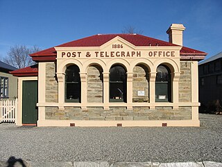
Ophir is a small settlement in Central Otago, New Zealand, located between Alexandra and Ranfurly close to the east bank of the Manuherikia River. The settlement of Omakau is located on the opposite bank, 3 kilometres (1.9 mi) to the northwest.
Rongotea is a small rural township in the Manawatu District of the Manawatū-Whanganui region. Located on the western Manawatu Plains, approximately 19 km (12 mi) northwest of the region's main city, Palmerston North.
Waiwera South is a small settlement in the South Island of New Zealand, close to the boundary between the Otago and Southland regions. The settlement is located between Balclutha and Clinton, immediately to the south of State Highway 1, between branches of the Waiwera River and Kaihiku Stream, two minor tributaries of the Clutha River. The South Island Main Trunk railway also runs through the township. The settlement's population is around 100.
Waimana is a rural valley in the Whakatane District and Bay of Plenty Region of New Zealand's North Island. It is located in the northern Urewera. Waimana River, originally known as Tauranga River, runs through the valley, joining the Ohinemataroa River one kilometre south-west of the Tāneatua.
Eskdale is a rural settlement the Hastings District and Hawke's Bay Region of New Zealand's North Island. It is located north of Napier on State Highway 5, near the mouth of the Esk River.
Elsthorpe is a village in the Central Hawke's Bay District and Hawke's Bay Region of New Zealand's North Island. It is located east of Ōtāne, Waipawa and State Highway 2 and west of the east coast.
Omakere is a farming settlement in the Central Hawke's Bay District and Hawke's Bay Region of New Zealand's North Island. It is located east of Waipawa.
Brunswick is a rural community in the Whanganui District and Manawatū-Whanganui region of New Zealand's North Island.

