Oneroa, New Zealand

Last updated

Oneroa
Oneroa.jpg
Oneroa and Oneroa Bay
Oneroa, New Zealand
Coordinates: 36°46′55″S175°00′32″E / 36.782°S 175.009°E / -36.782; 175.009
CountryNew Zealand
City Auckland
Local authority Auckland Council
Electoral ward Waitematā and Gulf ward
Local board Waiheke Local Board
Area
[1]
  Land842 ha (2,081 acres)
Population
 (June 2023) [2]
  Total1,430
Ferry terminals Matiatia
(Hauraki Gulf)
Matiatia
Pfeil oben.svg
Pfeil links.svgOneroaPfeil rechts.svg
Pfeil unten.svg
Palm Beach
Blackpool Surfdale

Oneroa is a settlement on Waiheke Island in northern New Zealand.

The New Zealand Ministry for Culture and Heritage gives a translation of "long beach" for Oneroa. [3]

Whittaker's Music Museum, a specialist music museum, has operated in Oneroa since 1996. [4] [5]

Demographics

The statistical area of Oneroa West, which includes the suburb and areas west of it, covers 8.42 km2 (3.25 sq mi) [1] and had an estimated population of 1,430 as of June 2023, [2] with a population density of 170 people per km2.

Historical population
YearPop.±% p.a.
20061,287    
20131,425+1.47%
20181,434+0.13%
Source: [6]

Oneroa West had a population of 1,434 at the 2018 New Zealand census, an increase of 9 people (0.6%) since the 2013 census, and an increase of 147 people (11.4%) since the 2006 census. There were 606 households, comprising 699 males and 735 females, giving a sex ratio of 0.95 males per female. The median age was 48.6 years (compared with 37.4 years nationally), with 195 people (13.6%) aged under 15 years, 198 (13.8%) aged 15 to 29, 705 (49.2%) aged 30 to 64, and 339 (23.6%) aged 65 or older.

Ethnicities were 91.2% European/Pākehā, 10.3% Māori, 3.1% Pacific peoples, 3.8% Asian, and 3.6% other ethnicities. People may identify with more than one ethnicity.

The percentage of people born overseas was 34.5, compared with 27.1% nationally.

Although some people chose not to answer the census's question about religious affiliation, 63.2% had no religion, 24.5% were Christian, 0.2% had Māori religious beliefs, 0.2% were Muslim, 0.8% were Buddhist and 2.7% had other religions.

Of those at least 15 years old, 438 (35.4%) people had a bachelor's or higher degree, and 150 (12.1%) people had no formal qualifications. The median income was $36,000, compared with $31,800 nationally. 303 people (24.5%) earned over $70,000 compared to 17.2% nationally. The employment status of those at least 15 was that 588 (47.5%) people were employed full-time, 225 (18.2%) were part-time, and 36 (2.9%) were unemployed. [6]

Related Research Articles

<span class="mw-page-title-main">Havelock, New Zealand</span> Town in Marlborough, New Zealand

Havelock is a small town in the Marlborough Region of New Zealand, at the head of Pelorus Sound, one of the Marlborough Sounds, and at the mouth of the Pelorus and Kaituna Rivers

<span class="mw-page-title-main">Far North District</span> Territorial authority district in Northland Region, New Zealand

<span class="mw-page-title-main">Pukawa</span> Settlement in Waikato, New Zealand

Pukawa or Pukawa Bay is a bay and a small township on the southern shores of Lake Taupō on New Zealand's North Island. It is off State Highway 41 between Turangi and Taumarunui, in the Taupō District and Waikato region.

<span class="mw-page-title-main">Ōhura</span> Settlement in Manawatū-Whanganui Region, New Zealand

Ōhura is a small town in the west of the North Island of New Zealand. It is located to the west of Taumarunui in the area known as the King Country, in inland Manawatū-Whanganui. It lies on the banks of the Mangaroa Stream, a tributary of the Ōhura River which is a tributary of the Whanganui River.

<span class="mw-page-title-main">Tokomaru, New Zealand</span> Settlement in Manawatū-Whanganui, New Zealand

Tokomaru is a small town in the district of Horowhenua, in the southwestern North Island of New Zealand. It is located 18 kilometres southwest of Palmerston North, and a similar distance northeast of Shannon. The Tokomaru railway station on the North Island Main Trunk was open from 1885 to 1982.

<span class="mw-page-title-main">Herekino</span> Place in Northland Region, New Zealand

Herekino is a locality in Northland, New Zealand. It lies 26 km south west of Kaitaia. The Herekino Harbour, also called the Herekino River, is an estuary and inlet from the Tasman Sea to the west. The Herekino Forest, which contains a stand of large kauri, is to the north, and the Tauroa Peninsula lies to the north west.

<span class="mw-page-title-main">Mangawhai</span> Place in Northland Region, New Zealand

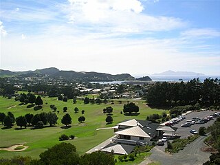
Mangawhai is a locality in Northland, New Zealand around the Mangawhai Harbour. The township of Mangawhai is at the south west extent of the harbour, and the township of Mangawhai Heads is 5 km north east. Kaiwaka is 13 km south west, and Waipu is 20 km north west of Mangawhai Heads.

Egmont Village is a settlement in Taranaki, New Zealand. State Highway 3 runs through it. New Plymouth is 12 km to the north-west, and Inglewood is 6 km to the south-east. Waiwhakaiho River and Mangaoraka Stream flow past to the west and east, respectively.

<span class="mw-page-title-main">The Wood, New Zealand</span> Suburb of Nelson, New Zealand

The Wood is a suburb of the South Island, New Zealand city of Nelson. It lies just to the north-east of the city centre and adjoins it.

Tahuna is a small rural settlement located 18 km north of Morrinsville. In the Māori language Tahuna means sandbank, likely to refer to the sandbanks along the nearby Piako River, where a Māori settlement started. Tahuna is seen as the upper limit for navigatable travel on the Piako River. The settlement has a rugby club, a lawn bowls club, a golf course and various shops.

<span class="mw-page-title-main">Wakefield, New Zealand</span> Town in Tasman District, New Zealand

Wakefield is a settlement in the Tasman District of New Zealand's South Island, located about 25km south west of Nelson.

Hihi or Hihi Beach is a village and rural community in the Far North District and Northland Region of New Zealand's North Island.

Pokuru is a rural community in the Waipa District and Waikato region of New Zealand's North Island.

Waitahanui is a village in the Taupō District, Waikato region, New Zealand. The village is on the eastern shore of Lake Taupō, 14 km (9 mi) south of the district seat of Taupō.

<span class="mw-page-title-main">Haruru, New Zealand</span> Locality in New Zealand

Haruru is a residential and commercial locality in the Far North District of New Zealand. State Highway 11 runs through the locality. Puketona is 10 kilometres west, and Paihia is 4 kilometres east, The name means a continuous noise or roar in the Māori language, which refers to the sound of Haruru Falls, a five metre high broad waterfall about a kilometre away.

<span class="mw-page-title-main">Lower Moutere</span> Rural locality in Tasman, New Zealand

Lower Moutere is a settlement in the Tasman District of New Zealand's upper South Island. It is a farming community it the Lower Moutere valley, 6 km (3.7 mi) from Motueka close to the Moutere Inlet.

<span class="mw-page-title-main">Palm Beach, New Zealand</span> Suburb in Auckland, New Zealand

Palm Beach is a settlement on Waiheke Island in northern New Zealand. The eponymous beach is named for phoenix palms at the eastern end, and has safe swimming and white sand.

<span class="mw-page-title-main">Onetangi</span> Suburb in Auckland, New Zealand

Onetangi is a settlement on the north coast of Waiheke Island in New Zealand. It has a long white-sand beach fronting onto Onetangi Bay.

Fencourt is a rural locality in the Waipa District and Waikato region of New Zealand's North Island.

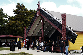
Holdens Bay is an eastern suburb of Rotorua in the Bay of Plenty region of New Zealand's North Island.

References

  1. 1 2 "ArcGIS Web Application". statsnz.maps.arcgis.com. Retrieved 21 July 2022.
  2. 1 2 "Population estimate tables - NZ.Stat". Statistics New Zealand . Retrieved 25 October 2023.
  3. "1000 Māori place names". New Zealand Ministry for Culture and Heritage. 6 August 2019.
  4. "Whittaker's Music Museum". Whittaker's Music Museum.
  5. "Whittaker's Music Museum on NZ Museums". nzmuseums.co.nz. Te Papa.
  6. 1 2 "Statistical area 1 dataset for 2018 Census". Statistics New Zealand. March 2020. Oneroa West (144600). 2018 Census place summary: Oneroa West