Ostend, New Zealand

Last updated

Ostend
Ostend, New Zealand.jpg
Ostend, September 2018
Ostend, New Zealand
Coordinates: 36°47′50″S175°02′50″E / 36.79722°S 175.04722°E / -36.79722; 175.04722
CountryNew Zealand
City Auckland
Local authority Auckland Council
Electoral ward Waitematā and Gulf ward
Local board Waiheke Local Board
Area
[1]
  Land391 ha (966 acres)
Population
 (June 2023) [2]
  Total2,000
Oneroa Palm Beach Onetangi
Surfdale
Pfeil oben.svg
Pfeil links.svgOstendPfeil rechts.svg
Pfeil unten.svg
Rural Waiheke
(Putiki Bay) Omiha

Ostend is a settlement on Waiheke Island, in New Zealand's Hauraki Gulf within the Auckland Region. Ostend is located in the west of the island, on and around a small peninsula which juts into Putiki Bay, one of two large indentations in the island's southwest coast. The southwest of the island contains much of the island's population, with Ostend being located immediately to the east of the settlement of Surfdale, and to the southwest of Onetangi.

Contents

Ostend is connected to Surfdale by a causeway which crosses the western arm of Putiki Bay. The area is used by boatsmen who moor their boats on the beach, as it is easy to access from the mainland marina at Half Moon Bay. Ostend is home to the island's only supermarket (Countdown), a branch office of the Auckland council, the island's Baptist church, and a medical centre. It is known as the industrial area of the island.

History

In late 1915, a competition was held to decide the name of the new settlement, which was won by Miss Boylan, a resident of Auckland, who suggested the name Ostend, [3] referencing the Belgian city of the same name, which had been a part of the theatre of World War I. The land at Ostend Estate was first auctioned on 18 February 1916. [4] The name area originally referred to land at both Putiki Bay and Onetangi Bay (modern-day Ostend and Onetangi).

Demographics

Ostend covers 3.91 km2 (1.51 sq mi) [1] and had an estimated population of 2,000 as of June 2023, [2] with a population density of 512 people per km2.

Historical population
YearPop.±% p.a.
20061,617    
20131,734+1.00%
20181,905+1.90%
Source: [5]

Ostend had a population of 1,905 at the 2018 New Zealand census, an increase of 171 people (9.9%) since the 2013 census, and an increase of 288 people (17.8%) since the 2006 census. There were 771 households, comprising 933 males and 972 females, giving a sex ratio of 0.96 males per female. The median age was 45.3 years (compared with 37.4 years nationally), with 285 people (15.0%) aged under 15 years, 315 (16.5%) aged 15 to 29, 891 (46.8%) aged 30 to 64, and 411 (21.6%) aged 65 or older.

Ethnicities were 87.7% European/Pākehā, 12.1% Māori, 3.6% Pacific peoples, 4.7% Asian, and 4.9% other ethnicities. People may identify with more than one ethnicity.

The percentage of people born overseas was 32.6, compared with 27.1% nationally.

Although some people chose not to answer the census's question about religious affiliation, 62.8% had no religion, 22.2% were Christian, 0.6% had Māori religious beliefs, 0.3% were Hindu, 0.2% were Muslim, 1.1% were Buddhist and 4.4% had other religions.

Of those at least 15 years old, 405 (25.0%) people had a bachelor's or higher degree, and 216 (13.3%) people had no formal qualifications. The median income was $28,500, compared with $31,800 nationally. 219 people (13.5%) earned over $70,000 compared to 17.2% nationally. The employment status of those at least 15 was that 750 (46.3%) people were employed full-time, 270 (16.7%) were part-time, and 39 (2.4%) were unemployed. [5]

Education

One of the three schools on Waiheke Island is in Ostend. The others are in Surfdale.

Waiheke Primary School is a coeducational full primary school (years 1–8) with a roll of 233 as of February 2024. [6] [7]

Related Research Articles

<span class="mw-page-title-main">Great Barrier Island</span> Island in New Zealand

Great Barrier Island lies in the outer Hauraki Gulf, New Zealand, 100 kilometres (62 mi) north-east of central Auckland. With an area of 285 square kilometres (110 sq mi) it is the sixth-largest island of New Zealand and fourth-largest in the main chain. Its highest point, Mount Hobson, is 627 metres (2,057 ft) above sea level. The local authority is the Auckland Council.

<span class="mw-page-title-main">Waiheke Island</span> Island in the Hauraki Gulf of New Zealand

Waiheke Island is the second-largest island in the Hauraki Gulf of New Zealand. Its ferry terminal in Matiatia Bay at the western end is 21.5 km (13.4 mi) from the central-city terminal in Auckland.

<span class="mw-page-title-main">Auckland Region</span> Region of New Zealand

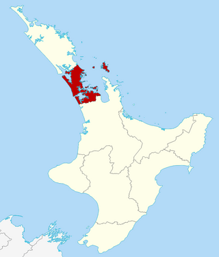
Auckland is one of the 16 regions of New Zealand, which takes its name from the eponymous urban area. The region encompasses the Auckland metropolitan area, smaller towns, rural areas, and the islands of the Hauraki Gulf. Containing 33 percent of the nation's residents, it has by far the largest population and economy of any region of New Zealand, but the second-smallest land area.

<span class="mw-page-title-main">Colville, New Zealand</span> Place in Waikato, New Zealand

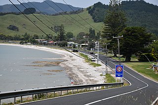
Colville, a small town in the north of the Coromandel Peninsula in the North Island of New Zealand, lies 26 kilometres north of Coromandel in Colville Bay on the Hauraki Gulf, and is the northernmost town of any note on the peninsula. North of Colville, 28 kilometres of rough road lead to the small settlement of Port Jackson, close to the peninsula's northwesternmost point, Cape Colville and 20 km to Port Charles on the northeastern side.

<span class="mw-page-title-main">Pōrangahau</span> Settlement in Hawkes Bay Region, New Zealand

Pōrangahau, a township close to the Pacific Ocean coast in the south-east of the North Island of New Zealand, has a very small population. It lies in the southernmost part of Hawke's Bay, 45 kilometres south of Waipukurau, and close to the mouth of the Porangahau River. The settlement includes a marae and a school.

<span class="mw-page-title-main">Torbay, New Zealand</span> Suburb in Auckland, New Zealand

Torbay is a northern suburb of Auckland, New Zealand. It is located in the upper East Coast Bays of the city's North Shore, and is governed by Auckland Council.

<span class="mw-page-title-main">Mellons Bay</span> Suburb in Auckland, New Zealand

Mellons Bay is a suburb of East Auckland. It is south of Eastern Beach and north of Howick.

<span class="mw-page-title-main">Oneroa, New Zealand</span> Suburb in Auckland, New Zealand

Oneroa is a settlement on Waiheke Island in northern New Zealand.

<span class="mw-page-title-main">Opua</span> Place in Northland Region, New Zealand

Opua is a locality in the Bay of Islands, in the sub-tropical Northland Region of New Zealand. It is notable as the first port for overseas yachts arriving in the country after crossing the Pacific Ocean. In the original 1870s plans for the town, it was named Newport. The town of Paihia is nearby, and the small settlement of Te Haumi is in between.

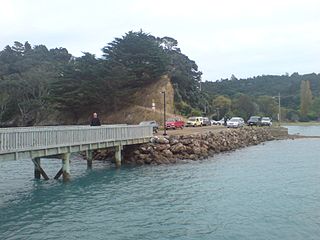
Kennedy Bay is a locality in the north eastern Coromandel Peninsula of New Zealand. The Harataunga and Omoho Streams flow from the Coromandel Range past the settlement and into the bay to the east.

<span class="mw-page-title-main">Māpua, New Zealand</span> Settlement in Tasman District, New Zealand

Māpua is a small town in the South Island of New Zealand. It is to the west of Nelson on State Highway 60 and on the coastline of Tasman Bay.

<span class="mw-page-title-main">Parua Bay</span> Place in Northland Region, New Zealand

Parua Bay is a locality and bay on the northern side of the Whangārei Harbour in Northland, New Zealand. Whangārei is 19 km to the west, and Whangārei Heads are 10 km to the south east, with Munro Bay between the two. The western head is called Manganese Point, and the eastern is Reserve Point. The Nook is a small bay just to the north of Reserve Point.

<span class="mw-page-title-main">Whangārei Heads</span> Place in Northland Region, New Zealand

Whangārei Heads is a locality and volcanic promontory on the northern side of the Whangārei Harbour in Northland, New Zealand. Whangārei is 29 km (18 mi) to the north-west, and Ocean Beach is 8 km (5.0 mi) to the south-east, with Taurikura between the two. Mount Manaia rises to 420 metres to the east.

<span class="mw-page-title-main">Putiki</span> Suburb of Whanganui

Putiki is a settlement in the Whanganui District and Manawatū-Whanganui region of New Zealand's North Island, located across the Whanganui River from Whanganui city. It includes the intersection of State Highway 3 and State Highway 4.

<span class="mw-page-title-main">Palm Beach, New Zealand</span> Suburb in Auckland, New Zealand

Palm Beach is a settlement on Waiheke Island in northern New Zealand. The eponymous beach is named for phoenix palms at the eastern end, and has safe swimming and white sand.

<span class="mw-page-title-main">Surfdale</span> Suburb in Auckland, New Zealand

Surfdale is a settlement on Waiheke Island in northern New Zealand. The original name being Okahu, Surfdale beach on Huruhi Bay has tidal mudflats, and is often used for windsurfing or kitesurfing. Shelly beach on Pukiki Bay is sandy and shelly. The area was developed in the mid–1920s.

<span class="mw-page-title-main">Onetangi</span> Suburb in Auckland, New Zealand

Onetangi is a settlement on the north coast of Waiheke Island in New Zealand. It has a long white-sand beach fronting onto Onetangi Bay.

<span class="mw-page-title-main">Rural Waiheke</span> Locality in New Zealand

Rural Waiheke comprises the eastern and southern parts of Waiheke Island in the Hauraki Gulf near Auckland, in New Zealand. Apart from small settlements at Ōmiha and Orapiu, the area south and east of Onetangi is mostly private farmland. Waiheke Island Aerodrome is approximately in the centre of the island.

<span class="mw-page-title-main">Kawakawa Bay</span> Rural settlement in Auckland Region, New Zealand

Kawakawa Bay is an east coast bay and settlement in the Franklin area of New Zealand's Auckland Region.

<span class="mw-page-title-main">Ōmiha</span> Place in Auckland Region, New Zealand

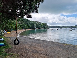
Ōmiha is a rural settlement on the southwest coast of Waiheke Island in the Auckland Region of New Zealand. The settlement began when the O'Brien brothers subdivided their farm in 1922, naming it "Omiha Beach Estate". The area is also known as Rocky Bay from the bay to the south. A proposal that the name change to Rocky Bay in 2017 met strong opposition and was rejected. The name Ōmiha, with the macron, became official in 2018.

References

  1. 1 2 "ArcGIS Web Application". statsnz.maps.arcgis.com. Retrieved 24 July 2022.
  2. 1 2 "Population estimate tables - NZ.Stat". Statistics New Zealand . Retrieved 25 October 2023.
  3. "Untitled". Auckland Star . Papers Past. 11 November 1915. p. 4. Retrieved 1 November 2021.
  4. "Advertisements". Pukekohe & Waiuku Times. Papers Past. 28 January 1916. p. 3. Retrieved 1 November 2021.
  5. 1 2 "Statistical area 1 dataset for 2018 Census". Statistics New Zealand. March 2020. Ostend (148700). 2018 Census place summary: Ostend
  6. "New Zealand Schools Directory". New Zealand Ministry of Education. Retrieved 14 March 2024.
  7. Education Counts: Waiheke Primary School