
The City of Gosnells is a local government area in the southeastern suburbs of the Western Australian capital city of Perth, located northwest of Armadale and about 20 kilometres (12 mi) southeast of Perth's central business district. The City covers an area of 128 square kilometres (49.42 sq mi), a portion of which is state forest rising into the Darling Scarp to the east, and had a population of approximately 118,000 at the 2016 Census. The largest activity centre in the City is the Central Maddington shopping centre. District centres exist in the Gosnells town centre, Thornlie and Canning Vale.

Peppermint Grove is an affluent western suburb of Perth, Western Australia on the north bank of the Swan River at Freshwater Bay. Its local government area, the smallest in the country, is the Shire of Peppermint Grove. The suburb was named after its trademark Swan River peppermint trees lining many streets. The suburb has long been associated with Western Australia's wealthiest and oldest families. Their prosperity is reflected in the many historical houses in the area, such as The Cliffe and the Federation Queen Anne style St Just. Colin Barnett, a former Premier of Western Australia, dubbed the suburb "Monaco of WA" due to its small size and concentration of wealth.

Atwell is a suburb within the metropolitan area of Perth, Western Australia, situated 21 kilometres (13 mi) south of Perth City, and located in the City of Cockburn local government area.
Bickley is a suburb located within the City of Kalamunda, in Perth, Western Australia.

Lesmurdie is a suburb of Perth, Western Australia, located within the City of Kalamunda. It was established in 1897 by Archibald Sanderson, a politician and journalist, who began buying properties in the area from the Canning Jarrah Timber Company to build up a rural retreat and fruit-growing property. He named it after Lesmurdie Cottage, a shooting box near Dufftown, Scotland that his father had rented. It was officially gazetted on 8 June 1959.
Wattle Grove is a suburb of Perth, Western Australia, located within the City of Kalamunda.

Whiteman Park is a 4,000-hectare bushland area located 22 km (14 mi) north of Perth, Western Australia. The park is in the suburb of Whiteman, in the Swan Valley in the upper reaches of the Swan River.

The Serpentine Dam is a major water supply dam for Perth, Western Australia. The dam is used to store water that is released at a controlled rate to regulate the level in the Serpentine Pipehead Dam reservoir, which in turn feeds water to the metropolitan trunk main network depending on demand. Construction of the dam was completed in 1961.

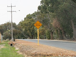
The City of Kalamunda is a local government area in the eastern metropolitan region of the Western Australian capital city of Perth about 25 kilometres (16 mi) east of Perth's central business district. The area covers 324 square kilometres (125 sq mi), much of which is state forest rising into the Darling Scarp to the east. In the mid 2010s, the area had a population of 57 thousand people.
Toodyay Road is a mostly 2-lane undivided single carriageway in Western Australia, running from the north-eastern Perth suburb of Middle Swan, through Gidgegannup and Bailup, to the Wheatbelt town of Toodyay. It is signposted as State Route 50.

Cullacabardee is a northeastern rural suburb of Perth, the capital city of Western Australia, located 21 km (13 mi) from Perth's central business district via Alexander Drive or Beechboro Road. It is in the City of Swan local government area. Most of the suburb is covered in native sheoak and banksia forest. A small Noongar community is based on Baal Street, a drug rehabilitation retreat is located off Gnangara Road in the suburb's northeast, and the Perth International Telecommunications Centre facility is based in the suburb's northwest.
Bickley Pumpback Dam, known also as the Lower Bickley Brook reservoir, is located in Perth, Western Australia.

The Canning Dam and reservoir provide a major fresh water resource for the city of Perth, Western Australia. The dam is situated on the Darling Scarp and is an impoundment of the Canning River. It is noted for its innovative structural and hydraulic design that was considered to be at the forefront of concrete gravity dam design at the time of construction. The Canning Dam was Perth's primary water supply up until the 1960s when other sources of fresh water were tapped. Currently the dam supplies approximately 20 percent of Perth's fresh water. Inflow into the Canning Reservoir is estimated to be 22 gigalitres and has a storage capacity of 90.352 gigalitres.
Araluen Pumpback Dam is a minor dam on the Canning River. Water stored in the dam can be pumped back into Canning Dam where the water is treated and distributed through the metropolitan trunk main distribution system.

Churchman Brook Dam is an earthfill embankment dam approximately 30 kilometres (20 mi) south east of Perth, Western Australia in the City of Armadale. The reservoir is a water source for Perth.

Kalamunda is an electoral district of the Legislative Assembly in the Australian state of Western Australia.
As Australia's supply of freshwater is increasingly vulnerable to droughts, possibly as a result of climate change, there is an emphasis on water conservation and various regions have imposed restrictions on the use of water.
Lesmurdie Senior High School is a public co-educational high school in the Perth suburb of Lesmurdie, Western Australia.
Kattamordo Heritage Trail is a walk track in the Shire of Mundaring and the City of Kalamunda in the Darling Range.

Arthur James Hillman was born in Perth, Western Australia in 1884. Arthur Hillman was a civil engineer who worked for the Public Works Department of Western Australia. He served with the Australian Army during World War I and spent most of his service tunnelling under the front line trenches in France. When he returned to Perth after the war, he resumed working for the Public Works Department. Hillman worked on water supply projects including being executive engineer on the Lower Bickley Brook Reservoir. Hillman died in 1922 as a result of an ongoing medical issue, which was caused by being gassed during WWI.

