Otterville, Missouri

Last updated

Otterville, Missouri
City
Cooper County Missouri Incorporated and Unincorporated areas Otterville Highlighted.svg
Location of Otterville, Missouri
USA Missouri relief location map.svg
Red pog.svg
Otterville
Location within Missouri
Usa edcp relief location map.png
Red pog.svg
Otterville
Location within the United States
Coordinates: 38°42′11″N93°00′08″W / 38.70306°N 93.00222°W / 38.70306; -93.00222 [1]
CountryUnited States
State Missouri
County Cooper
Township Otterville
Founded1837 (as Elkton)
1848 (as Otterville)
Incorporated1848
Named for Otter Creek
Area
[2]
  Total0.49 sq mi (1.27 km2)
  Land0.49 sq mi (1.27 km2)
  Water0.00 sq mi (0.00 km2)
Elevation
[1]
810 ft (250 m)
Population
 (2020)
  Total440
  Density899.80/sq mi (347.23/km2)
Time zone UTC-6 (Central (CST))
  Summer (DST) UTC-5 (CDT)
ZIP code
65348
Area code 660
FIPS code 29-55478 [3]
GNIS feature ID =2396108 [1]

Otterville is a city in southwest Cooper County, Missouri, United States. The population was 454 at the 2010 census.

Contents

History

Otterville was originally called Elkton, and under the latter name was platted in 1837. [4] The present name is after nearby Otter Creek. [5] A post office called Otterville has been in operation since 1848. [6]

Geography

Otterville is located on routes A and BB three-quarters of a mile north of the county line and U.S. Route 50. The community is on the Long Branch tributary to the Lamine River and the Lamine River Conservation Area which is one mile east of the town. Clifton City is about 4.5 miles to the north on route BB. Syracuse is about seven miles to the east-southeast in Morgan County and Smithton is about 4.5 miles to the southwest in Pettis County. Sedalia is twelve miles to the west. [7]

According to the United States Census Bureau, the city has a total area of 0.49 square miles (1.27 km2), all land. [8]

Demographics

Historical population
CensusPop.Note
1880 505
1890 439−13.1%
1900 384−12.5%
1910 45318.0%
1920 4826.4%
1930 421−12.7%
1940 4302.1%
1950 414−3.7%
1960 4160.5%
1970 4405.8%
1980 4727.3%
1990 5077.4%
2000 476−6.1%
2010 454−4.6%
2020 440−3.1%
U.S. Decennial Census [9]

2010 census

As of the census [10] of 2010, there were 454 people, 190 households, and 125 families living in the city. The population density was 926.5 inhabitants per square mile (357.7/km2). There were 224 housing units at an average density of 457.1 per square mile (176.5/km2). The racial makeup of the city was 96.3% White, 1.3% African American, 0.7% Native American, and 1.8% from two or more races. Hispanic or Latino of any race were 1.1% of the population.

There were 190 households, of which 33.7% had children under the age of 18 living with them, 48.9% were married couples living together, 12.6% had a female householder with no husband present, 4.2% had a male householder with no wife present, and 34.2% were non-families. 30.0% of all households were made up of individuals, and 15.3% had someone living alone who was 65 years of age or older. The average household size was 2.39 and the average family size was 2.90.

The median age in the city was 36 years. 26.9% of residents were under the age of 18; 5.6% were between the ages of 18 and 24; 25.5% were from 25 to 44; 26% were from 45 to 64; and 15.9% were 65 years of age or older. The gender makeup of the city was 47.1% male and 52.9% female.

2000 census

As of the census [3] of 2000, there were 476 people, 200 households, and 136 families living in the city. The population density was 972.5 inhabitants per square mile (375.5/km2). There were 226 housing units at an average density of 461.7 per square mile (178.3/km2). The racial makeup of the city was 98.53% White, 0.21% Native American, 0.42% from other races, and 0.84% from two or more races. Hispanic or Latino of any race were 0.84% of the population.

There were 200 households, out of which 28.0% had children under the age of 18 living with them, 53.0% were married couples living together, 9.5% had a female householder with no husband present, and 32.0% were non-families. 27.0% of all households were made up of individuals, and 11.5% had someone living alone who was 65 years of age or older. The average household size was 2.38 and the average family size was 2.85.

In the city the population was spread out, with 22.1% under the age of 18, 11.3% from 18 to 24, 22.9% from 25 to 44, 27.7% from 45 to 64, and 16.0% who were 65 years of age or older. The median age was 40 years. For every 100 females, there were 95.9 males. For every 100 females age 18 and over, there were 89.3 males.

The median income for a household in the city was $27,031, and the median income for a family was $33,750. Males had a median income of $25,125 versus $16,250 for females. The per capita income for the city was $12,741. About 8.1% of families and 14.3% of the population were below the poverty line, including 21.9% of those under age 18 and 15.6% of those age 65 or over.

Media

KCVK (107.7 FM) is an affiliate of Spirit FM, a network of non-commercial Christian music and talk stations owned by Lake Area Educational Broadcasting Foundation. KCVK's programming originates from KCVO in Camdenton.

Related Research Articles

<span class="mw-page-title-main">Cooper County, Missouri</span> County in Missouri, United States

Cooper County is located in the central portion of the U.S. state of Missouri. As of the 2020 United States census, the population was 17,103. Its county seat is Boonville. The county was organized December 17, 1818 and named for Sarshell Cooper, a frontier settler who was killed by Native Americans near Arrow Rock in 1814. It is a part of the Columbia, Missouri metropolitan area.

<span class="mw-page-title-main">Otterville, Illinois</span> Town in Illinois, United States

Otterville is an incorporated town in Jersey County, Illinois, United States. As of the 2020 census, the town had a total population of 87.

<span class="mw-page-title-main">Rosendale, Missouri</span> City in Missouri, United States

Rosendale is a city in Andrew County, Missouri, United States. The population was 143 at the 2010 census.

<span class="mw-page-title-main">Washington, Missouri</span> City in Missouri, United States

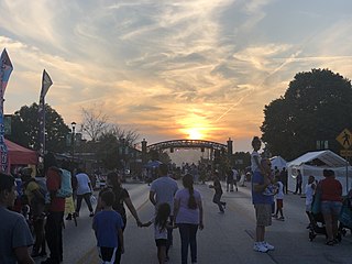
Washington is a city on the south banks of the Missouri River, 50 miles west of St. Louis, Missouri, and the largest in Franklin County, Missouri, United States. The estimated population in July 2021 was 14,916, an increase of 7% since the 2010 census. It is the corncob pipe capital of the world, with Missouri Meerschaum located on the riverfront.

<span class="mw-page-title-main">Grandview, Missouri</span> City in Missouri, United States

Grandview is a city in Jackson County, Missouri, United States. The population was 24,475 at the 2010 census. It is part of the Kansas City metropolitan area.

<span class="mw-page-title-main">Meadville, Missouri</span> City in Missouri, United States

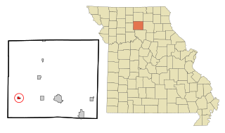
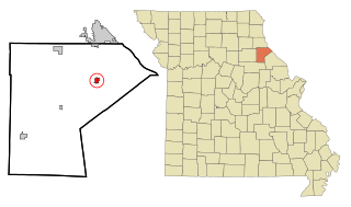
Meadville is a city in southwest Linn County, Missouri, United States. The population was 415 at the 2020 census.

<span class="mw-page-title-main">Morehouse, Missouri</span> City in Missouri, United States

Morehouse is a city in New Madrid County, Missouri, United States. The population was 973 at the 2010 census.

<span class="mw-page-title-main">Gainesville, Missouri</span> City in Missouri, United States

Gainesville is a city in Ozark County, Missouri, United States. The population was 745 at the 2020 census. It is the county seat of Ozark County.

<span class="mw-page-title-main">Houstonia, Missouri</span> City in Missouri, United States

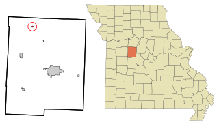
Houstonia is a city in northwest Pettis County, Missouri, United States. The population was 220 at the 2010 census.

<span class="mw-page-title-main">Parkville, Missouri</span> City in Missouri, United States

Parkville is a city in Platte County, Missouri, United States and is a part of the Kansas City Metropolitan Area. The population was 7,177 at the 2020 census. Parkville is known for its antique shops, art galleries, and historic downtown. The city is home to Park University, English Landing Park, Platte Landing Park, and the National Golf Club of Kansas City. Large neighborhoods in Parkville include: Riss Lake, The National, Thousand Oaks, Creekside, Parkville Heights, River Hills, Riverchase, The Bluffs, Downtown, and Pinecrest.

<span class="mw-page-title-main">Bolivar, Missouri</span> City in Missouri, United States

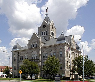
Bolivar is a city and county seat of Polk County, Missouri, United States.

<span class="mw-page-title-main">New London, Missouri</span> City in Missouri, United States

New London is a city in Ralls County, Missouri, United States. The population was 943 at the 2020 census. It is the county seat of Ralls County.

<span class="mw-page-title-main">Benton, Missouri</span> City in Missouri, United States

Benton is a city in Scott County, Missouri, United States. The population was 863 at the 2010 census. It is the county seat of Scott County.

<span class="mw-page-title-main">Lakeshire, Missouri</span> City in Missouri, United States

Lakeshire is a city in St. Louis County, Missouri, United States. The population was 1,432 at the 2010 census.

<span class="mw-page-title-main">Manchester, Missouri</span> City in Missouri, United States

Manchester is a city in St. Louis County, Missouri, United States. The population was 18,333 at the 2020 census.

<span class="mw-page-title-main">Velda City, Missouri</span> City in Missouri, United States

Velda City is a city in St. Louis County, Missouri, United States. The population was 1,420 at the 2010 census.

<span class="mw-page-title-main">Milan, Missouri</span> City in Missouri, United States

Milan is a city in Sullivan County, Missouri, United States. The population was 1,819 at the 2020 census. It is the county seat of Sullivan County.

<span class="mw-page-title-main">Gower, Missouri</span> City in Missouri, United States

Gower is a city in Buchanan and Clinton counties in the U.S. state of Missouri and is part of the Kansas City metropolitan area. The population was 1,526 at the 2010 census.

<span class="mw-page-title-main">Osborn, Missouri</span> City in Missouri, United States

Osborn is a city in northern Clinton and southern DeKalb counties in the U.S. state of Missouri. The population was 374 at the 2020 census.

<span class="mw-page-title-main">Browning, Missouri</span> City in Missouri, United States

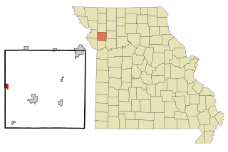
Browning is a city in Linn and Sullivan counties in the U.S. state of Missouri. The population was 219 at the 2020 census.

References

  1. 1 2 3 U.S. Geological Survey Geographic Names Information System: Otterville, Missouri
  2. "ArcGIS REST Services Directory". United States Census Bureau. Retrieved August 28, 2022.
  3. 1 2 "U.S. Census website". United States Census Bureau . Retrieved January 31, 2008.
  4. "Cooper County Place Names, 1928–1945 (archived)". The State Historical Society of Missouri. Archived from the original on June 24, 2016. Retrieved September 22, 2016.{{cite web}}: CS1 maint: bot: original URL status unknown (link)
  5. Eaton, David Wolfe (1916). How Missouri Counties, Towns and Streams Were Named. The State Historical Society of Missouri. pp.  281.
  6. "Post Offices". Jim Forte Postal History. Retrieved September 22, 2016.
  7. Missouri Atlas & Gazetteer, DeLorme, 1998, First edition, p. 36, ISBN   0-89933-224-2
  8. "US Gazetteer files 2010". United States Census Bureau. Archived from the original on July 2, 2012. Retrieved July 8, 2012.
  9. "Census of Population and Housing". Census.gov. Retrieved June 4, 2015.
  10. "U.S. Census website". United States Census Bureau . Retrieved July 8, 2012.