Oyster Bay Cove, New York

Last updated

Oyster Bay Cove, New York
Incorporated Village of Oyster Bay Cove
Village of Oyster Bay Cove sign.jpg
A village sign.
Nassau County New York incorporated and unincorporated areas Oyster Bay Cove highlighted.svg
Location in Nassau County and the state of New York.
Location map Long Island.png
Red pog.svg
Location within the state of New York
USA New York location map.svg
Red pog.svg
Oyster Bay Cove, New York (New York)
Usa edcp location map.svg
Red pog.svg
Oyster Bay Cove, New York (the United States)
Coordinates: 40°51′46″N73°29′41″W / 40.86278°N 73.49472°W / 40.86278; -73.49472
Country Flag of the United States.svg  United States
State Flag of New York.svg  New York
County Flag of Nassau County, New York.svg  Nassau County, New York
Town Oyster Bay
Incorporated 1931
Area
[1]
  Total4.25 sq mi (11.02 km2)
  Land4.18 sq mi (10.84 km2)
  Water0.07 sq mi (0.18 km2)
Elevation
59 ft (18 m)
Population
 (2020)
  Total2,265
  Density541.35/sq mi (209.00/km2)
Time zone UTC-5 (Eastern (EST))
  Summer (DST) UTC-4 (EDT)
ZIP codes
11771, 11791
Area code 516
FIPS code 36-56011
GNIS feature ID0959719
Website www.oysterbaycove.net

Oyster Bay Cove is a village located within the Town of Oyster Bay in Nassau County, on Long island, in New York. The population was 2,197 at the 2010 census. it is part of the Greater Oyster Bay area anchored by Oyster Bay.

Contents

Youngs Memorial Cemetery, resting place of President Theodore Roosevelt, is located in the village.

History

The village incorporated in 1931, and on January 14, 1932, residents unanimously voted in George T. Bowdoin as the first Mayor of Oyster Bay Cove. [2] [3]

The village expanded its borders through annexations in 1963. [2] [4]

Geography

U.S. Census Map Oyster-bay-cove-ny-map.gif
U.S. Census Map

According to the United States Census Bureau, the village has a total area of 4.3 square miles (11 km2), of which 4.2 square miles (11 km2) is land and 0.1 square miles (0.26 km2) (1.41%) is water. [5]

Demographics

Historical population
CensusPop.Note
1940 466
1950 56120.4%
1960 98876.1%
1970 1,32033.6%
1980 1,79936.3%
1990 2,10917.2%
2000 2,2627.3%
2010 2,197−2.9%
2020 2,2653.1%
U.S. Decennial Census [6]

At the 2000 census there were 2,262 people, 725 households, and 633 families in the village. The population density was 538.1 inhabitants per square mile (207.8/km2). There were 742 housing units at an average density of 176.5 per square mile (68.1/km2). The racial makeup of the village was 90.23% White, 5.97% Asian, 1.77% African American, 0.09% Native American, 0.97% from other races, and 0.97% from two or more races. Hispanic or Latino of any race were 1.68%. [7]

Of the 725 households 42.5% had children under the age of 18 living with them, 82.3% were married couples living together, 3.4% had a female householder with no male present, and 12.6% were non-families. 9.9% of households were one person and 4.3% were one person aged 65 or older. The average household size was 3.12 and the average family size was 3.31.

The age distribution was 28.4% under the age of 18, 5.5% from 18 to 24, 21.9% from 25 to 44, 32.3% from 45 to 64, and 11.9% 65 or older. The median age was 42 years. For every 100 females, there were 94.7 males. For every 100 females age 18 and over, there were 98.5 males.

The median household income was in excess $200,000, as is the median family income . Males had a median income of over $100,000 versus $53,750 for females. The per capita income for the village was $103,203. About 1.3% of families and 2.6% of the population were below the poverty line, including 0.8% of those under age 18 and 5.6% of those age 65 or over.

Education

School districts

Oyster Bay Cove is primarily within the boundaries of (and is thus served by) the Oyster Bay–East Norwich Central School District. [8] [9] However, southern portions and some of the easternmost extremes of the village are served by the Syosset Central School District and the Cold Spring Harbor Central School District, respectively. [8] [9] As such, students who attend public schools and reside in Oyster Bay Cove attend school in one of these three districts depending on where they live in the village. [8] [9]

Library districts

Oyster Bay Cove is located within the boundaries of Cold Spring Harbor's library district, the Oyster Bay–East Norwich Library District, and the Syosset Library District. [8] The boundaries of these districts within the village roughly correspond with those of the school districts. [8]

Related Research Articles

<span class="mw-page-title-main">Bowdoin, Maine</span> Town in the state of Maine, United States

Bowdoin is a town in Sagadahoc County, Maine, United States. Bowdoin is included in the Lewiston-Auburn, Maine metropolitan New England city and town area. The population was 3,136 at the 2020 census. Bowdoin is 31 land miles north of Portland, and 21 land miles south of Augusta.

<span class="mw-page-title-main">Centre Island, New York</span> Village in New York, United States

Centre Island is an upscale residential village located within the Town of Oyster Bay in Nassau County, on Long Island, in New York, United States. Centre Island is home to many high profile figures in politics, advertising, media, finance, and entertainment. Its population was 410 as of the 2010 census.

<span class="mw-page-title-main">Cove Neck, New York</span> Village in New York, United States

Cove Neck is a village located within the Town of Oyster Bay in Nassau County, on the North Shore of Long Island, in New York. The population was 286 at the 2010 census.

<span class="mw-page-title-main">East Massapequa, New York</span> Hamlet and census-designated place in New York, United States

East Massapequa is a hamlet and census-designated place (CDP) located within the Town of Oyster Bay in Nassau County, on the South Shore of Long Island, in New York, United States. The population was 19,069 at the 2010 census.

<span class="mw-page-title-main">East Norwich, New York</span> Hamlet and census-designated place in New York, United States

East Norwich is a hamlet and census-designated place (CDP) located within the Town of Oyster Bay in Nassau County, on the North Shore of Long Island, in New York, United States. The population was 2,792 at the time of the 2020 census.

<span class="mw-page-title-main">Glen Head, New York</span> Hamlet and census-designated place in New York, United States

Glen Head is a hamlet and census-designated place (CDP) located within the Town of Oyster Bay in Nassau County, on the North Shore of Long Island, in New York, United States. It is considered part of the greater Glen Cove area, which is anchored by the City of Glen Cove. The population was 4,837 at the 2020 census.

<span class="mw-page-title-main">Glenwood Landing, New York</span> Hamlet and census-designated place in New York, United States

Glenwood Landing is a hamlet and census-designated place (CDP) in Nassau County, New York. The population was 3,948 at the time of the 2020 census.

<span class="mw-page-title-main">Greenvale, New York</span> Hamlet and census-designated place in New York, United States

Greenvale is a hamlet and census-designated place (CDP) in the towns of North Hempstead and Oyster Bay in Nassau County, on the North Shore of Long Island, in New York, United States. It is considered part of the Greater Roslyn area, which is anchored by the Incorporated Village of Roslyn. The population was 1,069 at the time of the 2020 census.

<span class="mw-page-title-main">Laurel Hollow, New York</span> Village in New York, United States

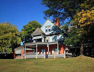
Laurel Hollow is a village in the Town of Oyster Bay in Nassau County, on the North Shore of Long Island, in New York, United States. The population was 1,952 at the 2010 census. According to Bloomberg BusinessWeek, Laurel Hollow was the eighth wealthiest town in America.

<span class="mw-page-title-main">Matinecock, New York</span> Village in New York, United States

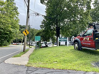
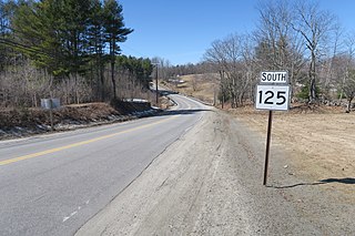
Matinecock is a village located within the Town of Oyster Bay in Nassau County, on Long Island, in New York, United States. The population was 810 at the 2010 census.

<span class="mw-page-title-main">Mill Neck, New York</span> Village in New York, United States

Mill Neck is a village in the Town of Oyster Bay in Nassau County, on the North Shore of Long Island, in New York, United States. The population was 997 at the 2010 census.

<span class="mw-page-title-main">Muttontown, New York</span> Village in New York, United States

Muttontown is a village located within the Town of Oyster Bay in Nassau County, on Long Island, in New York, United States. The population was 3,497 at the 2010 census. it is part of the Greater Oyster Bay area anchored by Oyster Bay.

<span class="mw-page-title-main">North Massapequa, New York</span> Hamlet and census-designated place in New York, United States

North Massapequa is a hamlet and census-designated place (CDP) located on Long Island within the Town of Oyster Bay in Nassau County, on Long Island, in New York, United States. It is considered part of the Greater Massapequa area, which is anchored by Massapequa. The population was 17,886 at the 2010 census.

<span class="mw-page-title-main">Old Brookville, New York</span> Village in New York, United States

Old Brookville is a village located within the Town of Oyster Bay in Nassau County, on the North Shore of Long Island, in New York, United States. The village population was 2,020 at the time of the 2020 census.

<span class="mw-page-title-main">Syosset, New York</span> Hamlet and census-designated place in New York, United States

Syosset is a hamlet and census-designated place in the Town of Oyster Bay, in Nassau County, on the North Shore of Long Island, in New York, United States. The population was 19,259 at the 2020 census.

<span class="mw-page-title-main">Woodbury, Nassau County, New York</span> Hamlet and census-designated place in New York, United States

Woodbury is a hamlet and census-designated place (CDP) located within the Town of Oyster Bay in Nassau County, on Long Island, in New York, United States. The population was 9,335 at the 2020 census.

<span class="mw-page-title-main">Oyster Creek, Texas</span> City in Texas, United States

For the river in Fort Bend and Brazoria Counties, Texas see: Oyster Creek (Texas).

<span class="mw-page-title-main">North Bay, Wisconsin</span> Village in Wisconsin, United States

North Bay is a village in Racine County, Wisconsin, United States. The population was 209 at the 2020 census.

<span class="mw-page-title-main">Oyster Bay (hamlet), New York</span> Hamlet and census-designated place in New York, United States

Oyster Bay is a hamlet and census-designated place (CDP) within the town of Oyster Bay on the North Shore of Long Island in Nassau County in the state of New York, United States. The hamlet is also the site of a station on the Oyster Bay Branch of the Long Island Rail Road and the eastern termination point of that branch of the railroad.

<span class="mw-page-title-main">Oyster Bay, New York</span> Town in New York, United States

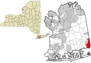
The Town of Oyster Bay is the easternmost of the three towns that make up Nassau County, New York, United States. Part of the New York metropolitan area, it is the only town in Nassau County to extend from the North Shore to the South Shore of Long Island. As of the 2020 census, it had a population of 301,332, Making it the 5th most populous city or town in the state.

References

  1. "ArcGIS REST Services Directory". United States Census Bureau. Retrieved September 20, 2022.
  2. 1 2 Winsche, Richard (October 1, 1999). The History of Nassau County Community Place-Names. Interlaken, New York: Empire State Books. ISBN   978-1557871541.
  3. "OYSTER BAY COVE ELECTS.; G.T. Bowdoin Chosen First Mayor of New Village". The New York Times. January 15, 1932. ISSN   0362-4331 . Retrieved December 20, 2021.
  4. "Welcome to the Village of Oyster Bay Cove".
  5. "US Gazetteer files: 2010, 2000, and 1990". United States Census Bureau. February 12, 2011. Retrieved April 23, 2011.
  6. "Census of Population and Housing". Census.gov. Retrieved June 4, 2015.
  7. "U.S. Census website". United States Census Bureau . Retrieved January 31, 2008.
  8. 1 2 3 4 5 "Long Island Index: Interactive Map". www.longislandindexmaps.org. Retrieved August 9, 2021.
  9. 1 2 3 "Composite School District Boundaries Shapefiles". NCES. Retrieved October 23, 2020.