Related Research Articles

Taney County is a county in the southwestern portion of the U.S. state of Missouri. As of the 2020 census, the population was 56,066. Its county seat is Forsyth. It is included in the Branson, Missouri, Micropolitan Statistical Area.
Powersite is an unincorporated community in Taney County, Missouri, United States. It is located across Lake Taneycomo from Forsyth on the southeast end of Powersite Dam. The community is part of the Branson, Missouri Micropolitan Statistical Area.
Baird Mountain is a summit in Taney County in southern Missouri. The peak has an elevation of 1,234 feet (376 m) The peak lies just southeast of the Table Rock Lake dam above Missouri Route 265. Table Rock State Park lies just to the west. Baird Mountain is where the United States Army Corps of Engineers quarried the rock to make all the concrete for Table Rock Dam. The rock was transported off Baird Mountain with a one-mile-long conveyor belt to the site of the dam.
Bull Creek is a stream in Christian and Taney counties in the Ozarks of southern Missouri.
Cedar Valley is an extinct town in Taney County, in the U.S. state of Missouri. The townsite was on Long Creek and Big Cedar Hollow just north of the current Missouri Route 86 bridge. The location is currently submerged under the waters of Table Rock Lake.
Day is an unincorporated community in Taney County, in the Ozarks of southern Missouri. Day is located in the northwest part of the county, just south of the Taney-Christian county line on Missouri Route 176 and approximately one mile west of U.S. Route 65.
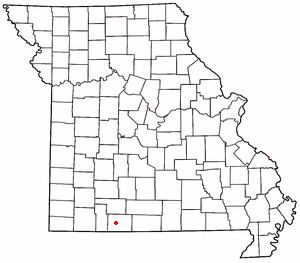
Dickens is an unincorporated community in north central Taney County, in the U.S. state of Missouri. The community is located on Missouri Route 76, approximately one mile southwest of Taneyville and 4.5 miles northeast of Forsyth.
Eastview is an extinct town in northeastern Taney County, in the Ozarks of southwest Missouri. The location is along a ridge occupied by Farm Road 147 which is a portion of the scenic Glade Top Trail within the Mark Twain National Forest.
Flag is an extinct community in Taney County, in the U.S. state of Missouri. It was on the west side of the county, near the Stone County line, a bit north of the present day location of the Table Rock Dam.
Garber is an unincorporated community in western Taney County in the Ozarks of southern Missouri. Garber is located along the Missouri Pacific Railroad line and Roark Creek, approximately four miles northwest of Branson.
Gettman Hollow is a valley in Taney County in the Ozarks of southwestern Missouri. Gettman Hollow is a tributary to Bull Creek.
Gravelly Hollow is a valley in northern Taney County in the Ozarks of southwest Missouri. The stream in the valley is a tributary to Bull Creek.
Hercules is an unincorporated community in Taney County, in the Ozarks of southern Missouri. Hercules is located on Missouri Route 125, south of Bradleyville and just northeast of the Hercules Glades Wilderness protected area. The townsite is adjacent to Brushy Creek and within the Mark Twain National Forest.
Melva is an extinct town in southern Taney County, in the Ozarks of southwest Missouri. The GNIS classifies it as a populated place. The site was located south of Hollister on the east bank of Turkey Creek along the Missouri Pacific Railroad. On March 11, 1920, the town was destroyed by a deadly tornado that killed 11 people, including 9 children. Some of the remains of Melva, mostly foundations of homes, remain on the site today.
Mildred is an unincorporated community in Taney County, in the Ozarks of southern Missouri. Mildred is located on Missouri Route 76, south of Forsyth and east of Kirbyville.
Mincy is an unincorporated community in south-central Taney County, in the Ozarks of southern Missouri, United States. Mincy is located approximately four miles north of the Missouri-Arkansas border and near the upper end of Bull Shoals Lake of the White River. Mincy is the namesake for the Drury-Mincy Conservation Area to the south and east.
Nance is an extinct town in eastern Taney County, in the Ozarks of southwest Missouri. The GNIS classifies it as a populated place. The townsite sits above the east bank of the west fork of Big Creek about one mile north of U.S. Route 160 and about 1.7 miles west of the Taney - Ozark county line. The site is at an elevation of 876 feet.
Swan Creek is a stream in the Ozarks of southern Missouri. It is a tributary of the White River downstream from the Lake Taneycomo dam.
Swan is an unincorporated community in north central Taney County, in the U.S. state of Missouri. Swan is located on Missouri Route AA, along Blue Creek and approximately 3.5 miles northwest of Taneyville.

Turkey Creek is a stream in the Ozarks of southern Missouri and northern Arkansas. It is a tributary of Lake Taneycomo. The stream source is two-thirds of a mile south of the Missouri - Arkansas border in Boone County north of the village of Crest. The Missouri Pacific Railroad line follows the stream course after exiting the Crest railroad tunnel under Arkansas State Route 14 at Crest. North of the state line in Taney County the stream flows north through west Hollister to its confluence with Lake Taneycomo south of Branson. The stream covers a linear distance of 86 mi (138 km) between the border and its confluence.
References
- ↑ U.S. Geological Survey Geographic Names Information System: Ozark Beach, Missouri
- ↑ Missouri Atlas & Gazetteer, DeLorme, 1998, First edition, p. 62, ISBN 0-89933-224-2
- ↑ "Taney County Place Names, 1928–1945". The State Historical Society of Missouri. Archived from the original on June 24, 2016. Retrieved December 27, 2016.
- ↑ "Post Offices". Jim Forte Postal History. Retrieved December 27, 2016.
Municipalities and communities of Taney County, Missouri, United States | ||
|---|---|---|
| Cities |  | |
| Villages | ||
| Townships | ||
| CDP | ||
| Other unincorporated communities | ||
| Ghost towns | ||
| Footnotes | ‡This populated place also has portions in an adjacent county or counties | |
36°39′32″N93°08′20″W / 36.65889°N 93.13889°W
| | This Taney County, Missouri state location article is a stub. You can help Wikipedia by expanding it. |