Rueter, Missouri

Last updated

MOMap-doton-Rueter.png

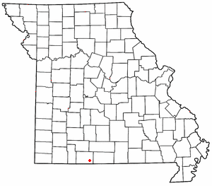
Rueter is an extinct town in southeastern Taney County, Missouri. The GNIS classifies it as a populated place. [1] The town site is located at western intersection of U.S. Route 160 and Route 125. [2] Rueter is part of the Branson, Missouri Micropolitan Statistical Area.

A post office called Rueter was established in 1906. [3] A variant spelling was "Reuter". [1] One Mr. Reuter, an early postmaster, gave the community his last name. [4]

Related Research Articles

<span class="mw-page-title-main">Taney County, Missouri</span> County in Missouri, United States

Taney County is a county in the southwestern portion of the U.S. state of Missouri. As of the 2020 census, the population was 56,066. Its county seat is Forsyth. It is included in the Branson, Missouri, Micropolitan Statistical Area.

<span class="mw-page-title-main">Protem, Missouri</span>

Protem is an unincorporated community in southeastern Taney County, Missouri, United States. It is located on Route 125, and is approximately two miles north of the Missouri-Arkansas state line. Protem is part of the Branson, Missouri Micropolitan Statistical Area.

<span class="mw-page-title-main">McClurg, Missouri</span>

McClurg is an unincorporated community in extreme northeastern Taney County, Missouri, United States. It is located on Missouri Supplemental Route W, approximately three miles east of Brownbranch or twenty miles (32 km) northeast of Forsyth. McClurg is part of the Branson, Missouri Micropolitan Statistical Area.

<span class="mw-page-title-main">Walnut Shade, Missouri</span>

Walnut Shade is an unincorporated community in Taney County, Missouri, United States. It is located approximately six miles northwest of Forsyth on U.S. Route 160. The town sits at the confluence of Bull and Bear Creeks. Walnut Shade is part of the Branson, Missouri Micropolitan Statistical Area. The ZIP Code for Walnut Shade is 65771.

<span class="mw-page-title-main">Kissee Mills, Missouri</span> Census-Designated Place in Missouri, United States

Kissee Mills is a census-designated place in Taney County, Missouri, United States. It is located on U.S. Route 160, approximately five miles east of Forsyth. Kissee Mills is part of the Branson, Missouri Micropolitan Statistical Area.

Cedar Creek or Cedarcreek is an unincorporated community in Taney County, Missouri, United States. It is located approximately fifteen miles southeast of Branson at the intersection of Missouri Supplemental Routes M and KK. The stream Cedar Creek lies about three miles north on route M. The community is part of the Branson, Missouri Micropolitan Statistical Area.

<span class="mw-page-title-main">Hilda, Missouri</span>

Hilda is an unincorporated community in Taney County, Missouri, United States. It is located on U.S. Route 160 two miles east of the Kissee Mills recreation area on the Beaver Creek arm of Bull Shoals Lake and approximately fifteen miles east of Branson. The Hilda Lookout Tower in approximately one mile south on Lime Kiln Mountain. Hilda is part of the Branson Micropolitan Statistical Area.

Cedar Valley is an extinct town in Taney County, in the U.S. state of Missouri. The townsite was on Long Creek and Big Cedar Hollow just north of the current Missouri Route 86 bridge. The location is currently submerged under the waters of Table Rock Lake.

Day is an unincorporated community in Taney County, in the Ozarks of southern Missouri. Day is located in the northwest part of the county, just south of the Taney-Christian county line on Missouri Route 176 and approximately one mile west of U.S. Route 65.

Dickens is an unincorporated community in north central Taney County, in the U.S. state of Missouri. The community is located on Missouri Route 76, approximately one mile southwest of Taneyville and 4.5 miles northeast of Forsyth.

Eastview is an extinct town in northeastern Taney County, in the Ozarks of southwest Missouri. The location is along a ridge occupied by Farm Road 147 which is a portion of the scenic Glade Top Trail within the Mark Twain National Forest.

Flag is an extinct community in Taney County, in the U.S. state of Missouri. It was on the west side of the county, near the Stone County line, a bit north of the present day location of the Table Rock Dam.

Hercules is an unincorporated community in Taney County, in the Ozarks of southern Missouri. Hercules is located on Missouri Route 125, south of Bradleyville and just northeast of the Hercules Glades Wilderness protected area. The townsite is adjacent to Brushy Creek and within the Mark Twain National Forest.

Lime Kiln Mountain is a long ridge in Taney County in the Ozarks of southern Missouri. The ridge reaches an elevation of 1,330 feet (410 m) at 36°36′13″N92°53′22″W. U.S. Route 160 traverses the ridgeline from Rueter in the southeast to Hilda in the northwest for a distance of approximately 7.5 mi (12.1 km). Cane Creek, a tributary of Beaver Creek, runs roughly parallel to the ridge along the northeast.

McFarland is an extinct town in Taney County, in the U.S. state of Missouri. The community was on Swan Creek approximately two miles north of Forsyth.

Melva is an extinct town in southern Taney County, in the Ozarks of southwest Missouri. The GNIS classifies it as a populated place. The site was located south of Hollister on the east bank of Turkey Creek along the Missouri Pacific Railroad. On March 11, 1920, the town was destroyed by a deadly tornado that killed 11 people, including 9 children. Some of the remains of Melva, mostly foundations of homes, remain on the site today.

Mildred is an unincorporated community in Taney County, in the Ozarks of southern Missouri. Mildred is located on Missouri Route 76, south of Forsyth and east of Kirbyville.

Nance is an extinct town in eastern Taney County, in the Ozarks of southwest Missouri. The GNIS classifies it as a populated place. The townsite sits above the east bank of the west fork of Big Creek about one mile north of U.S. Route 160 and about 1.7 miles west of the Taney - Ozark county line. The site is at an elevation of 876 feet.

Swan is an unincorporated community in north central Taney County, in the U.S. state of Missouri. Swan is located on Missouri Route AA, along Blue Creek and approximately 3.5 miles northwest of Taneyville.

<span class="mw-page-title-main">Beaver Township, Taney County, Missouri</span>

Beaver Township is an active township in Taney County, in the U.S. state of Missouri.

References

  1. 1 2 U.S. Geological Survey Geographic Names Information System: Rueter
  2. Protem. Missouri, 7.5 Minute Topographic Quadrangle, USGS, 1968
  3. "Post Offices". Jim Forte Postal History. Retrieved December 27, 2016.
  4. "Taney County Place Names, 1928–1945". The State Historical Society of Missouri. Archived from the original on June 24, 2016. Retrieved December 27, 2016.

36°36′30″N92°52′09″W / 36.60833°N 92.86917°W / 36.60833; -92.86917