
Magnetic Island is an island 8 kilometres (5 mi) offshore from the city of Townsville, Queensland, Australia. This 52 km2 (20.1 sq mi) mountainous island in Cleveland Bay has effectively become a suburb of Townsville, with 2,335 permanent residents. The island is accessible from Townsville Breakwater to Nelly Bay Harbour by ferry. There is a large 39.5 km2 (15.3 sq mi) National Park and bird sanctuary and walking tracks can be taken between the populated bays and to a number of tourist destinations such as the World War II forts.

Bald Hills is the northernmost suburb in the City of Brisbane, Queensland, Australia. In the 2016 census Bald Hills had a population of 6,502 people.

Picnic Bay is a town and suburb of Magnetic Island in the City of Townsville, Queensland, Australia. In the 2016 census, Picnic Bay had a population of 291 people.
Wulguru is an outer southern suburb of Townsville in the City of Townsville, Queensland, Australia. In the 2016 census, Wulguru had a population of 4,570 people.

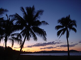
Horseshoe Bay is a bay, town and suburb on Magnetic Island in the City of Townsville, Queensland, Australia. It is a major tourist accommodation and recreation centre on the island. In the 2016 census the suburb of Horseshoe Bay had a population of 578 people.

Moffat Beach is a coastal suburb in the Sunshine Coast Region, Queensland, Australia. In the 2016 census, Moffat Beach had a population of 2,553 people.

Railway Estate is a suburb of Townsville in the City of Townsville, Queensland, Australia. In the 2016 census Railway Estate had a population of 2,852 people.
Rowes Bay is a suburb of Townsville in the City of Townsville, Queensland, Australia. In the 2016 census, Rowes Bay had a population of 573 people.

Bushland Beach is a coastal suburb in the northern beaches area of Townsville in the City of Townsville, Queensland, Australia. In the 2016 census Bushland Beach had a population of 6,181 people.
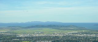
The Cape Pallarenda Conservation Park is a protected conservation park located 10 kilometres (6.2 mi) north-east of Townsville in the Far North region of Queensland, Australia. The 44-hectare (110-acre) regional park is located within the suburb of Pallarenda.

Bluewater is a town and coastal suburb in the City of Townsville, Queensland, Australia. In the 2016 census the suburb of Bluewater had a population of 1,040 people.
Saunders Beach is a coastal town and suburb of Townsville in the City of Townsville, Queensland, Australia. In the 2016 census, the suburb of Saunders Beach had a population of 409 people.
Toolakea is a coastal town and suburb in the City of Townsville, Queensland, Australia. In the 2016 census, Toolakea had a population of 205 people.

Balgal Beach is a coastal suburb and a beach in the City of Townsville, Queensland, Australia. The town of Balgal is within the locality. In the 2016 census, Balgal Beach had a population of 966 people.
Toomulla is a coastal town and suburb in the City of Townsville, Queensland, Australia. In the 2016 census, Toomulla had a population of 183 people.

Cape Pallarenda Quarantine Station is a heritage-listed former quarantine station at 1 The Esplanade, Pallarenda, City of Townsville, Queensland, Australia. It was built from 1915 to 1916. It is also known as Northern Regional Office, Department of Environment and Resource Management, Northern Regional Office, Environmental Protection Agency, and Cape Pallarenda Coastal Battery. It was added to the Queensland Heritage Register on 23 April 1999. The building is part of Cape Pallarenda Conservation Park.

Town Common is a coastal suburb of Townsville in the City of Townsville, Queensland, Australia. In the 2016 census, Town Common had a population of 71 people.
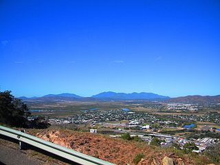
Castle Hill is a suburb of Townsville in the City of Townsville, Queensland, Australia. In the 2016 census, Castle Hill had a population of 941 people. The suburb is based on and around the mountain of the same name.
West Point is an island town and suburb of Magnetic Island in the City of Townsville, Queensland, Australia. In the 2016 census the suburb of West Point had a population of 32 people.

George Poynter Heath was a Royal Navy captain and the first portmaster of Queensland, Australia. It was under his supervision and administration that the 2,086 miles (3,357 km) of coast of Queensland, and its numerous river and creeks, were marked for navigation purposes by means of buoys, beacons, and lights.
