Charters Towers is a rural town in the Charters Towers Region, Queensland, Australia. It is 136 kilometres (85 mi) by road south-west from Townsville on the Flinders Highway. During the last quarter of the 19th century the town boomed as the rich gold deposits under the city were developed. After becoming uneconomic in the 20th century, profitable mining operations have commenced once again. In the 2016 census, Charters Towers had a population of 8,120 people.
Ingham is a rural town and locality in the Shire of Hinchinbrook, Queensland, Australia. In the 2016 census, the locality of Ingham had a population of 4,426 people. It is named after William Bairstow Ingham and is the administrative centre for the Shire of Hinchinbrook.

Garbutt is a suburb of Townsville in the City of Townsville, Queensland, Australia. In the 2016 census Garbutt had a population of 2,396 people.

Picnic Bay is a town and suburb of Magnetic Island in the City of Townsville, Queensland, Australia. In the 2016 census, Picnic Bay had a population of 291 people.
Wulguru is an outer southern suburb of Townsville in the City of Townsville, Queensland, Australia. In the 2016 census, Wulguru had a population of 4,570 people.
Stuart is a rural coastal suburb in the City of Townsville, Queensland, Australia. In the 2016 census, Stuart had a population of 1,386 people.

South Townsville is a coastal suburb of Townsville in the City of Townsville, Queensland, Australia. In the 2016 census, South Townsville had a population of 2,353 people.

Deeragun is an outer western town and suburb of Townsville in the City of Townsville, Queensland, Australia. In the 2016 census, Deeragun had a population of 4,250 people.

Hermit Park is a suburb of Townsville in the City of Townsville, Queensland, Australia. In the 2016 census Hermit Park had a population of 3,414 people.

Idalia is a southern suburb in the City of Townsville, Queensland, Australia. In the 2016 census Idalia had a population of 4,438 people.

Townsville City is a coastal suburb at the centre of the City of Townsville, Queensland, Australia. In the 2016 census, the suburb of Townsville City had a population of 2,910 people.

North Ward is a coastal suburb of Townsville in the City of Townsville, Queensland, Australia. In the 2016 census, North Ward had a population of 5,065 people.

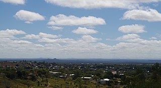
Ravenswood is a rural town and locality in the Charters Towers Region, Queensland, Australia. In the 2016 census, the locality of Ravenswood had a population of 255 people.

Gulliver is a suburb in the City of Townsville, Queensland, Australia. In the 2016 census Gulliver had a population of 2,825 people.

Bluewater is a town and coastal suburb in the City of Townsville, Queensland, Australia. In the 2016 census the suburb of Bluewater had a population of 1,040 people.

Ipswich is the central suburb and central business district in Ipswich in the City of Ipswich, Queensland, Australia. It is also known as Ipswich CBD. In the 2016 census, the suburb had a population of 2,459 people.
Forrest Beach is a small coastal locality in the Shire of Hinchinbrook, Queensland, Australia. In the 2016 census, Forrest Beach had a population of 1,254 people.

Mount St John is an industrial suburb of Townsville in the City of Townsville, Queensland, Australia. In the 2016 census Mount St John had a population of 62 people.

Currajong is a suburb in the City of Townsville, Queensland, Australia. In the 2016 census, Currajong had a population of 2,548 people.
Currajong is a heritage-listed detached house at 5 Castling Street, West End, City of Townsville, Queensland, Australia. It was built from 1887 to 1888. It was added to the Queensland Heritage Register on 21 October 1992.


