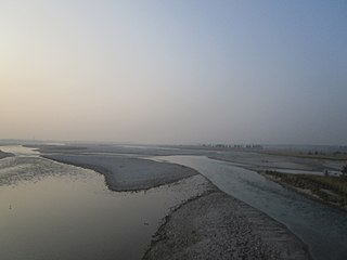
Parangarpar

Last updated
Parangarpar
Census Town
West Bengal location map.svg
Red pog.svg
Parangarpar
Location in West Bengal, India
India location map 3.png
Red pog.svg
Parangarpar
Parangarpar (India)
Coordinates: 26°32′37″N89°11′40″E / 26.5437°N 89.1945°E / 26.5437; 89.1945 Coordinates: 26°32′37″N89°11′40″E / 26.5437°N 89.1945°E / 26.5437; 89.1945
CountryFlag of India.svg  India
State West Bengal
District Alipurduar
Area
  Total5.7041 km2 (2.2024 sq mi)
Population
 (2011)
  Total11,408
  Density2,000/km2 (5,200/sq mi)
Time zone UTC+5:30 (IST)
PIN
735211
Telephone/STD code03563
Vehicle registration WB
Lok Sabha constituency Alipurduars
Vidhan Sabha constituency Falakata
Website alipurduar.gov.in

Parangarpar is a census town in the Falakata CD block in the Alipurduar subdivision of the Alipurduar district in the state of West Bengal, India.

Contents

Geography

Places and tea estates in the western portion of Alipurdar subdivision (including Madarihat-Birpara, Falakata and Alipuduar I CD blocks) in Alipurduar district
CT: census town, R: rural/ urban centre, N: neighbourhood, NP: national park/ wildlife sanctuary, TE: tea estate
Abbreviations used in names – TG for Tea Garden (town/village), TE for Tea Estate
Owing to space constraints in the small map, the actual locations in a larger map may vary slightly

Location

Parangarpar is located at 26°32′37″N89°11′40″E / 26.5437°N 89.1945°E / 26.5437; 89.1945 .

Area overview

Alipurduar district is covered by two maps. It is an extensive area in the eastern end of the Dooars in West Bengal. It is undulating country, largely forested, with numerous rivers flowing down from the outer ranges of the Himalayas in Bhutan. It is a predominantly rural area with 79.38% of the population living in the rural areas. The district has 1 municipal town and 20 census towns and that means that 20.62% of the population lives in urban areas. The scheduled castes and scheduled tribes, taken together, form more than half the population in all the six community development blocks in the district. There is a high concentration of tribal people (scheduled tribes) in the three northern blocks of the district. [1] [2] [3]

Note: The map alongside presents some of the notable locations in the subdivision. All places marked in the map are linked in the larger full screen map.

Demographics

As per the 2011 Census of India, Parangarpar had a total population of 11,408. There were 5,930 (52%) males and 5,478 (48%) females. There were 1,084 persons in the age range of 0 to 6 years. The total number of literate people in Parangarpar was 8.750 (84.75% of the population over 6 years). [4]

Infrastructure

According to the District Census Handbook 2011, Jalpaiguri, Parangarpar covered an area of 5.7041 km2. Among the civic amenities, it had 23 km roads, with open drains, the protected water supply involved tap water from treated sources, uncovered wells. It had 1,661 domestic electric connections, 175 road lighting points. Among the medical facilities it had 1 dispensary/ health centre, 1 family welfare centre, 1 maternity and child welfare centre, 1 maternity home, 1 veterinary hospital, 10 medicine shops. Among the educational facilities it had 7 primary schools, 3 middle schools, 2 secondary schools, 2 senior secondary schools. It had 1 recognised shorthand, typewriting and vocational training centre, 5 non-formal education centres (Sarva Shiksha Abhiyan), 1 orphanage home. Three important commodities it produced were: ply wood, wooden furniture, jute choir. It had branches of 1 nationalised bank, 2 cooperative banks. [5]

Related Research Articles

Birpara Town in West Bengal, India

Birpara is a census town in Alipurduar I CD block in Alipurduar subdivision of Alipurduar district, West Bengal, India.

Alipurduar Railway Junction Census Town in West Bengal, India

Alipurduar Railway Junction is a census town in the Alipurduar I CD block in the Alipurduar subdivision of the Alipurduar district in the state of West Bengal, India.

Bholar Dabri Census Town in West Bengal, India

Bholar Dabri is a census town in the Alipurduar I CD block in the Alipurduar subdivision of the Alipurduar district in the state of West Bengal, India.

Chechakhata Census Town in West Bengal, India

Chechakhata is a census town in the Alipurduar I CD block in the Alipurduar subdivision of the Alipurduar district in the state of West Bengal, India.

Falakata Census Town in West Bengal, India

Falakata is a census town in the Falakata CD block in the Alipurduar subdivision of the Alipurduar district in the state of West Bengal, India.

Paschim Jitpur Census Town in West Bengal, India

Paschim Jitpur is a census town in the Alipurduar I CD block in the Alipurduar subdivision of the Alipurduar district in the Indian state of West Bengal.

Madarihat Census Town in West Bengal, India

Madarihat is a census town and a gram panchayat in the Madarihat-Birpara CD block in the Alipurduar subdivision of the Alipurduar district, West Bengal, India. This town is situated on the outskirts of Jaldapara National Park, which is famous for Indian rhinoceros. This is one of the main tourist spots in North Bengal, surrounded by tea gardens, forests, hills, and small rivers, and also having highly diverse population. Madarihat is also world famous for the local wooden furniture.

Samuktala Census Town in West Bengal, India

Samuktala is a census town and a gram panchayat in the Alipurduar II CD block in the Alipurduar subdivision of the Alipurduar district in the state of West Bengal, India.

Jashodanga Village in West Bengal, India

Jashodanga is a village in the Alipurduar II CD block in the Alipurduar subdivision of the Alipurduar district in the state of West Bengal, India.

Odlabari Census Town in West Bengal, India

Odlabari is a census town in the Mal CD block in the Malbazar subdivision of the Jalpaiguri district in the state of West Bengal, India.

Dakshin Odlabari Census Town in West Bengal, India

Dakshin Odlabari is a census town in the Mal CD block in the Malbazar subdivision of the Jalpaiguri district in the state of West Bengal, India.

Sisha Jumrha Census Town in West Bengal, India

Sisha Jumrha is a census town in the Madarihat-Birpara CD block in the Alipurduar subdivision of the Alipurduar district in the state of West Bengal, India.

Mechiabasti Census Town in West Bengal, India

Mechiabasti is a census town in the Kalchini CD block in the Alipurduar subdivision of the Alipurduar district in the state of West Bengal, India.

Uttar Satali Census Town in West Bengal, India

Uttar Satali is a census town in the Kalchini CD block in the Alipurduar subdivision of the Alipurduar district in the state of West Bengal, India.

Jagijhora Barabak Census Town in West Bengal, India

Jugijhora Barobak is a census town in the Falakata CD block in the Alipurduar subdivision of the Alipurduar district in the state of West Bengal, India.

Jateswar Census Town in West Bengal, India

Jateswar is a census town and a gram panchayat in the Falakata CD block in the Alipurduar subdivision of the Alipurduar district in the state of West Bengal, India.

Laskarpara Census Town in West Bengal, India

Laskarpara is a census town in the Kumargram CD block in the Alipurduar subdivision of the Alipurduar district in the state of West Bengal, India.

Dakshin Rampur Census Town in West Bengal, India

Dakshin Rampur is a census town in the Kumargram CD block in the Alipurduar subdivision of the Alipurduar district in the state of West Bengal, India.

Uttar Mandabari Village in West Bengal, India

Uttar Mandabari is a village and a gram panchayat in the Kalchini CD block in the Alipurduar subdivision of the Alipurduar district in the state of West Bengal, India.

Sonapur, Alipurduar Village in West Bengal, India

Sonapur is a village in the Alipurduar I CD block in the Alipurduar subdivision of the Alipurduar district in the state of West Bengal, India.

References

  1. "District Statistical Handbook 2014 Jalpaiguri". Tables 2.2, 2.4b. Department of Planning and Statistics, Government of West Bengal. Retrieved 29 June 2020.
  2. "CD block Wise Primary Census Abstract Data(PCA)". 2011 census: West Bengal – District-wise CD blocks. Registrar General and Census Commissioner, India. Retrieved 29 June 2020.
  3. "District Census Handbook, Jalpaiguri, Series 20, Part XIIA" (PDF). Census of India 2011, page 13 Physiography. Directorate of Census Operations, West Bengal. Retrieved 18 June 2020.
  4. "C.D. Block Wise Primary Census Abstract Data(PCA)". West Bengal – District-wise CD Blocks. Registrar General and Census Commissioner, India. Retrieved 6 July 2020.
  5. "District Census Handbook Jalpaiguri, Census of India 2011, Series 20, Part XII A" (PDF). Section II Town Directory, Pages 451-453: Statement I: Status and Growth History, Pages 454-455: Statement II: Physical Aspects and Location of Towns, Pages 456-457: Statement III: Civic and other Amenities, Pages 458-459: Statement IV: Medical Facilities 2009, Pages 460—463: Statement V: Educational, Recreational and Cultural Facilities, Pages 464: Statement VI:Industry and Banking. Directorate of Census Operations V, West Bengal. Retrieved 26 June 2020.